[ccfic]
- £15m+ deal places Leicestershire-based Bluesky at forefront of UK aerial data provision
- Geospatial Commission awards specialist contract to sole supplier for the first time
- Deal places Leicestershire firm at the forefront of national aerial data provision
- Benefits to public sector organisations include data provided free at point of use
The Government’s Geospatial Commission has awarded Bluesky International a multi-million-pound contract to supply aerial photography to public sector organisations across Great Britain.
The contract, which also includes the provision of 3D height models and colour infrared, runs for 3 years (with an option to extend for a further 2 years) and is worth more than £15 million.
Branded as Aerial Photography for Great Britain (APGB), the contract commits Leicestershire-based Bluesky as the sole supplier of data on a two-year cyclic basis.
It means more than 4500 local authorities, emergency services, environmental bodies, and central government departments will gain access to the most up-to-data aerial imagery and height data available – free at point of use.
It is the first time the contract has been awarded to a sole supplier and puts the innovative Ashby-based aerial survey company firmly at the forefront of aerial data provision for Great Britain.
Bluesky’s CEO Rachel Tidmarsh said: “The award of this contract is a great achievement and is testament to the high standards of work we produce and the professionalism of our team.
“Bluesky celebrated its 20th year just a few months ago, and this contract highlights the importance of the investment and innovation we have carried out over this time.
“The APGB contract offers significant benefits to the public sector. We are seeing public organisations use our data to unlock an increasing number of applications.
“This is particularly important as these government organisations strive to meet legislative requirements around biodiversity, climate change and planning.”
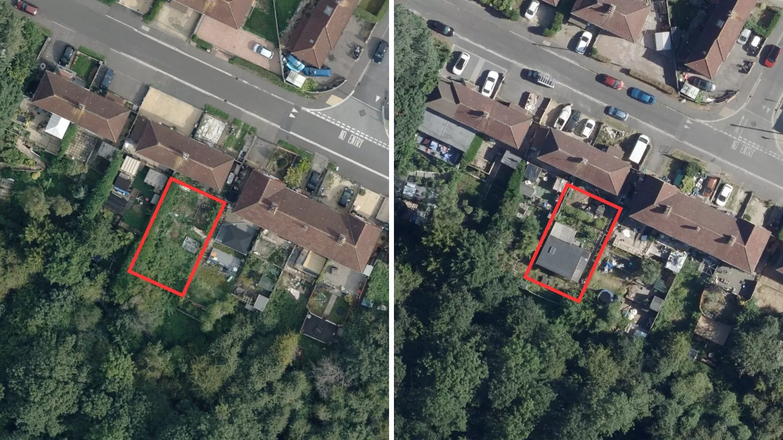
Under the APGB agreement, Bluesky will provide aerial imagery at 12.5cm resolution across the entirety of England, Wales and Scotland. Urban areas (as defined by the ONS) will be even more closely photographed, with images captured at an incredible 5cm.
In addition, Bluesky will provide access to its derived datasets, including Digital Surface Models (DSM) at 2m, Digital Terrain Models at 5m, and Colour Infrared at 50cm.
APGB members will also have access – free at point of use – to all of Bluesky’s historical imagery. This highly detailed archive dates back to 2000, with historical data having an important role to play in measuring change over the past two decades. It will also help with identifying patterns, to support local authority future planning.
The Geospatial Commission works on behalf of the English, Scottish and Welsh Governments and is part of the Department for Science, Innovation and Technology.