National Hedgerow Map™
Hedgerows play an important role in agricultural and natural environments. They serve as vital wildlife habitats and corridors, enhance landscape connectivity to promote ecological resilience, and store large amounts of carbon as both above and below ground biomass.
Hedgerows can help regulate local microclimate and additionally reduce flood risk, provide a natural noise barrier and contribute to soil fertility. In agriculture, hedgerows can offer benefits to farmers through agroforestry practices, and promoting sustainable farming. Despite their ecological importance, hedgerows currently are largely understudied and neglected carbon stores in the UK. However, this is beginning to change and their importance in supporting the UK’s environmental landscape is becoming increasingly acknowledged.
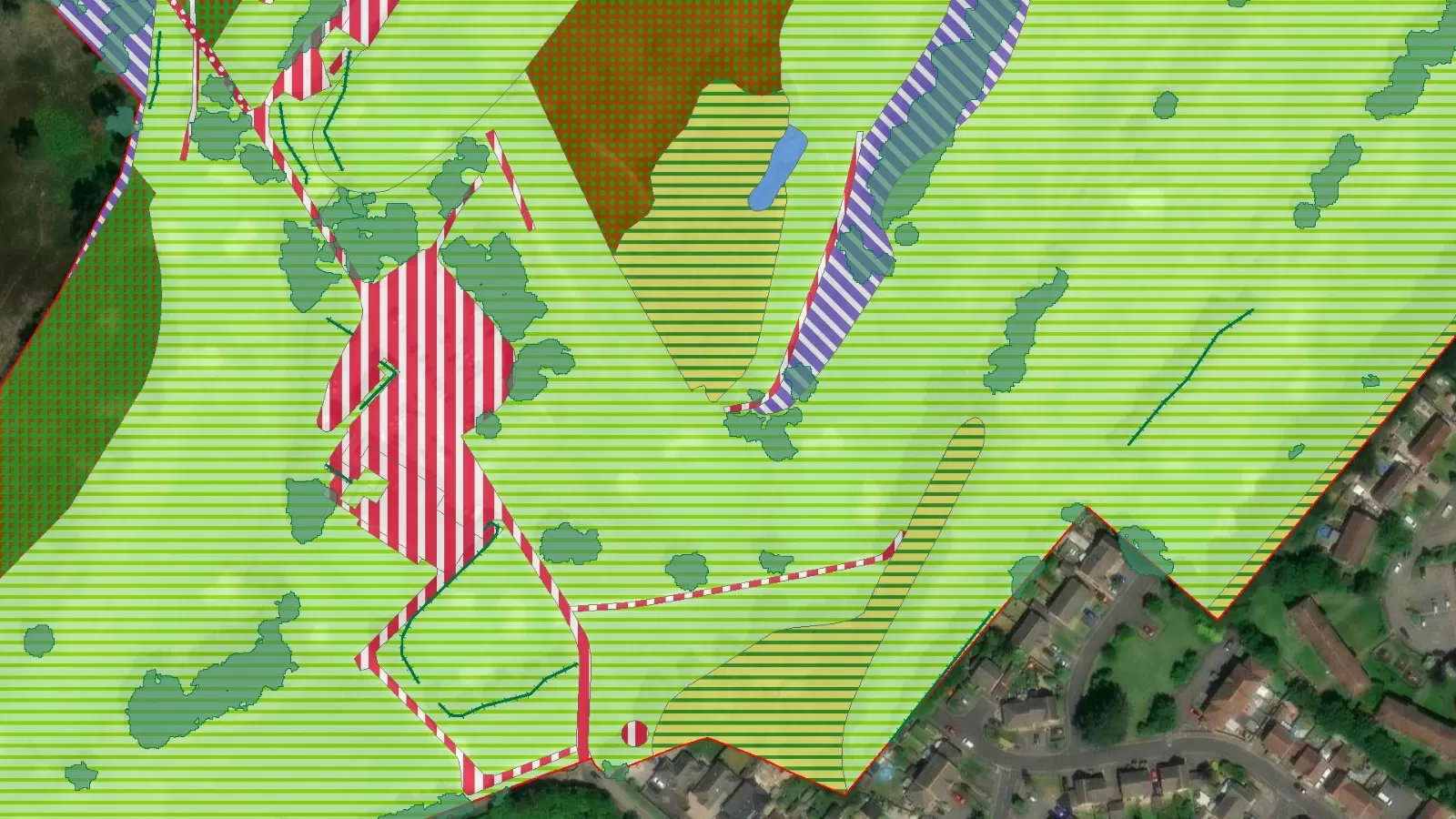
The Bluesky National Hedgerow Map™ (NHM™) is the only hedgerow map available that can accurately measure the volume of a hedge, and therefore the carbon captured. Historically, hedgerow maps have not offered the volumetric measurement but the polygons within the NHM™ enable this in addition to providing length and height attributes.
With coverage across England, Wales, Scotland and the Republic of Ireland, NHM™ provides a unique, comprehensive database of location, height, volume, vegetation extent, and centreline for all vegetation below 3 metres.
Created from our high resolution national aerial photography, accurate terrain and surface data, and colour infrared imagery, using innovative processing techniques, NHM™ is an ideal tool to support initiatives happening nationally to create new hedgerows, and importantly restore the existing ones. NHM™ means you can accurately assess where current gaps are – all from your desktop – informing reparation projects.
NHM™ is created from aerial photography as it becomes available through our cyclic aerial capture update program and ensures data used in the creation of the NHM™ is the most up-to-date available.
Specification
-
Vegetation between 0.5 and 2.99 metres
- Measurements of location, height, volume and vegetation extent
-
Vegetation polygons
-
Vegetation centrelines
-
Created from stereo aerial photography, accurate terrain and surface data, and colour infrared imagery
-
OSGB Projection
-
Vector format – ESRI .shp as standard
Applications
-
Carbon storage and above ground biomass calculations
-
Hedgerow monitoring and management
-
Other low vegetation mapping (e.g. shrubs, bushes and scrub)
-
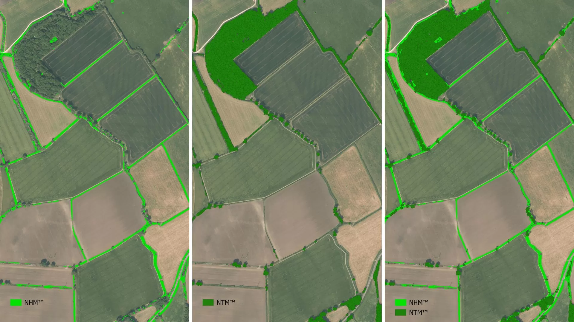
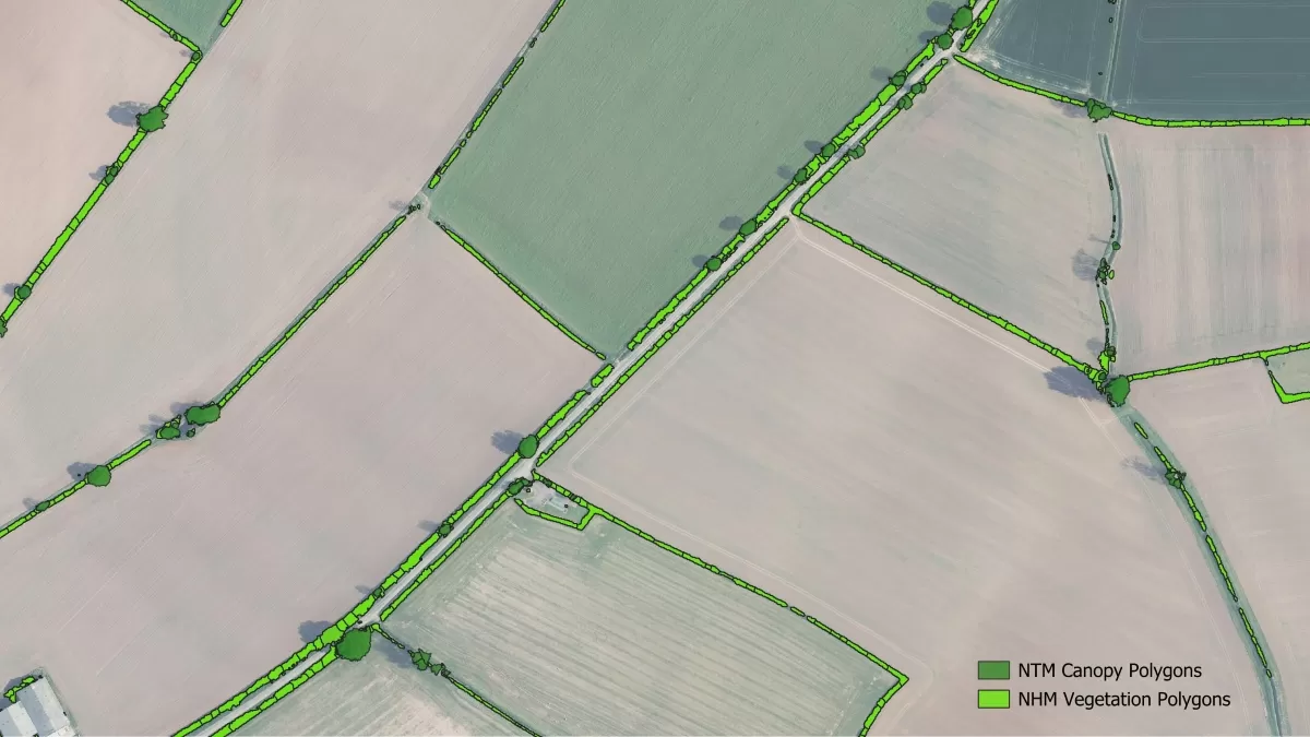
Can be combined with National Tree Map™ to map hedgerow trees and mature hedgerows 3 metres and taller
-
Aid hedgerow creation or gap restoration projects
- Habitat monitoring and analysis
-
Flood risk reduction and soil erosion mitigation
-
Noise mitigation mapping
- Agroforestry management
Benefits
-
Unique product – the only UK hedgerow map to provide volumetric measurements
- Easy-to-use vector data
- Compatible with Bluesky’s National Tree Map™
-
Compatible with Ordnance Survey products, including OS MasterMap®
-
Flexible licensing terms
-
Continually updated
National Hedgerow Map™ Features