[ccfic]
- Imagery archives dating back to 1999 offer valuable window to the past
- Public sector organisations can access imagery at no cost to them
- Awarded as part of the recently announced APGB contract
For the first time, historic national aerial imagery has been made available, free at point of use, to all public sector organisations to support them in a wide range of projects and future planning scoping.
Access to the imagery forms one of three lots recently awarded as part of a contract run by the Government’s Geospatial Commission.
Bluesky International has been awarded the role of consortium-lead for Lot 3 of the contract which is branded as the Aerial Photography for Great Britain (APGB). The Consortium also includes Getmapping, who will provide the web-service to stream this historical aerial imagery.
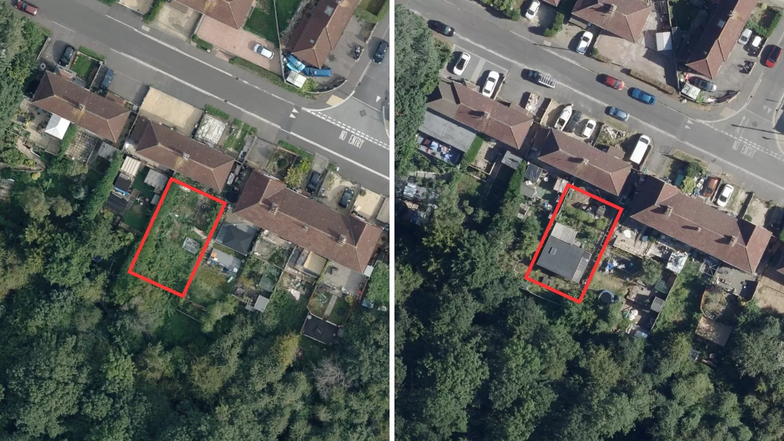
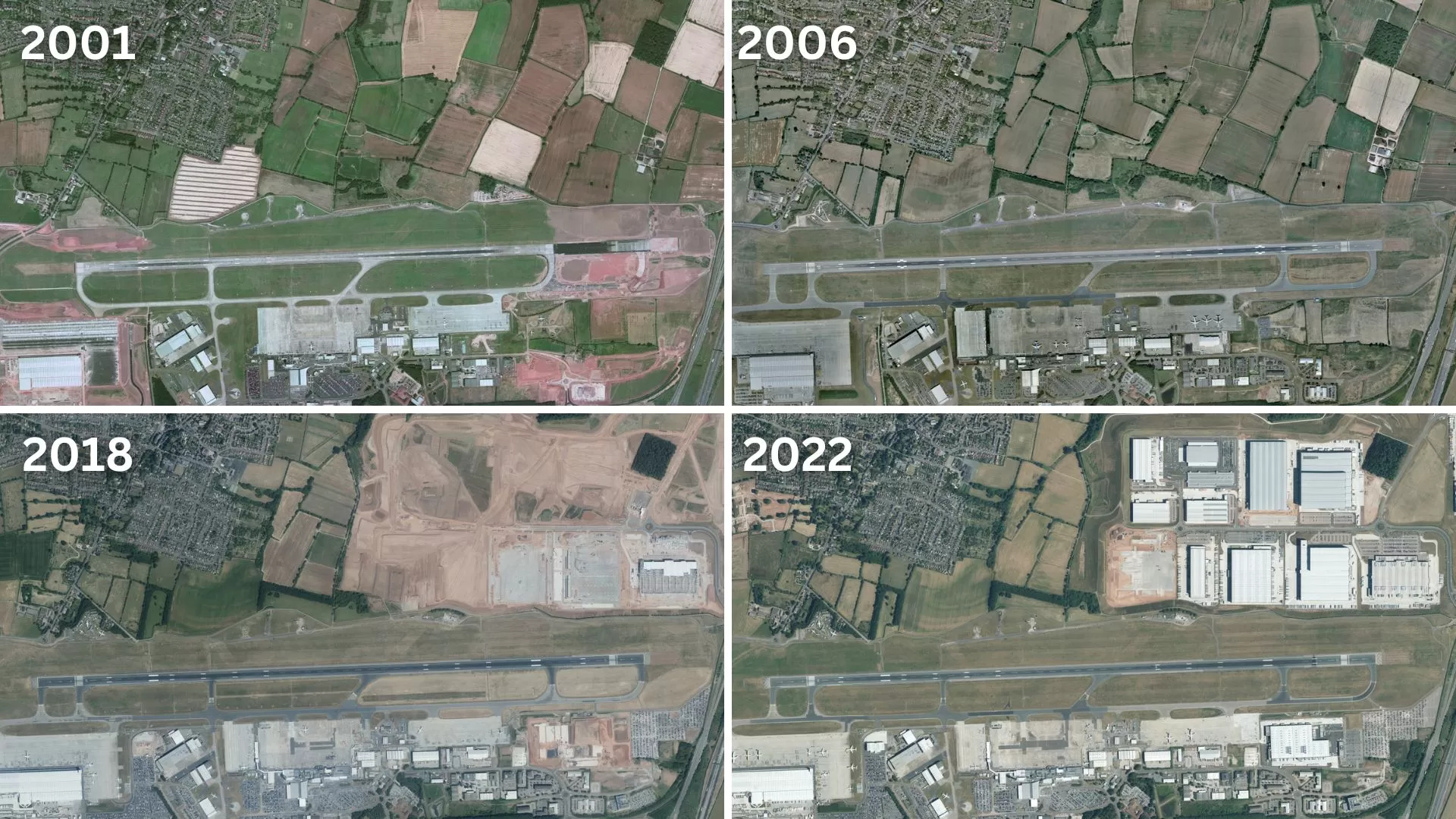
This new offering enables public sector organisations access to the substantial aerial photography archives of both Bluesky International Ltd and Getmapping Ltd, providing a fascinating and extremely useful window into the past. Imagery dated as far back as 1999 is available.
Ralph Coleman, Chief Commercial Officer at Bluesky said: “Having access to historical aerial photography will facilitate a broad range of new applications from analysing changes in our rural landscapes to predicting future patterns in our towns and cities.
“It offers a valuable window into the past and this is often one of the best places to start when making plans to inform the future. Historic imagery is something we have had numerous enquiries about from the public sector so to now be able to offer it as part of this contract is good news for them.”
APGB enables thousands of local authorities, emergency services, environmental bodies and central government departments to gain access to the rich historical data reaching back 30 years – free at point of use.
Bluesky currently captures national aerial imagery on a two-year cyclic basis which it licenses to UK government as part of Lot 1 of the contract ensuring the public sector also has access to the most-up-to-date aerial imagery available.