[ccfic]
- Aerial mapping technology can help to identify tree growth obstructing wireless communications links
- Power utilities utilise wireless communications links to control the electricity grid
- Keeping these links unobstructed is key to keeping the lights on
- Blockages previously had to be located manually by crews on the ground
Critical UK communications infrastructure is being maintained with the support of detailed aerial mapping – keeping sightlines clear between masts up to 90km apart.
Neos Networks utilises data from Bluesky International, applying both its Digital Surface Model (DSM) and National Tree Map™ (NTM™) as a method of identifying obstructions on the ground.
For more than 20 years, Neos Networks has been delivering critical infrastructure design to customers, including key energy utilities.
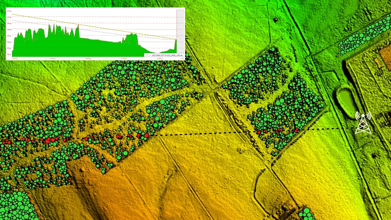
It is now using DSM and NTM™ to model path profiles and identify potential obstructions- such as tree growth – which can cause loss of signal between sites.
With link distances ranging from 1km to 90km, identifying the cause of obstructions has previously been a labour-intensive search between locations.
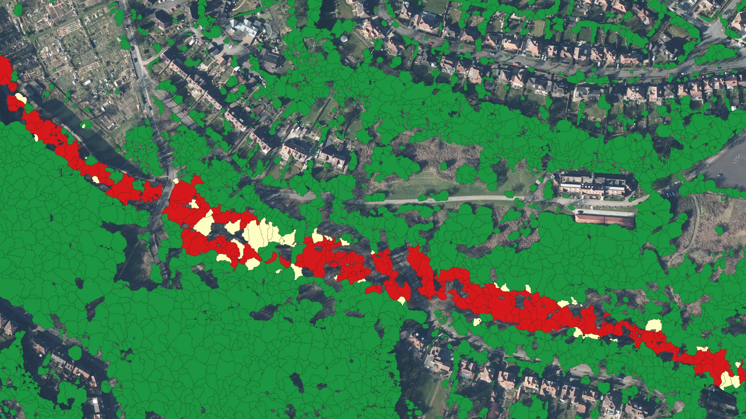
Now, through NTM™, identification of tree growth interference can be modelled on a desktop.
The Neos Networks team is also using Bluesky’s Digital Surface Models (DSM) to assess line of sight on planned antennae positions by capturing the height of nearby buildings and other above-ground objects.
Dan Saunders, Microwave Design Engineer at Neos Networks, said accurate data is essential to understand both plan and deliver microwaves between two masts.
“In the planning phase, we need to ensure that both the main beam of the microwave is unobstructed, but also the Fresnel zone around this main beam,” he said.
“In the past, design engineers relied heavily on visual line-of-sight surveys, but it’s difficult to assess just by looking where impingements on the Fresnel zone are located – this is where the Bluesky data comes into its own.”
Neos Networks is now using NTM™ to accurately direct its engineers to specific grid coordinates, where they can carry out assessments of obstructions and carry out clearance works to restore line of sight.
“As well as DSM, applying the data from the NTM™ means we can now quickly assess and respond to issues when alarms are triggered highlighting loss of signal”, Dan added.
“Five years ago, we would have had to send an engineer onsite to try and find where the problem was. More recently we’ve been able to use drones but being able to model the terrain using Bluesky’s data is much less resource intensive in terms of people, time and cost.”
In addition, NTM™ is also helping to forecast where future problems might arise. “It is taking the guesswork out,” said Dan.
Bluesky International is now in its 12th year of offering its unique NTM™ dataset.
Ralph Coleman, Chief Commercial Officer, at Bluesky, said: “Over the past two years in particular, we’ve seen a growing demand from a wide variety of sectors and industries who are realising the potential of having accurate, nationwide tree data at their fingertips.
“Neos Networks is a great example of how the height, location and canopy cover data – all included as part of the NTM™ – are enabling significant cost and time savings, as well as serving to inform future requirements.”
The NTM™ is a valuable resource to a wide range of partners, including environmental consultants, utilities, academia and research teams, insurance, forestry, and planners.
The dataset is created using high-resolution aerial imagery, accurate terrain and surface data, and colour infrared imagery captured by Bluesky and processed using proprietary and innovative techniques. Its UK imagery is updated every two years.


