[ccfic]
- Wessex Water applies National Tree Map™ data to map trees on landholding
- Supports a focus on managing high priority sites like those next to railways
- Aims to ensure public and employee safety
A UK utility company managing large and disparate expanses of land, has turned to Bluesky’s National Tree Map™ (NTM)™ to support the development of a dashboard for its tree safety guidance.
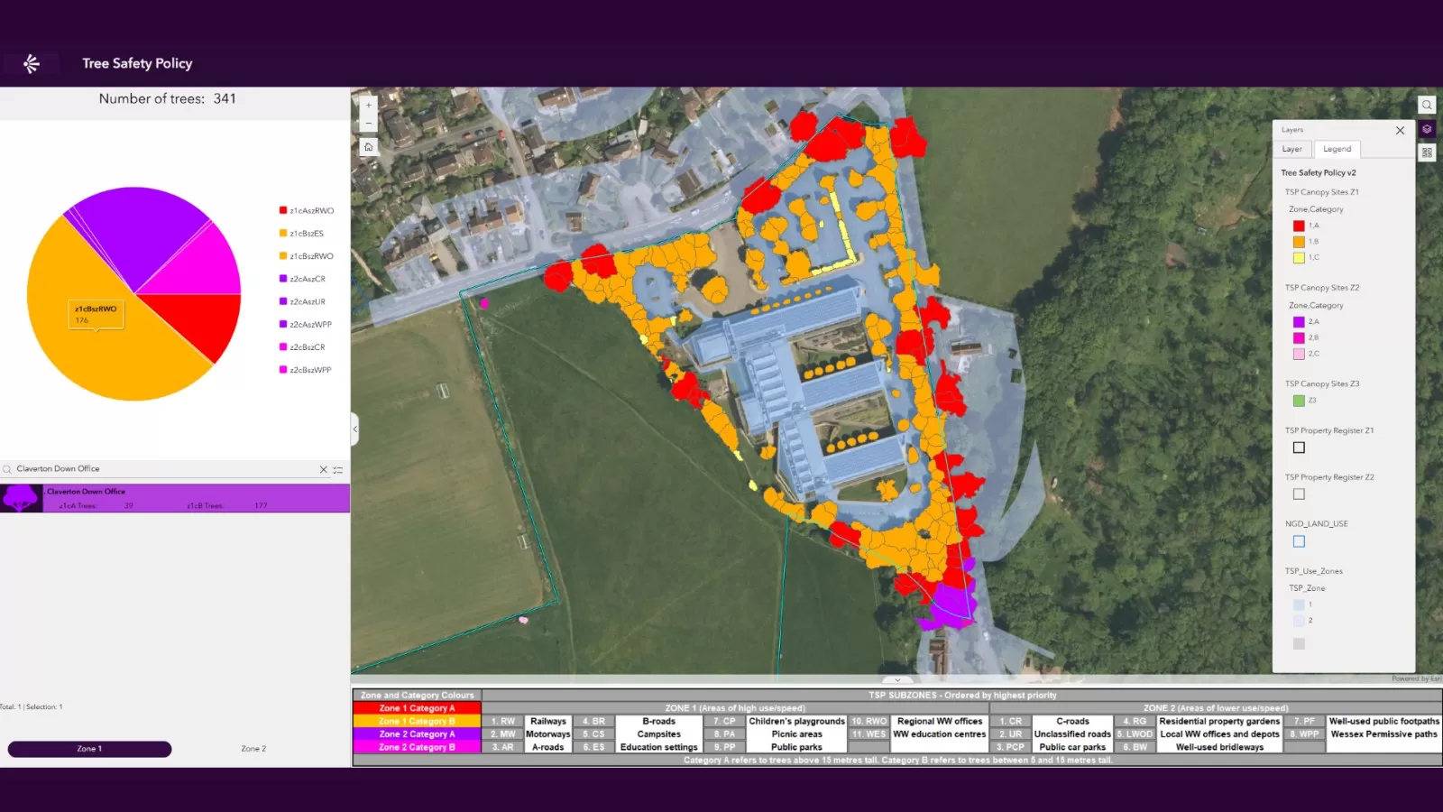
Wessex Water has been running a project, utilising the 2024 National Tree Safety Guidance, to create a dashboard, supporting the implementation of its Tree Safety Policy. This process aims to offer detailed guidance on how to safely manage trees on their land, within or near high-use zones.
The water and sewerage company serves 2.9 million customers across the south-west of England in a varied landscape ranging from the Mendip Hills and the levels of Somerset to the cliffs of Dorset and Wiltshire’s Salisbury Plain. Within that region, the company owns and manages operations at sites including woodlands, reservoirs and water source sites, as well as other locations classed as being within or near an identified high-use zone. This includes land encompassing or near to railways, motorways, facilities for education and other public areas such as public footpaths or public parks.
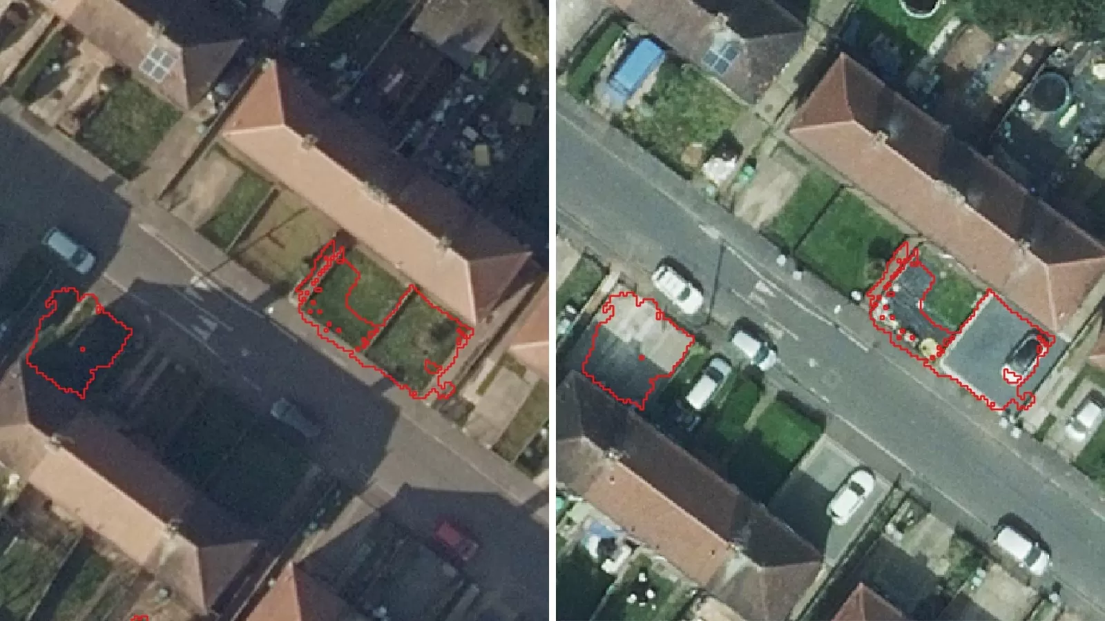
Bluesky’s NTM™ has been fundamental in the creation of the dashboard, providing insights including tree height and location, enabling quick and accurate identification of high priority assets.
Sophie Minett, Environmental Scientist at Wessex Water, said: “The NTM™ data has proved to be visually brilliant for us and has enabled us to apply the tree data to high-use zones. The point and canopy cover data supplied as part of the NTM™ has been integral to the project. The data has been more comprehensive than other datasets we have previously tried, proving to be the best option for us.
With a vast number of trees identified on our land, we have a responsibility to effectively and efficiently manage these trees accordingly. The dashboard splits our landholdings into three varying use zones; within these zones we have applied the tree data to assess where ‘high-risk’ trees may be located on our landholding.”
The Conservation, GIS and Environmental Investigation teams at Wessex Water have worked closely to develop the dashboard tool, ensuring that any newly purchased site can quickly and easily be incorporated.
Ralph Coleman, Chief Commercial Officer at Bluesky, added: “Over the past 24 months we have seen a growing demand for our suite of vegetation datasets. Our customers are becoming more focused on their environmental responsibilities, partly due to the introduction of new government legislation linked to Biodiversity Net Gain and the protection of vulnerable ecosystems. Bluesky will continue to launch relevant and targeted geospatial products that are designed to meet the needs of an ever increasing customer base.”
Wessex Water now plans to take the dashboard and develop this further, as it looks to build efficiencies in ways of working.