Our Services
We offer a range of tailored and bespoke services designed to deliver your exact data requirements to support your projects. From aerial photography capture at specific resolutions and locations, to change detection analysis to support planning and environmental reports, our team is well-placed to deliver and has a wealth of experience and expertise.
Get in touch and let us know your requirements, timings, and location.
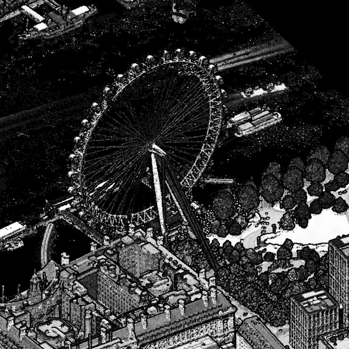
Bespoke Aerial Photography Survey
High-resolution aerial surveys from 2.5 cm GSD
Our experienced flight operations team and expert production crew deliver accurate, ultra-high-resolution imagery.
Whether it’s urban mapping, infrastructure inspection, or environmental monitoring, we tailor each mission to your exact requirements.
Capture every detail with precision.
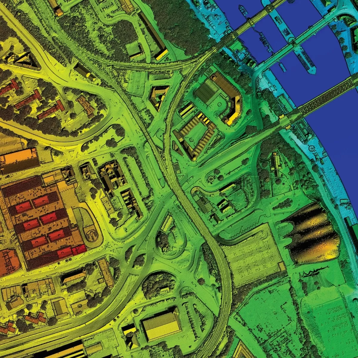
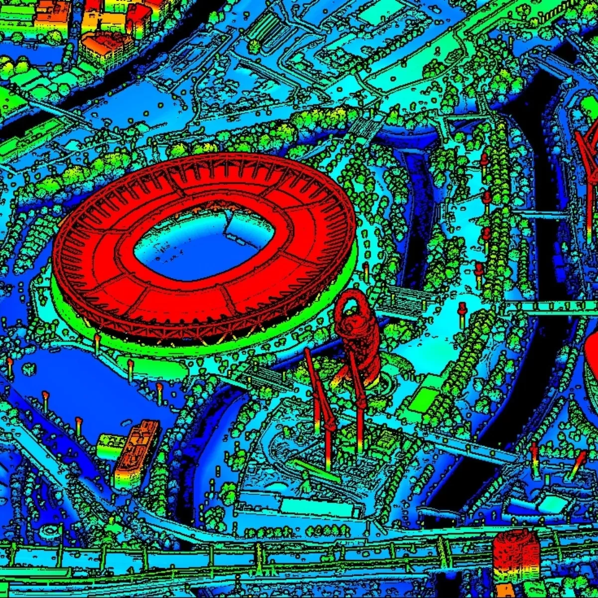
Bespoke Aerial LiDAR Survey
High-precision height information, tailored to your needs
Bluesky offers bespoke aerial LiDAR surveys to capture accurate, high-resolution elevation data. Whether you need coverage for flood risk modelling, infrastructure planning, forestry management, or environmental monitoring, we design each survey to match your exact specifications.
Our team will work with you to define:
- Survey area – any size, any location
- Resolution and point density – from broad coverage to ultra-detailed mapping
- Timing – capture when conditions suit your project best
- Data delivery – GIS-ready formats for seamless integration
- With our state-of-the-art aerial sensors and experienced operators, we deliver clean, precise datasets that support confident decision-making.
From concept to delivery, we make LiDAR work for your project.
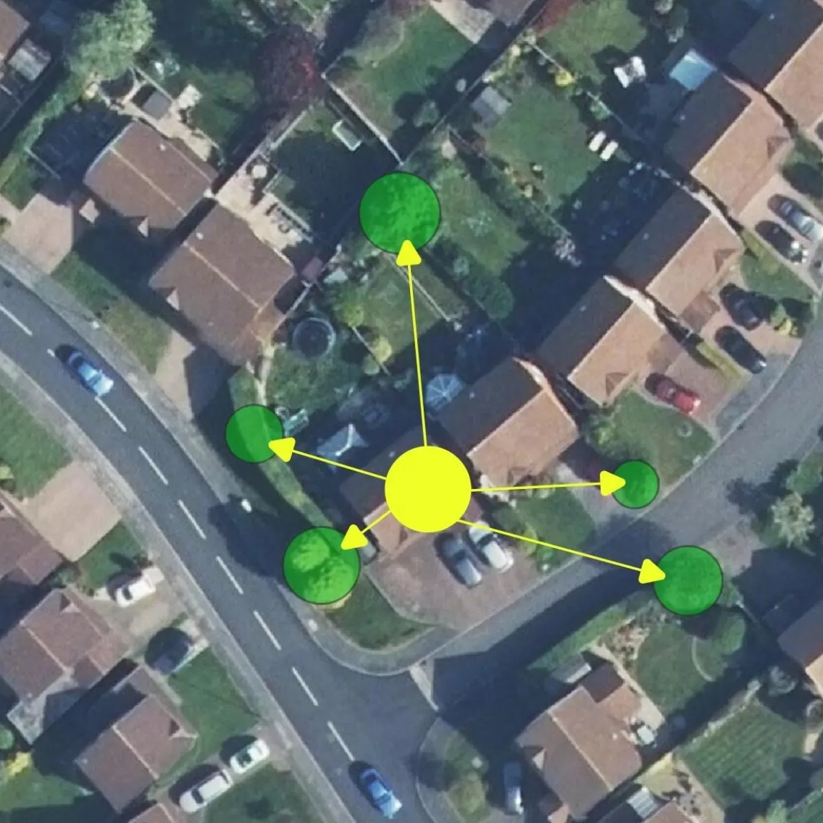
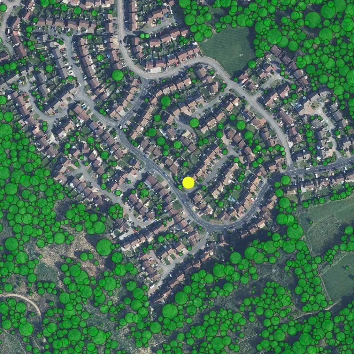
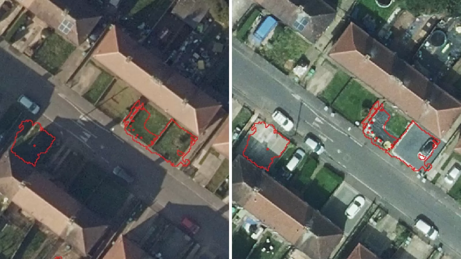
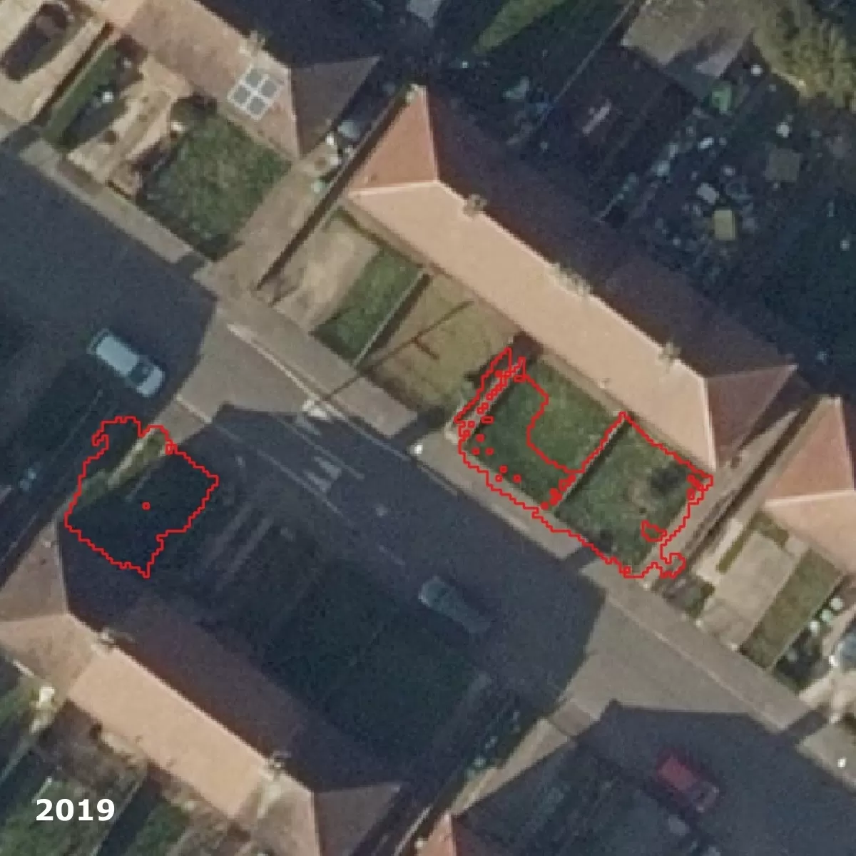
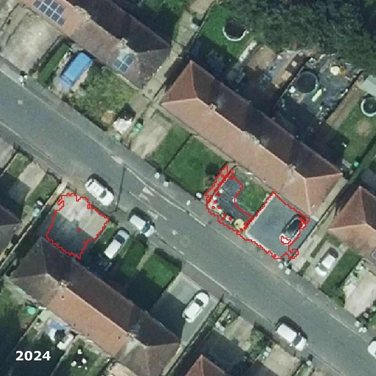
3+30+300 Service
Promoting healthier, greener cities
Bluesky’s add-on to the National Tree Map™ calculates the 3+30+300 score for neighbourhoods across Britain, a guideline introduced by Cecil Konijnendijk to improve urban greening and well-being.
Our analysis measures:
3 – At least 3 trees visible from every home
30 – 30% tree canopy cover in each neighbourhood
300 – Access to quality green space within 300 metres
We provide geospatial data, building-level scores, neighbourhood statistics, and a detailed PDF report, helping you see how many properties meet none, one, two, or all three targets.
Use these insights to both benchmark and prioritise tree planting, and integrate urban greening into planning strategies.
Designed for organisations leading the way in creating sustainable towns and cities.
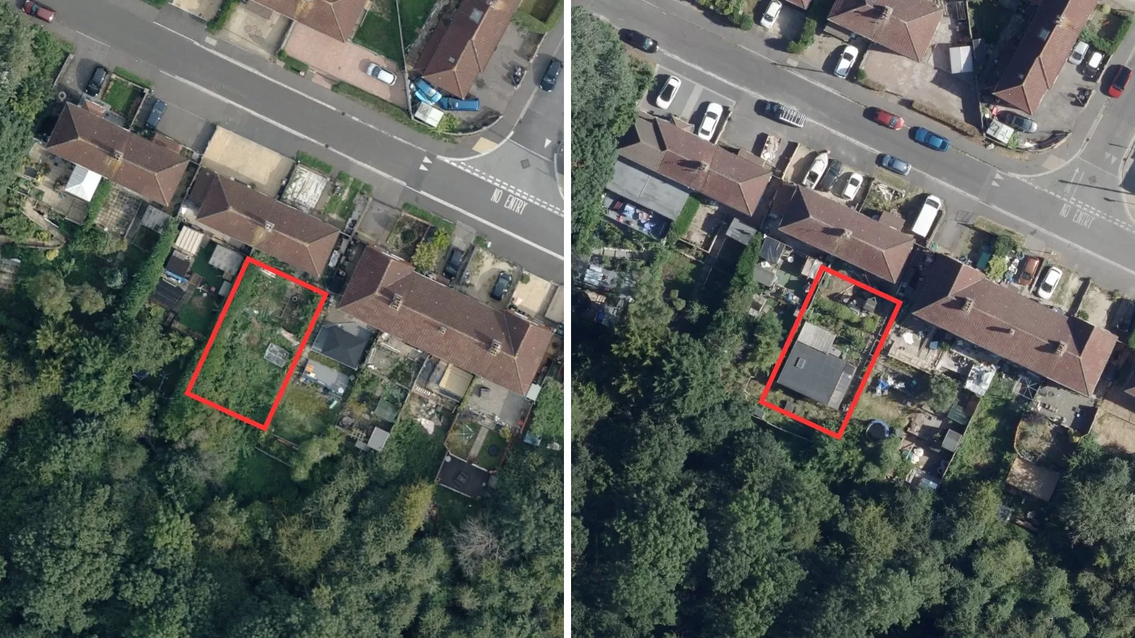
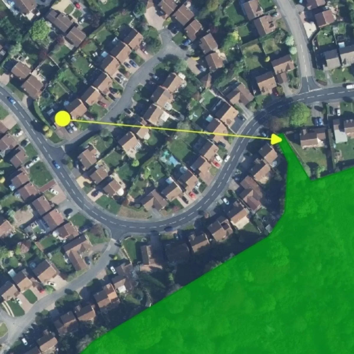
Change Detection
See the changes, plan with confidence
Environmental change is accelerating and with it, the pressure on local infrastructure. Our Change Detection Service gives clear, actionable intelligence to stay ahead.
What we track:
Impervious Surfaces – multi-year aerial photography reveals urban creep, crawl, and sprawl, helping you manage water and flood risk.
Tree Canopy Cover – canopy change data from our National Tree Map to assess development impact, planting success, and regeneration progress.
Why it matters
- Less green space and more hard surfaces mean higher flood risk and strain on drainage systems. With our data, you can:
- Spot problem areas early
- Model future scenarios
- Plan effective mitigation strategies
- Back proposals with solid evidence
Discover how our Change Detection Service can help your team make smarter, faster, and more sustainable decisions.
Act today to protect tomorrow.
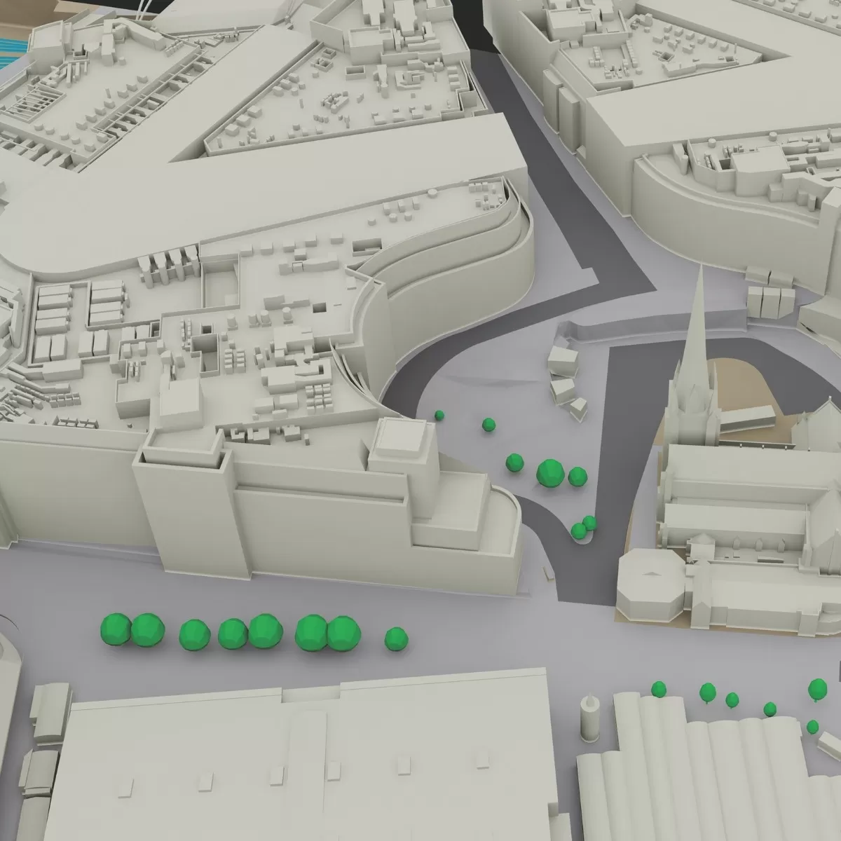
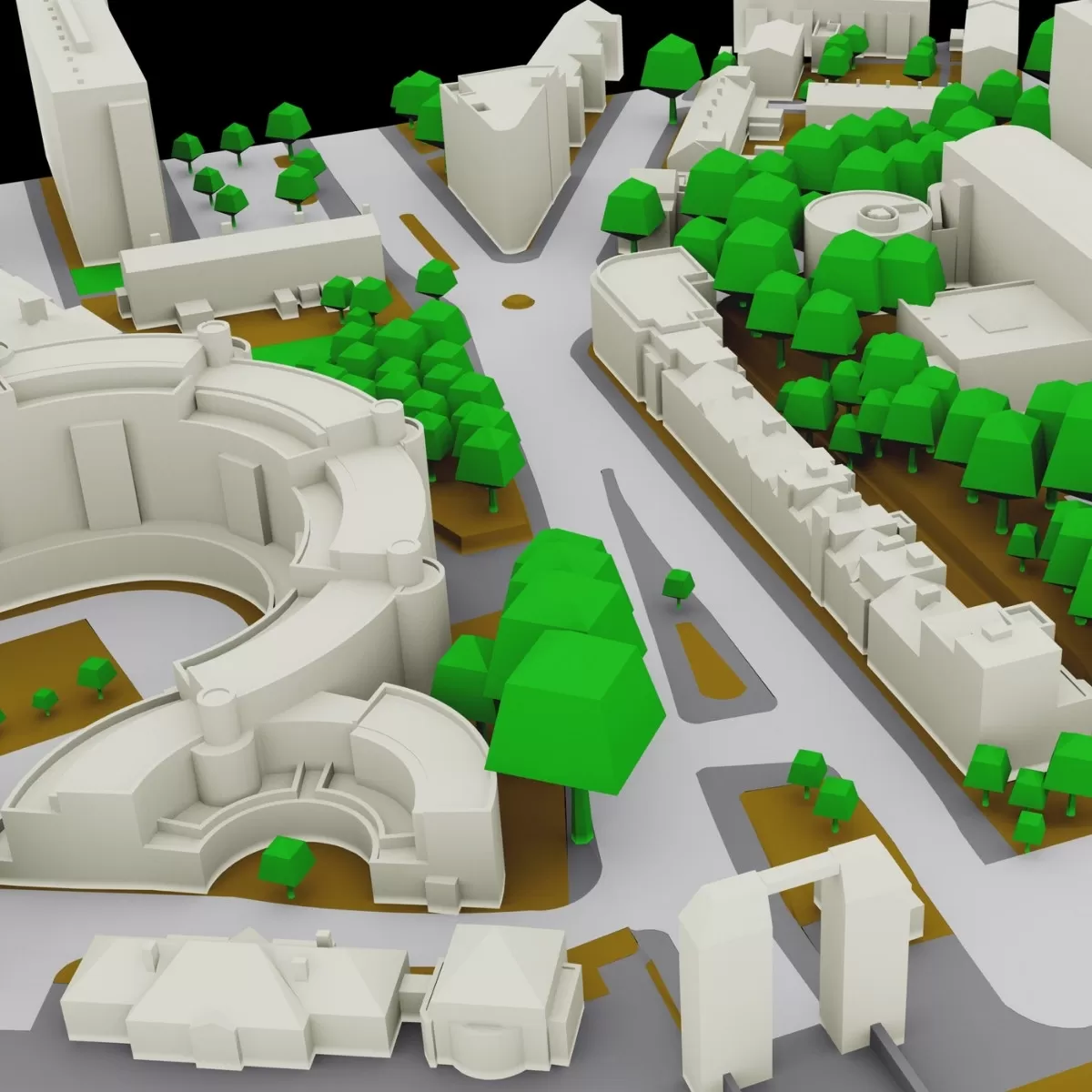
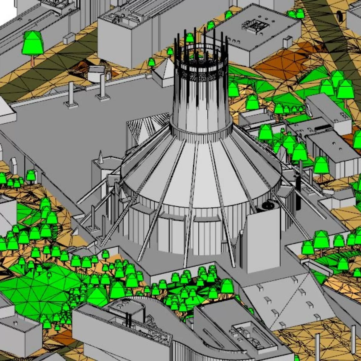
LOD Models and 3D Mapping
Precision that brings projects to life
Transform your projects with our bespoke 3D modelling and Level of Detail (LOD) mapping services. From cityscapes to industrial sites, we create highly accurate, photorealistic 3D models that capture every structure and surface.. Our LOD mapping ensures each model meets the precision and detail required for planning, simulation, visualisation, and analysis.
We combine our cutting-edge LiDAR and photogrammetry to deliver detailed models for applications such as urban planning, infrastructure design, environmental studies, and virtual simulations.
By leveraging bespoke workflows, advanced processing, and meticulous quality control, we provide 3D assets that are ready for analysis, integration into GIS platforms, or immersive visualisation. No matter the scale or complexity of your project, our models and LOD mapping give you clarity, insight, and confidence to make informed decisions.
Elevate your planning, design, and operational workflows with 3D models that are accurate, actionable, and visually compelling.