- Targeted change analysis will enhance and enable successful flood risk plans
- Flooding risk in the UK at an all-time high
- Local authorities, public environmental bodies, utility sector and housing developers could all benefit from the service
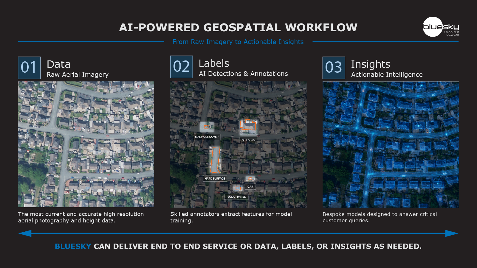
Change detection analysis that tracks the percentage in tree canopy cover change and permeable surface change has been launched with the aim to support the creation of successful flood risk strategies, tree planting programmes, as well as monitoring the impact of regeneration and greening schemes.
Flooding is now more likely in the UK with wetter weather increasing by 10 per cent over the last decade (2024 was the wettest on record), and a major flood occurring every year since 2007. Mitigating that risk is a burden that lies heavily on the shoulders of local authorities, other public sector bodies and utility companies. With UK landscapes undergoing rapid change, urban areas significantly increasing, and ambitious house building targets being set by the Government, this trend is likely to continue. Public bodies and service sectors are under increased pressure to both facilitate the increase and manage the subsequent environmental impact.
Bluesky International, a Woolpert company, has launched a change detection analysis service which integrates multiple proprietary geospatial datasets to offer valuable insight to determine where the effects of these changes will be felt.
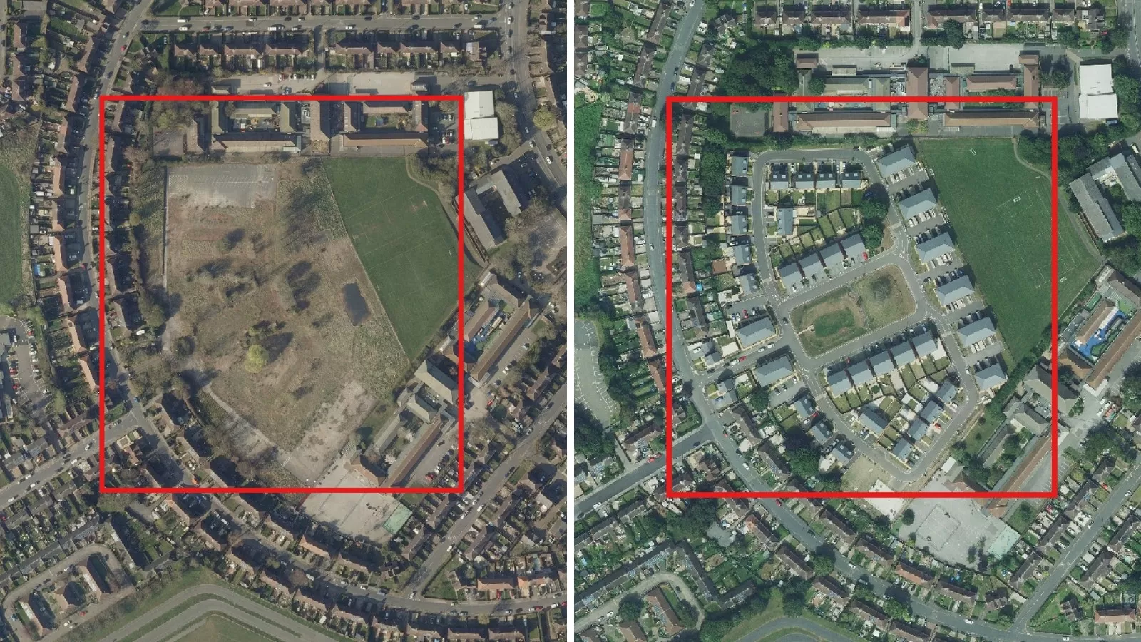
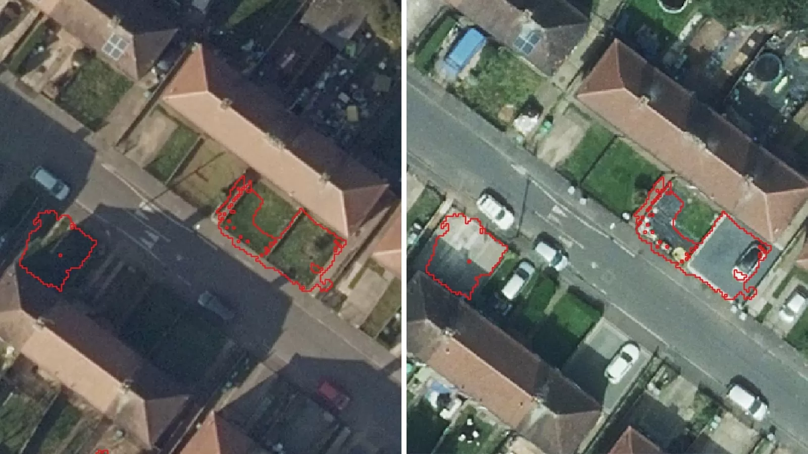
Image: Left - Nottingham, 2019. Right - Nottingham, 2024.
These new insights will enable identification of changes in tree canopy cover and increase in impervious surfaces, meaning local authorities, housing developers, utilities, environmental consultants, and many more will be able to conduct in-depth analysis and modelling, and prepare viable proposals and solutions all from the desktop.
Ian Dee, Associate Director responsible for R&D at Bluesky, explains: “Monitoring environmental change is critical if we want to get ahead of future risk. Urban creep, climate change, and large-scale development are all reducing permeable surfaces and increasing flood pressure, especially during extreme rainfall.
“Our change detection analysis gives clear, quantifiable insight into canopy loss and surface sealing over time. It helps authorities assess where planting schemes are working, where further intervention is needed, and where surface water risk is growing.”
Bluesky has applied its high-resolution aerial photography, current and historical, with 4-band infrared to assess the permeable surface change, and its unique National Tree Map™ (NTM™) – the only tree map to capture the height, location and canopy extent of trees 3 metres and taller in Great Britain and the Republic of Ireland – to assess canopy change.
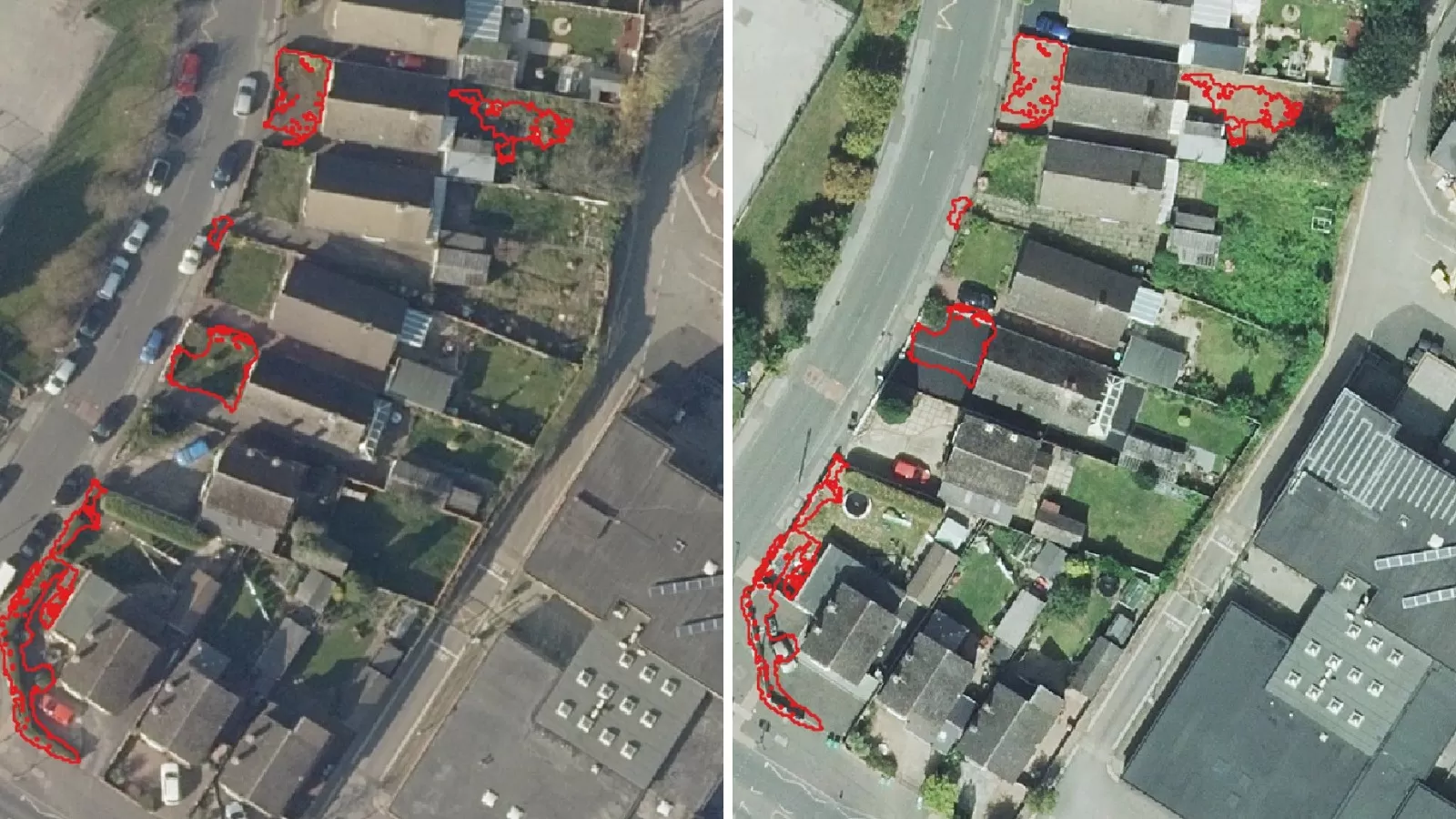
Image: Left - Nottingham, 2019. Right - Nottingham, 2024.