3+30+300 Rule
The 3+30+300 rule is grounded in research that links proximity to nature with a range of health benefits in people living nearby, including reduced stress levels, improved mood, enhanced physical activity, and even lower rates of certain chronic diseases.
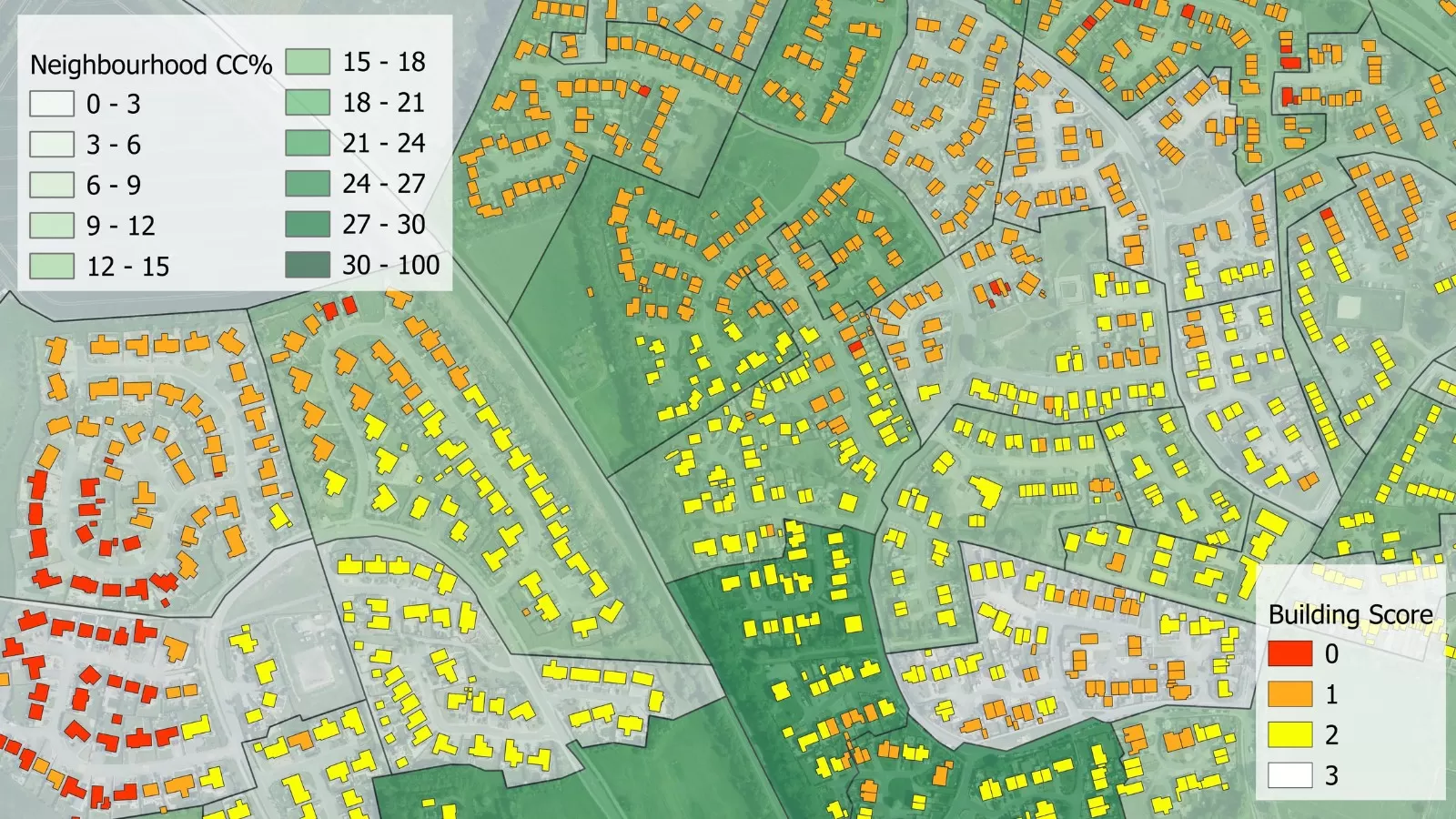
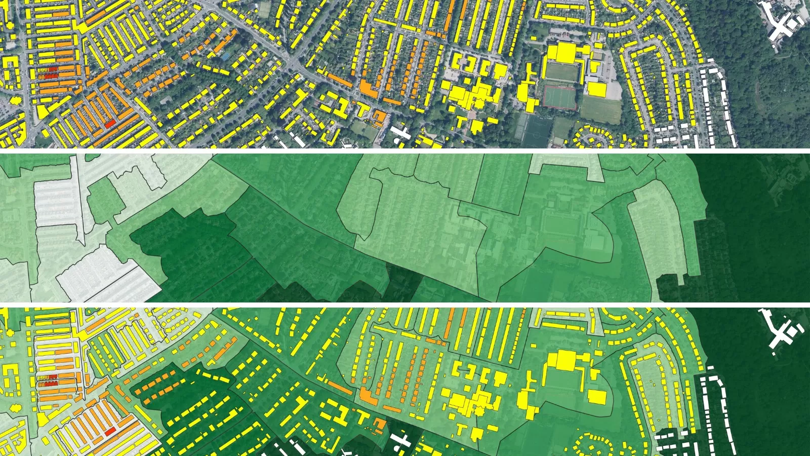
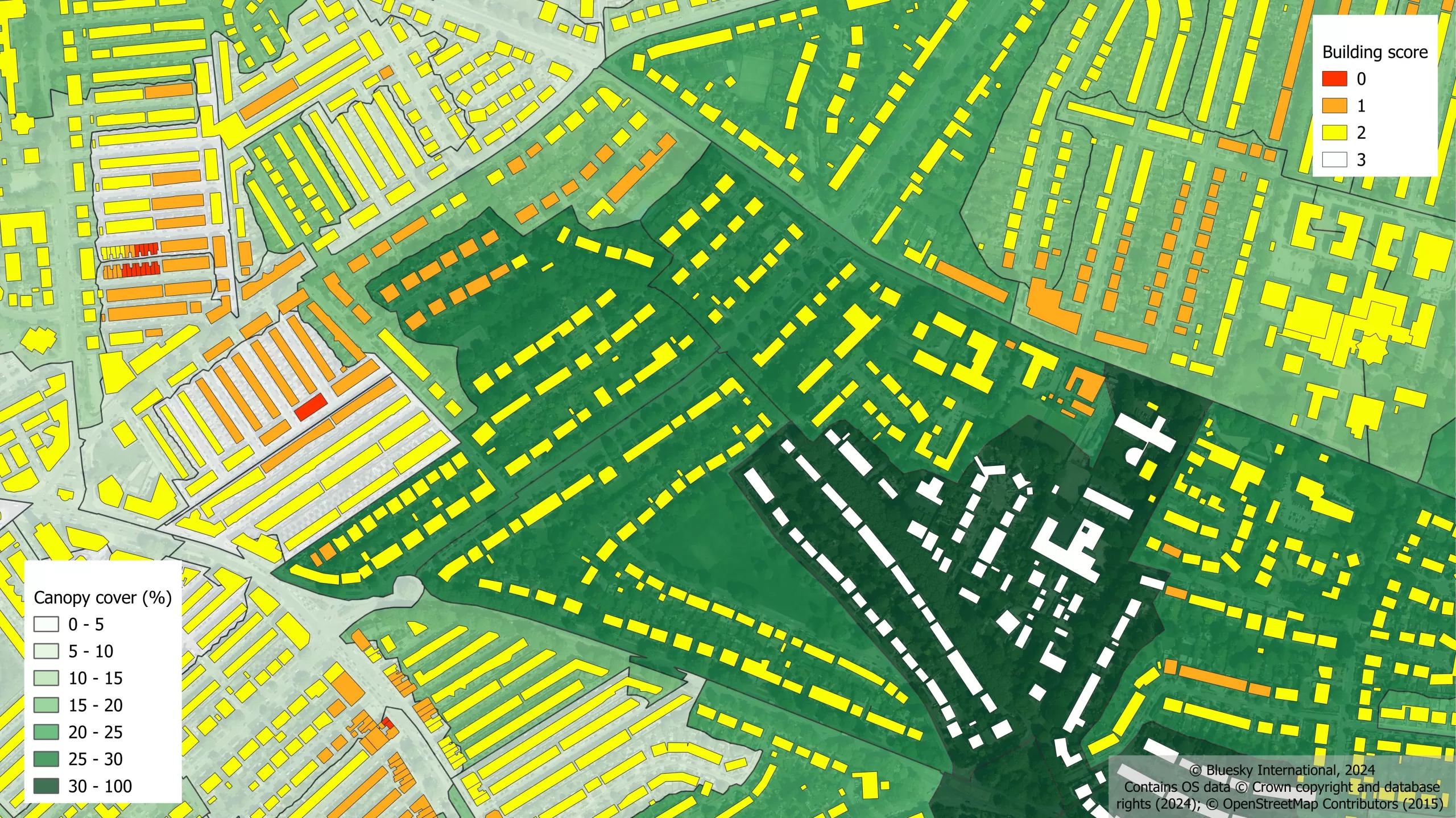
This rule focuses on integrating nature into urban settings, ensuring that people in cities benefit from trees and green spaces. It incorporates 3 components of nature: tree visibility, canopy cover and access to green space.
The 3+30+300 rule was introduced by Cecil Konijnendijk, Co-founder of the Nature Based Solutions Institute. It was first proposed in 2021 and has since gained traction with urban planners, and environmentalists, providing a guideline for urban greening, which could include the development of urban forests as part of plans to develop healthier and greener cities. It recognises the need for people to have proximity to trees and urban nature in order to see the full benefits trees can provide.
Bluesky has launched an ‘add-on’ service to its National Tree Map™ (NTM™) to calculate the 3+30+300 score for neighbourhoods across Britain. We offer analysis and guidance on the most beneficial proximity to trees and green spaces for a positive impact on people’s health and well-being.
The 3+30+300 calculations provided by Bluesky means users will quickly be able to assess the percentage of buildings meeting none, one, two or all three aspects of the rule. It analyses the score of buildings and neighbourhoods across Great Britain, providing geospatial information on all three components of the 3+30+300 rule as well as providing an overall score for each building. For the neighbourhood analysis, statistics on how many buildings meet each component are calculated. In addition to the GIS layer, a PDF report and guide to using the data is provided.
Understanding how buildings and neighbourhoods score on this rule, enables benchmarking exercises to be carried out and prioritisation for tree planting to be incorporated into urban planning.
This service based on the 3+30+300 research has been developed to assist companies and organisations at the forefront of urban greening and creating sustainable cities.
Hear from our product specialist and customers (Aberdeenshire Council and Dudley Metropolitan Borough Council) about how they are utilising our environmental datasets.
Specification
-
Trees over 3m in height
- Analysis of number of trees, canopy cover and green space proximity
-
Building polygons
-
Neighbourhood polygons
-
PDF report and guidance
-
Created from NTM™ (derived from stereo aerial photography)
-
OSGB Projection
-
Vector format – ESRI .shp as standard
Applications
- Urban planning for green infrastructure and green spaces
- Tracking urban greening policies and compliance with environmental regulations
- Can be used in conjunction with other geospatial datasets for management and monitoring, e.g. urban heat islands, public health
- Prioritising areas for urban greening
- Benchmarking urban greening
- Monitoring progress
- Supports planners, tree officers, open spaces teams, flood management and more
- Visualisations to aid community engagement with green space initiatives
Benefits
-
The only 3+30+300 rule analysis available for Great Britain and the Republic of Ireland
- Compatible with Bluesky’s NTM™ and National Hedgerow Map™
- Easy-to-use vector data
- Ongoing support and step-by-step guidance from our expert team
- Compatible with Ordnance Survey products
-
Compatible with OS MasterMap®
-
Continually updated
“The 3+30+300 rule is an evidence-based guideline for the greening of our cities and towns that has rapidly gained popularity across the globe. I am glad to see companies like Bluesky provide essential support to municipalities and organisations who want to use this guideline for development more impactful greening programs, in this case especially in the UK.”
3 + 30 + 300 Analysis Features
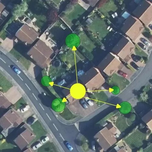
3 Trees
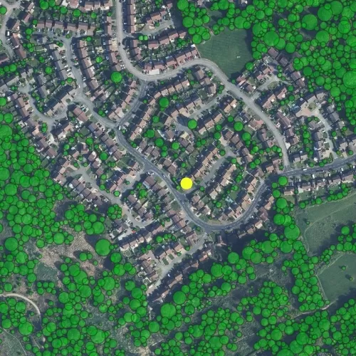
30% Canopy Cover
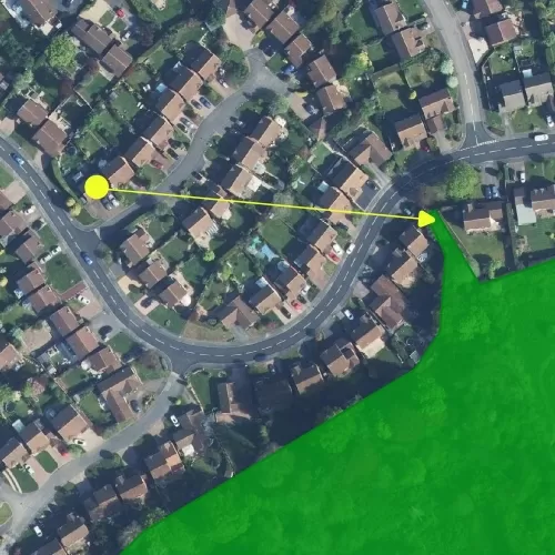
300 Metres