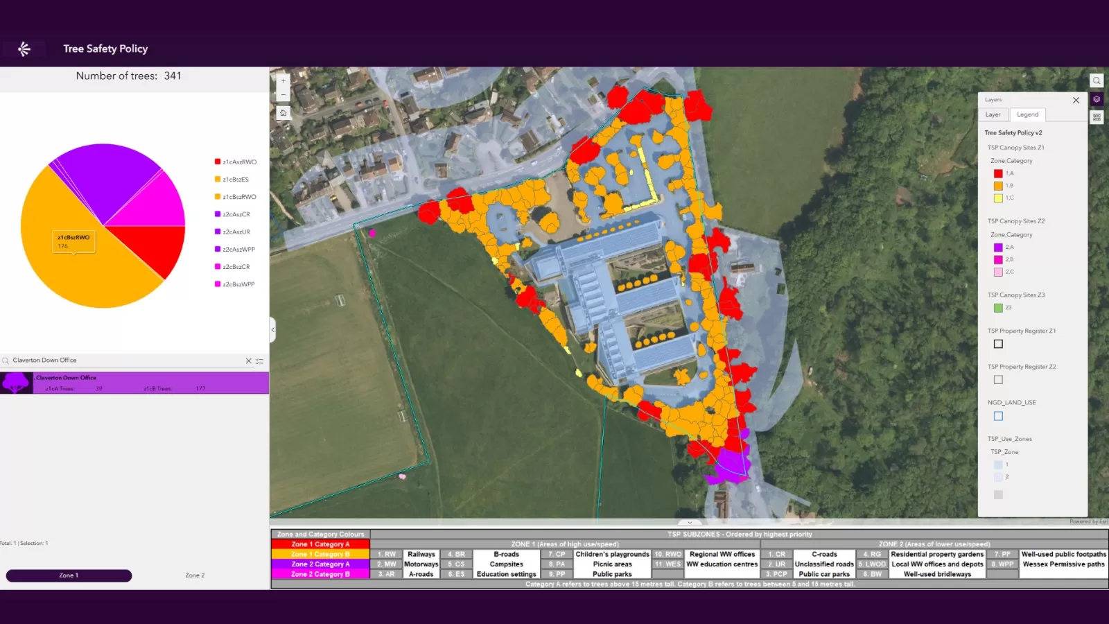
NTM Risk™
Bluesky’s NTM Risk™ is a ground-breaking product designed to offers users richer, more contextual and current tree intelligence than ever before. Created specifically for sectors like insurance and local authorities, the dataset provides intelligence on how trees interact with people, property, and infrastructure, offering a clear view of potential hazards and risks.
Using 13 years of expertise in tree mapping, Bluesky have developed NTM Risk™ to directly address industry pain points, reducing project time, increasing precision, and delivering immediate, actionable insight, transforming how our trees are mapped, monitored, and managed.
NTM Risk™ delivers intelligence to customer desktops that includes:
- Buildings: distance, height, fall radius, and number of properties at risk
- Road & Rail: proximity and angle to transport infrastructure
- Rivers: nearest watercourses, proximity and angle
- Wind: seasonal average speeds, predicted future speeds based on climate change levels
- Elevation: ground height above sea level — vital for flood-risk analysis
Bluesky's NTM™ is created using proprietary algorithms and processing techniques that use our high resolution national aerial photography, terrain and surface data, and colour infrared imagery. The data is updated regularly as part of our cyclic aerial imagery capture and update programme.
No other tree map product available on the market can match us for coverage and currency.
Other Bluesky NTM™ -derived and similar products available include:
Specification
-
Trees over 3m in height
- Measurements of location, height and canopy spread
-
Idealised crowns
-
Detailed crowns
-
Points
-
Created from stereo aerial photography
-
OSGB Projection
-
Vector format – ESRI .shp as standard
Applications
-
Insurance and risk assessment
-
Tree management (including tree preservation orders)
-
Flood and pollution monitoring
-
Transport infrastructure, e.g. railway lines
-
Utility and energy infrastructure
-
Town and city planning
-
Forestry
-
Ecology
-
Air quality monitoring
-
Land and estate management
Key Features
- Buildings: distance, height, fall radius, and number of properties at risk
- Road & Rail: proximity and angle to transport infrastructure
- Rivers: nearest watercourses, proximity and angle
- Wind: seasonal average speeds, predicted future speeds based on climate change levels
-
Elevation: ground height above sea level — vital for flood-risk analysis
- Flood Zones: classifications including Zones 2 and 3
Visit The Mapshop To Access our world of data
Our online Mapshop gives you immediate access to a diverse range of geospatial data ranging from Aerial Photography, LiDAR, Terrain, National Tree Map™, Ordnance Survey, Derived Data.
Quick search: Enter area of interest
(postcode, town/city, coordinates or OS reference)

NTM Risk™ Examples

Tree Fall Distance
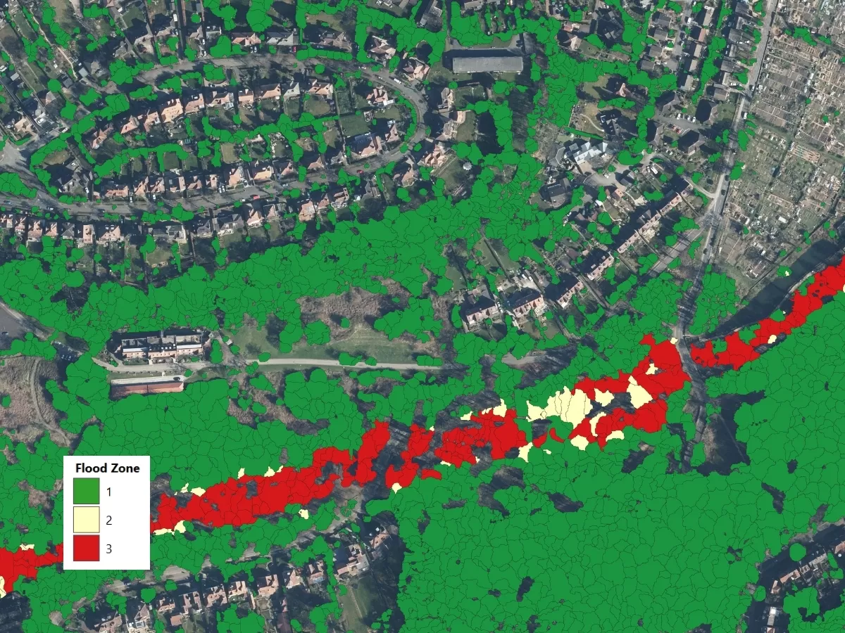
Trees by Flood Zone