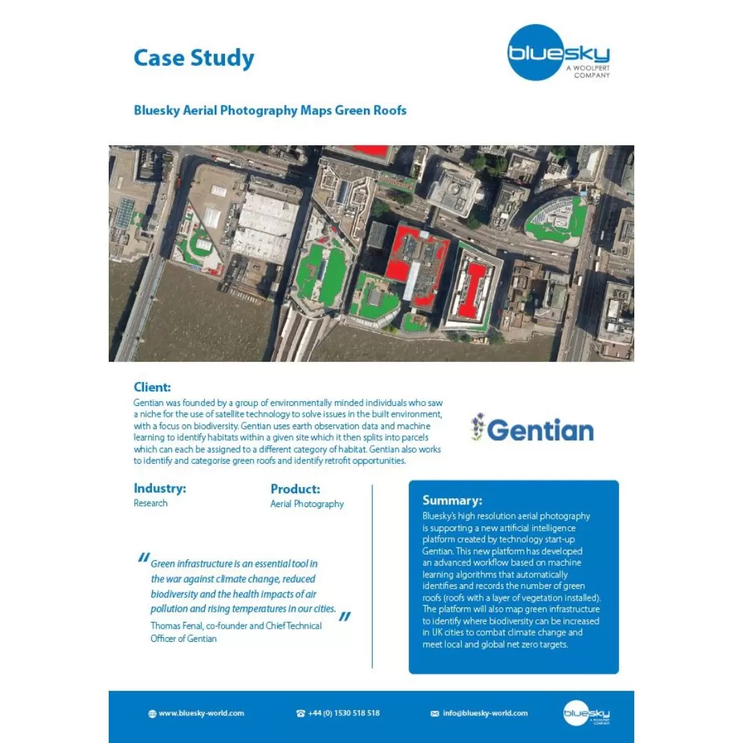
Case Studies – Aerial Photography

Explore how our customers have used our Aerial Photography data.

Screenshot of the Derby Homes case study

Derby Homes:

Bluesky Aerial Photography Helps Derby Homes Boost Solar Energy Output and Reduce Carbon Emissions

Screenshot of the Water Resilient Partnership case study

The Water Resilient Dundee Partnership:

Bluesky Data Supplied via APGB is Aiding Dundee’s Journey to Becoming a Future-Proofed, Flood-Resilient City

Screenshot of the North Ayrshire Council case study

North Ayrshire Council:

Bluesky Data Supplied via APGB is Integral in Supporting Different Services Across North Ayrshire Council

Screenshot of the Mersey Forest case study

The Mersey Forest Partnership:

Bluesky Data Supplied via APGB Helps Mersey Forest Create Flood Management Interventions

Screenshot of the Natural England case study

Natural England:

Bluesky Data Supplied via APGB Aids Natural England in Collecting Habitat and Ecosystem Data for the England Ecosystem Survey (EES)

Screenshot of the James Hutton case study

The James Hutton Institute:

Bluesky Data Supplied via APGB is used to Create a Deep-Learning Model to Map Peatland Drainage and Erosion Across Scotland

Screenshot of the Historic England case study

Historic England:

Bluesky Data Supplied via APGB Helps Identify, Map and Record Archaeological Features at a Landscape Scale

Screenshot of the Gentian case study

Gentian:

Bluesky Aerial Photography Maps Green Roofs