


Sample Data
Please click on the images below to download Bluesky sample data. The samples will open in most GIS Mapping applications. Each sample consists of a sq km of data with associated ESRI world file and projection file (if needed).
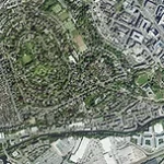
AERIAL PHOTOGRAPHY SAMPLE DATA

5cm Aerial Photography
Sample of ultra-high resolution (5cm GSD) aerial photo.
Data is provided as a zip file which contains the image data, an ESRI world file and projection file.

12.5cm Aerial Photography
Sample of high resolution (12.5cm GSD) aerial photo.
Data is provided as a zip file which contains the image data, an ESRI world file and projection file.
25cm Aerial Photography
Sample of standard resolution (25cm GSD) aerial photo.
Data is provided as a zip file which contains the image data, an ESRI world file and projection file.
50cm Colour Infrared Image
A 1 sq km sample of Bluesky Colour Infrared data, which is made of the near infrared band, red band, and green band. This type of data can be used for vegetation health studies.
Data is provided as a zip file which contains the image data, an ESRI world file and projection file.
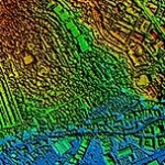
HEIGHT DATA SAMPLES

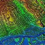
25cm DSM (Digital Surface Model)
This photogrammetrically derived DSM data includes all of the buildings, trees and other features on the ground.
The download includes an ASCII Grid file.
2m Photogrammetric DSM (Digital Surface Model)
This photogrammetrically derived DSM data includes all of the buildings, trees and other features on the ground.
The download includes an ASCII Grid file.
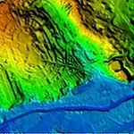
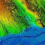
5m Photogrammetric DTM (Digital Terrain Model)
This photogrammetrically derived DTM has had all surface features removed, such as vegetation and buildings, to leave a bald earth terrain.
The download includes an ASCII Grid file.
1m LiDAR DSM (Digital Surface Model)
This LiDAR DSM data includes all of the buildings, trees and other features on the ground.
The download includes an ASCII Grid file.
1m LiDAR DTM (Digital Terrain Model)
This LiDAR DTM data has had all surface features removed, such as vegetation and buildings, to leave a bald earth terrain.
The download includes an ASCII Grid file.
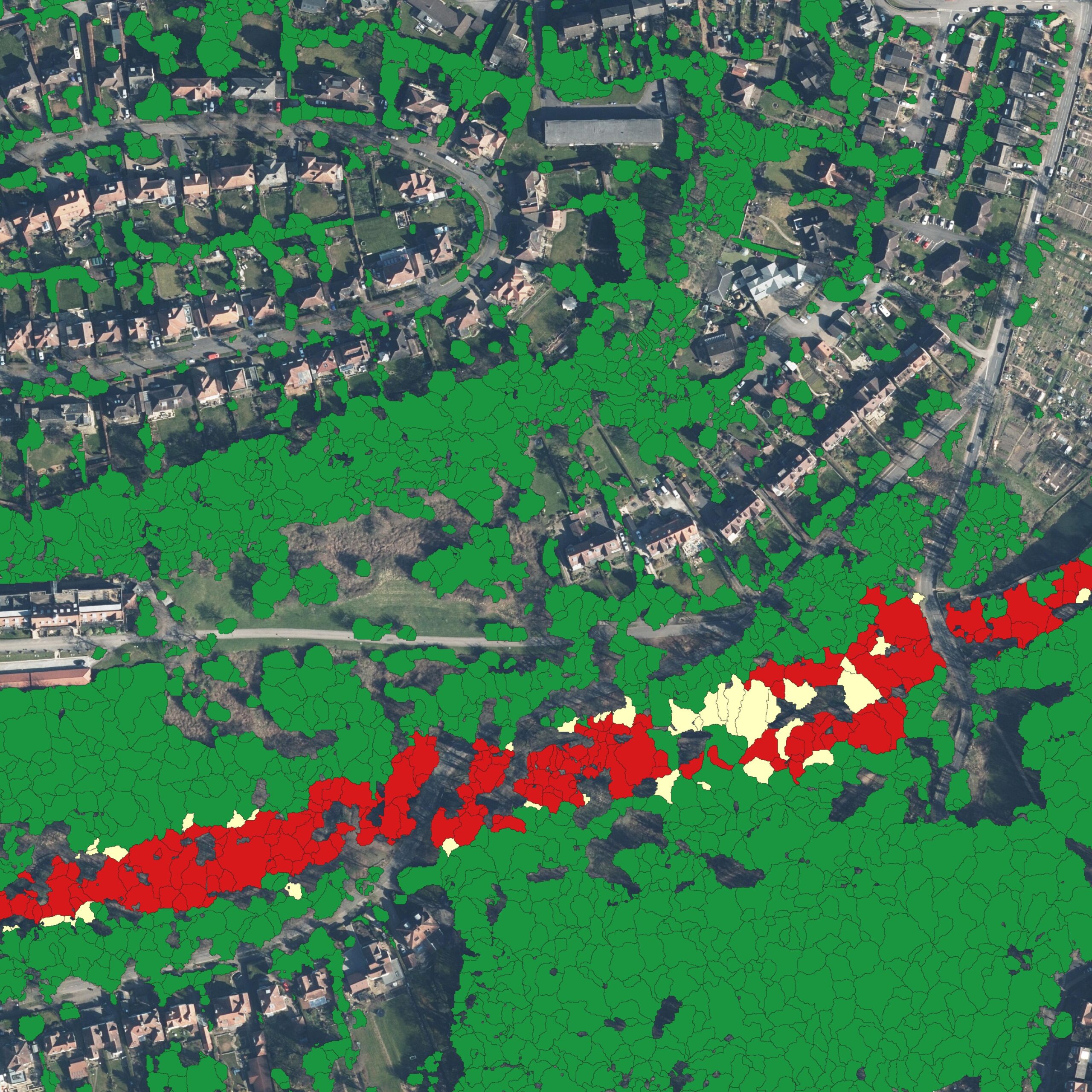
NATIONAL TREE MAP™ SAMPLE DATA
National Tree Map™ (NTM™)
Bluesky’s National Tree Map™ is a digital map layer accurately depicting the location and extent of trees. NTM™ details the exact spatial location and height of individual trees, together with the circumference of its canopy.
The download Zip file includes the three deliverables of Tree Points, Crowns and Canopies.
(The matching aerial photography tile is not included when purchased from Bluesky, but is included in this download for illustration purposes).
National Tree Map Plus™ (NTM+™)
Bluesky’s NTM+™ delivers intelligence to customer desktops that includes:
- Location: nearest UPRN, postcode, LSOA, district, and county
- Conservation: SSSI, AONB, SAC, National Park, or Greenbelt designations
- Land Use: residential, industrial, agricultural, and more
- Soils & Agriculture: soil type, drainage, and ALC grade
Sample data is available in .SHP and .GPKG file formats.
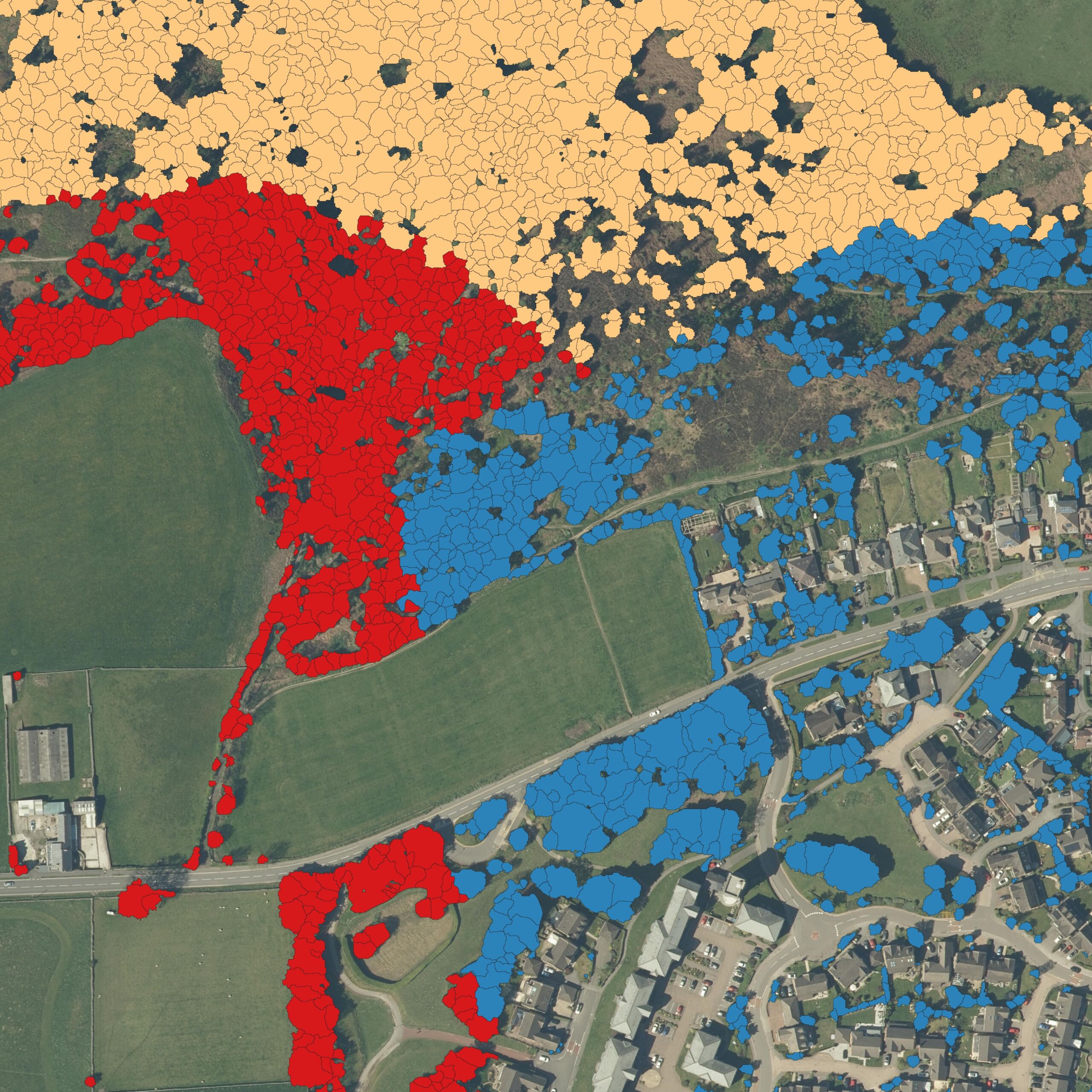
National Tree Map Risk™ (NTM Risk™)
Bluesky’s NTM Risk™ delivers intelligence to customer desktops that includes:
- Buildings: distance, height, fall radius, and number of properties at risk
- Road & Rail: proximity and angle to transport infrastructure
- Rivers: nearest watercourses, proximity and angle
- Wind: seasonal average speeds, predicted future speeds based on climate change levels
- Elevation: ground height above sea level — vital for flood-risk analysis
- Flood Zones: classifications including Zones 2 and 3
Sample data is available in .SHP and .GPKG file formats.

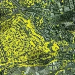
National Hedgerow Map™ (NHM™)
Bluesky’s National Hedgerow Map™ is a digital map layer accurately depicting the location and extent of hedgerows. NHM™ details the exact spatial location and height of hedgerows, together with the volume of the feature.
The download Zip file includes the three deliverables of Vegetation Polygons, Centrelines, and NTM™.
(The matching aerial photography tile is not included when purchased from Bluesky, but is included in this download for illustration purposes).
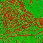
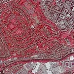
NDVI
NDVI (Normalised Difference Vegetation Index) is a widely used measurement of the visible and near-infrared light reflected by vegetation.
Data is provided as a zip file which contains the image data, an ESRI world file and projection file.
METROVISTA™ SAMPLE DATA

MetroVista™ Mesh
These automatically created mesh models are fully rendered using the vertical and oblique photography, making them a cost-effective alternative to traditional 3D models.
Formats: OBJ, FBX
Software: You will need specialist software to open MetroVista™ Mesh.
– For OBJ / FBX: AutoCAD, Maya (other software is available)
– Open source software can be used to view the data: e.g. CloudCompare, MeshLab
3D BUILDING MODEL DOWNLOADS

LOD 1
Level of Detail 1 – Models consist of simple block buildings.
The downloadable file includes .DGN, .DWG, .SKP & .OBJ.
Note: When opening the .OBJ file you will be prompted to select the .MTL file, this is also included in the download.

LOD 2
Level of Detail 2 – Models contain fully modelled pitched or flat roof shapes.
The downloadable file includes .DGN, .DWG, .SKP & .OBJ.
Note: When opening the .OBJ file you will be prompted to select the .MTL file, this is also included in the download.

LOD 3
Level of Detail 3 – Models contain roof shapes and structures, including dormer windows, chimneys and other small details visible within the aerial photography.
The downloadable file includes .DGN, .DWG, .SKP & .OBJ.
Note: When opening the .OBJ file you will be prompted to select the .MTL file, this is also included in the download.
THERMAL IMAGERY SAMPLE DATA
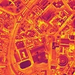
Thermal Imagery
Once combined with OS MasterMap or a similar building polygon database it is possible to measure the heat loss from individual buildings and pinpoint the most inefficient properties.
The image file available for download here is a greyscale TIFF image and its accompanying world file.
SOLAR PANEL MAPPING SAMPLE DATA
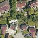
Solar Panel Mapping
Solar Panel Mapping assists in determining the location and placement of photovoltaic solar panels, ensuring the maximum possible light is obtained for highest efficiency.
This download includes a sample dataset, the presentation PDF file and marketing literature.