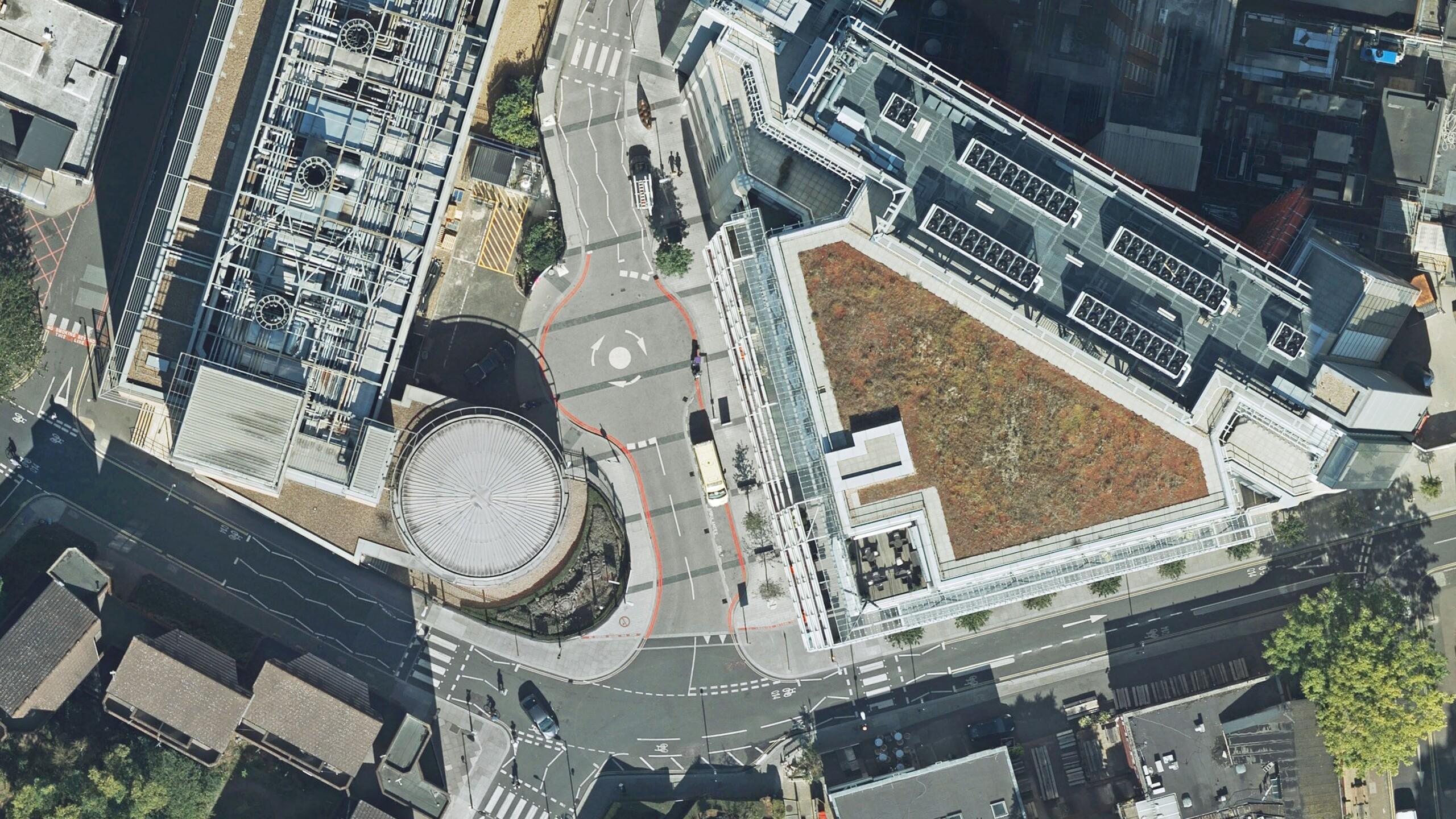
Southwark Council is using the highest resolution photography from Bluesky to inform frontline service provision and decision making across its planning, transport, housing and environment operations. The 5cm data offers previously unseen detail and feedback from users has already shown its applications for CCTV camera planning, investigation of ‘beds in sheds’ and the measurement of green infrastructure within the London Borough. The Bluesky aerial photography has also helped officers continue to operate during lockdown when site visits were not possible.
“We have deployed the Bluesky imagery to specialist users as well as making it available to every officer and every resident via our intranet and internet mapping services,” commented Stuart Carter, Corporate GIS Manager at Southwark Council. “Early feedback has been extremely positive with a wide range of applications including park construction projects, habitat mapping and feasibility assessments for new council homes.”
Southwark Council worked with aerial mapping company Bluesky to update its aerial photography and implement the new ultra-high resolution data. Captured using Bluesky’s state of the art CityMapper sensor, as part of its MetroVista product range, the 5cm imagery reveals previously ‘unseen’ detail such as rubbish bins, tree canopy cover and even air conditioning units on commercial premises.
“We have used the 5cm data to investigate issues in the private rented sector including unlicensed houses let in multiple occupation and illegally occupied outhouses,” added the Enforcement and Licensing Service Manager. “We regularly have to investigate a building with an old or unregistered address and before we investigate in person we try to gather as much evidence and intelligence as possible. The Bluesky data will help us locate sites and get a better understanding of what we may experience when attending.”
“Road markings are obviously not shown on Ordnance Survey maps so we would normally have to get someone to survey them,” said the Group Manager, Transport Projects. “Instead, I have been using the 5cm imagery to look at current markings around a junction and understand how improvements could be made. This has been particularly useful during lockdown when site visits have been a challenge.”
Southwark is a long-term user of aerial photography with coverage dating back to the early nineties including multiple datasets from aerial mapping company Bluesky. Deployed to users of the Council’s desktop Geographical Information Systems MapInfo and to non-specialist staff via Spectrum Spatial Analyst, an intranet mapping service from Precisely (formerly Pitney Bowes), the aerial photography is also available to members of the public and other interested parties using the online mapping service Southwark Maps.