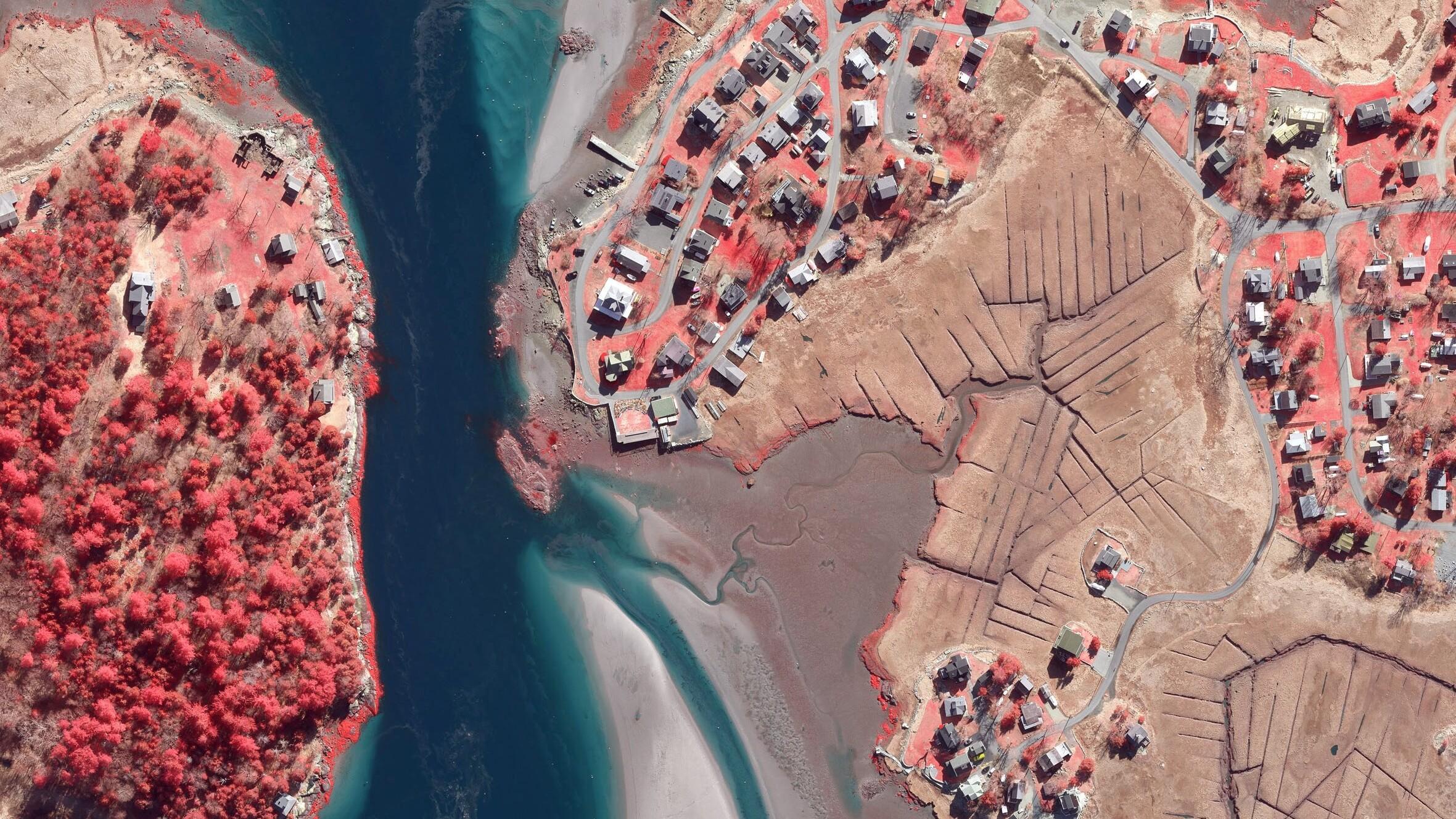
Researchers at Boston University are using high resolution aerial photography to investigate how important coastal ecosystems are responding to climate change. The study focused on an area of salt marsh in Massachusetts which saw an extreme storm event deposit more than 15 years’ worth of sediment onto the marshes. Using high resolution aerial photography from Bluesky researchers were able to examine the deposits in detail recording measurements of deposit’s distribution and total cover.
A second survey of the site has recently been completed by Bluesky to map depressions in the marsh surface, called potholes, which are important indicators of how the salt marsh is responding to rising sea level.
Salt marshes are among the most productive ecosystems providing a range of benefits including carbon sequestration, wildlife habitat and protection from storm surges and flooding. Coastal wetlands are progressively more at risk from the effects of climate change such as increasing carbon dioxide levels and rising temperatures. However, the primary impact is from rising sea level, which salt marshes are extremely vulnerable to due to their low, flat elevation.
“Many scientists believe that salt marshes possess resilience to low level rates of sea level rise because they are able to boost plant productivity with increasing water depth, adding to organic accretion. Likewise increasing periods of inundation will cause greater mineral sedimentation,” commented Professor Duncan M. FitzGerald of the Department of Earth and Environment at Boston University. “However, as the effects of climate change are predicted to include more extreme weather events, it is important that we understand how these events impact this important ecosystem.
“The Bluesky aerial photomaps allow us to observe and measure changes to the salt marsh and from this analysis we can get a better understanding of both short-term impact and the longer-term processes, which can then be used to help inform possible restoration methods,” he continued.
Bluesky Geospatial undertook the original survey of the Parker River Wildlife Refuge in Newburyport, Massachusetts following a period of extended low temperatures, which caused prolonged ice formation, followed by strong winds and an extremely high tide. 300 exposures were captured using a large format, digital aerial photogrammetric camera which were processed to produce seamless coverage of the 130 km2 site at 10 centimetre resolution. The follow up survey was undertaken during early April 2021. The Bluesky aerial photomaps are shared with Boston University for analysis using the ArcMap Geographical Information System (GIS).