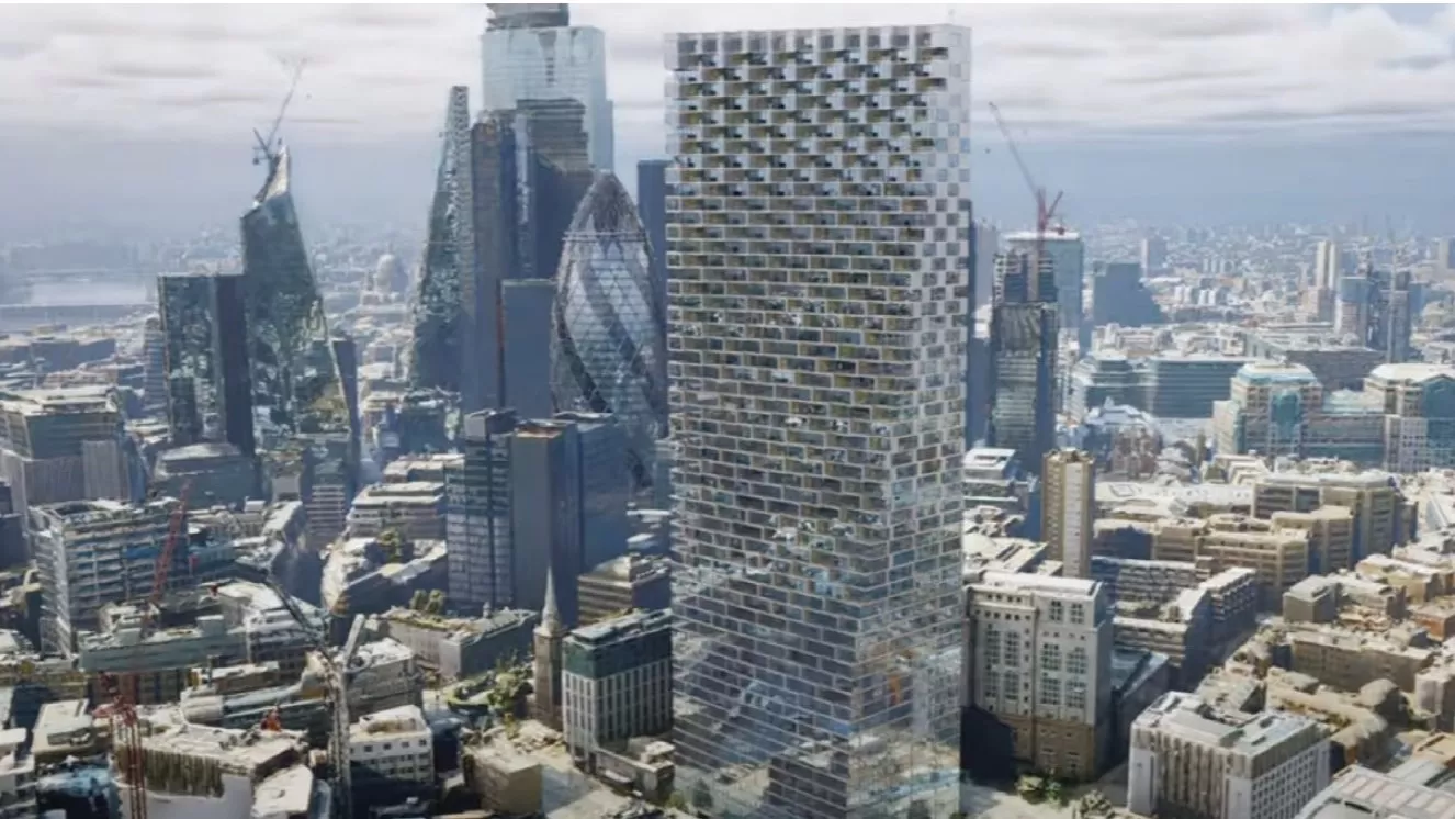
Photorealistic 3D models from aerial mapping specialist Bluesky are being used to create real-world interactive visualisations to transform how unbuilt commercial and residential property is presented for sale. Created by 3D rendering company Lunas, the real estate presentations can be run on interactive touch displays including tables and giant video walls, as well as on mobile phones, tablets and websites.
Using the Bluesky MetroVista mesh models as a base, new developments are shown in-situ and potential purchasers can interact with the surrounding environment, explore the neighbourhood and even experience different weather conditions.
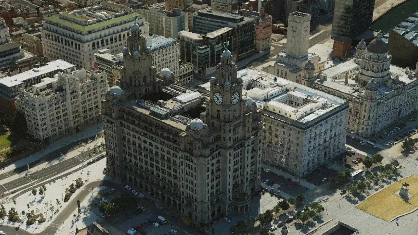
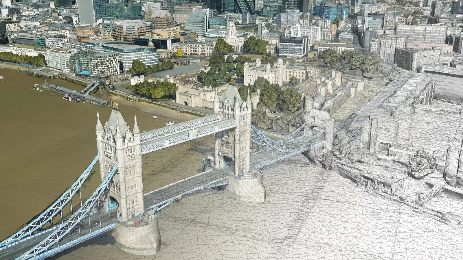
“In order to create these presentations, we need up-to-date base maps of the highest visual quality and geographic accuracy,” commented Slava Oganesian, CEO and Co-founder of Montreal-based Lunas Inc. “Which is why we worked with Bluesky. The MetroVista data captures a city as it actually is, with highly accurate LiDAR measurements of the terrain and existing developments and unparalleled visual records achieved through the simultaneous capture of both vertical and oblique aerial images.
“Building on our work to date with Bluesky we hope to create 3D twins for all major cities,” Oganesian continued, “showcasing our urban centres as they are today and revealing how they will look for future generations.”
Called L-Touch, the visualisation application is designed to help developers communicate future development plans to secure permission to proceed with a proposal and market the development for investment and sales. Suitable for use on a variety of platforms, L-Touch presentations provide a bird’s eye view of a project once built; affording a 360-degree view which can be rotated and viewed from different perspectives and different scales. Office buildings, apartment blocks and even hotels can be marketed with additional detail such as price and floor plans.
The visualisations can then be manipulated to show how they are positioned in relation to the sun, experience the view from the balcony and understand proximity to local services such as public transport, green space and leisure facilities. L-Touch can also be used to showcase different conditions and scenarios such as weather events, rush-hour traffic and even future developments nearby.
L-Touch uses the latest gaming technology to optimise and manipulate the Bluesky MetroVista data. Captured using the world’s first large format imagery and LiDAR hybrid airborne sensor, the Bluesky data includes simultaneously captured oblique and vertical aerial photography. The MetroVista datasets also include geographically accurate, phototextured, mesh models ready for use in 3D GIS, CAD and other modelling software as well as visualisation, gaming and Virtual Reality workflows.