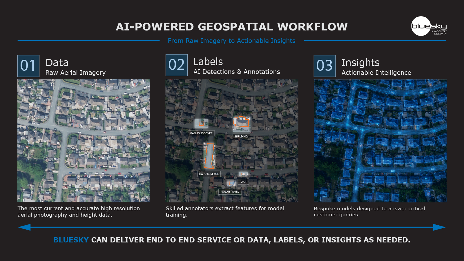
Aerial mapping company Bluesky International and the University of Leicester are using Artificial Intelligence and Machine Learning to make 3D models easier to use in smart city and digital twin applications. Using established mathematical techniques, the project will focus on Bluesky’s MetroVista mesh models as the basis for research into the simplification of the data without loss of detail or integrity. It is hoped the outcomes will address many of the barriers faced by potential users in the insurance, real estate and public administration sectors which can include processing time, data storage costs and energy consumption.
This latest partnership between Bluesky and the University of Leicester will be funded by the £7 million SPRINT (SPace Research and Innovation Network for Technology) programme. The project follows a previous collaboration to develop a new portfolio of geospatial data products for the UK insurance sector.
“We developed the new MetroVista product for smart cities and digital twin applications,” commented James Eddy, Technical Director at Bluesky International. “It’s created in a mesh format, but these models can be data intensive so we’re looking to refine our technology to ensure that we offer energy savings, reduced data handling and can make data smaller.
“With funded access to the expert team from the University of Leicester’s Applied Mathematics Group, we aim to make the technology more accessible and open up to new users. It’s a new product for many of the sectors involved in smart city and digital twin applications so this project will help us to accelerate the development of the technology and encourage people to get accustomed to it.”
Dr. Alberto Paganini, Lecturer in Applied Mathematics at the University of Leicester added, “This SPRINT project provides an exciting opportunity to apply state of the art mathematics in industrial innovation. It will have considerable impact on making digital mapping technologies accessible to new users.”
The SPRINT funded project is utilising Bluesky’s MetroVista mesh models to help develop a triangulated irregular network (TIN) simplification tool. Based on adaptive AI-guided mesh coarsening methods, an established technique used to accelerate the numerical simulation of physical phenomena, it is hoped this will reduce the complexity of the models making them easier to use and disseminate.
Captured using the world’s first large format imagery and LiDAR hybrid airborne sensor, the MetroVista datasets include geographically accurate, phototextured, mesh models ready for use in 3D GIS, CAD and other modelling software. The Bluesky data also includes simultaneously captured oblique and vertical aerial photography.