Aerial mapping company Bluesky International, has revealed a huge upsurge in the demand for same day delivery geospatial data. Since launching its online Mapshop, companies from industries such as architecture, construction, agriculture, land management, planning and utilities, are regularly accessing high-resolution aerial photography, 3D height data and other map layers. The increase in demand has seen downloads from Bluesky’s online Mapshop rise by a third in the last year, with the rise in remote working and a focus on environmental analysis and changes expected to continue driving this upward trend.
“During the first lockdown we saw unprecedented demand for off-the-shelf data as home working and restrictions on travel impacted on service delivery across a broad range of sectors,” commented Ralph Coleman, Sales Director at Leicestershire-based Bluesky International. “Being able to remotely experience an environment and make decisions based on accurate, up-to-date geographic intelligence, from your desk, whether that is back in the office or at the kitchen table, is now the new norm and we expect demand will continue to grow.
“Our Mapshop has two portals, one for England, Wales and Scotland, and one for the Republic Ireland, and we have also seen a significant increase in downloads of Irish data with an increase of nearly 90% compared to last year.”
The Bluesky Mapshop is an easy-to-use solution providing access to one of the largest online collections of geographic data in the UK. Multiple epochs of aerial photography are available with data ranging in resolution from ultra-high 5-centimetre cover of many UK cities and national 12.5cm resolution imagery in addition there is also 25-centimetre historical legacy imagery.
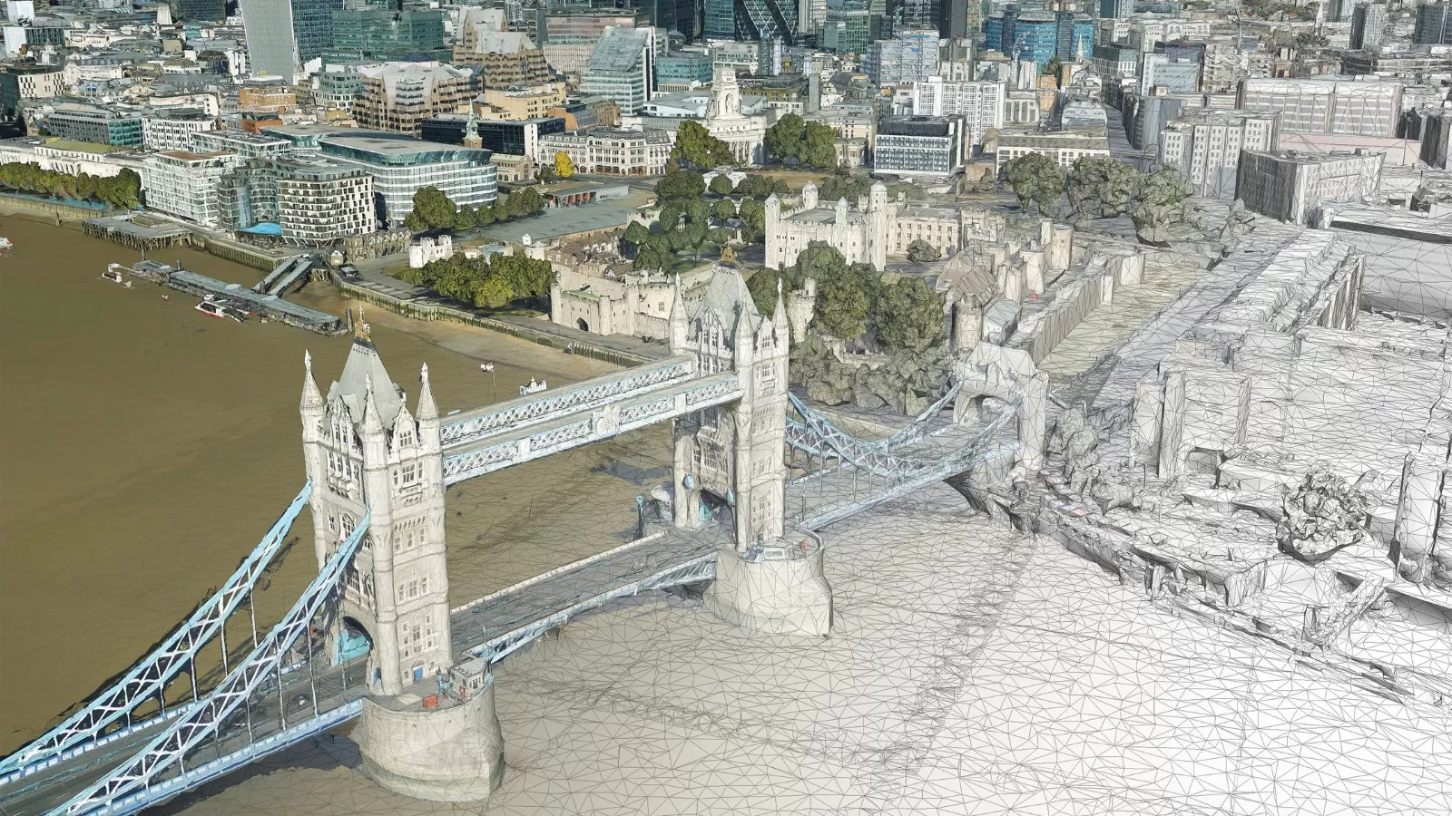
Bluesky also offers a range of 3D height data, including photogrammetrically derived national Digital Terrain and Surface Models (DTM / DSM), LiDAR data and MetroVista Mesh Models as well as a unique database of tree canopy cover and heights for trees 3-metres and taller, called the National Tree Map.
Other datasets available through the Bluesky Mapshop include a National Soil Map, geological and hydrological mapping as well as Ordnance Survey mapping products and free data from organisations such as the Environment Agency, British Geological Survey and Natural Resource Wales.
Bluesky is the only commercial aerial mapping company to have full coverage of high-resolution imagery and height data of the Republic of Ireland, England, Scotland and Wales, which it maintains on a rolling three-year cycle. These datasets underpin a contract with the Geospatial Commission which makes geographic information, including the aerial photography and height data, free at the point of use for all public sector bodies in Great Britain.