A new data visualisation tool has been developed and launched designed to support civil infrastructure teams expediate access to data during the planning phase enabling more informed decision making and significant reductions in time and resources.
Bluesky International Ltd and Sensat have entered into a partnership to merge rapid data collection methods and advanced visualisation capabilities, unlocking data certainty for infrastructure teams.
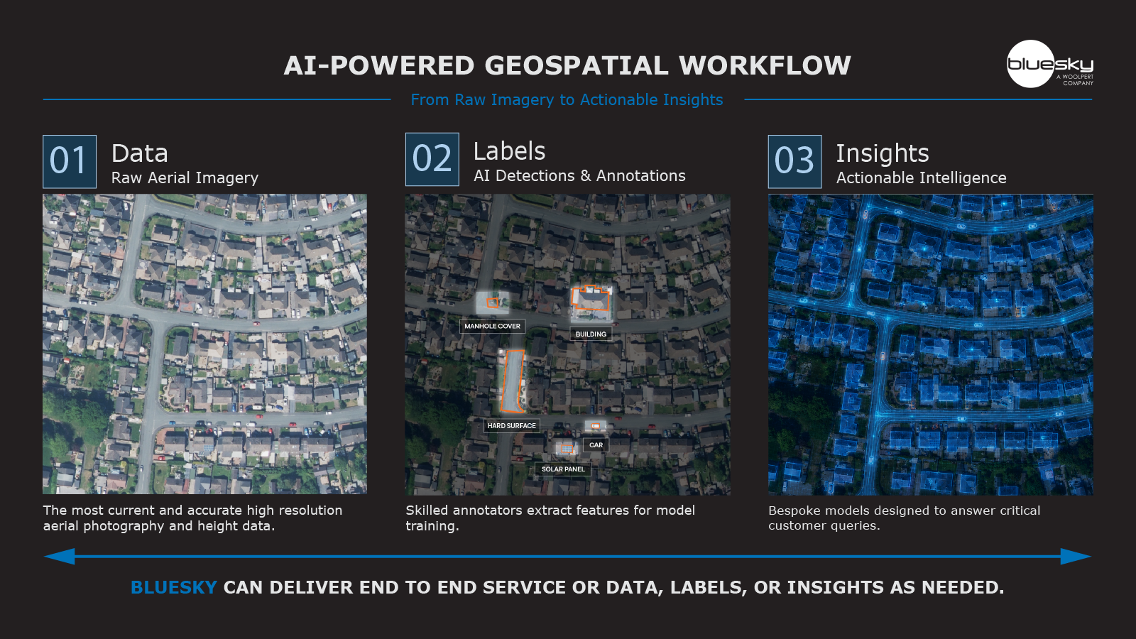
The benefits include the ability to access geospatial data early-on in the planning stage, often negating the requirement to conduct costly and time-intensive traditional surveys. Teams are now able to seamlessly overlay plans onto real-world contexts, ensuring decisions can be guided with the knowledge and security that they are based on accurate and current geospatial data.
Ralph Coleman, Chief Commercial Officer at Bluesky, said: “We are proud to embark on this transformative partnership with Sensat. By seamlessly integrating Bluesky’s geospatial data with Sensat’s visualisation platform, we empower civil infrastructure teams to break free from time and cost constraints of traditional survey methods. Together, we are providing a solution that accelerates data access, setting a new standard for efficiency and accuracy in the planning process.”
George Dey, Head of Partnerships at Sensat, added: “Data access is a significant challenge in civil infrastructure. Whereas before we relied on lengthy surveys, today, with state-of-the-art data capture and visualisation technologies at our fingertips, teams can make the best decisions from the get-go. Our partnership with Bluesky aligns perfectly with our shared values regarding data access. Bluesky provides the data, and we can open it up for teams to make sense of much faster than traditional means.”