High resolution aerial photography from Bluesky International is informing day-to-day decision making, long-term planning and reporting at the Metropolitan Police Service. Supplied as part of a multi-million-pound Government mapping contract, the Bluesky imagery is an essential layer in the Met Police’s newly relaunched Met Map. A lightweight, web-based Geographical Information System (GIS), Met Map provides access for more than 8,000 users to base mapping, including the Bluesky images, operational details and crime data. Applications of Met Map include crime analysis, enquiries and searches, specialist operations and event planning.
As part of its long-term strategy; the Met Direction, the Met has prioritised the use of data and advanced technologies, such as Met Map, to its advantage in the pursuit of criminals, making information and insight more accessible internally, and externally, to support evidence-based decisions and promote public confidence.
Met Map is accessed by users throughout the organisation to support day-to-day decision-making, analysis, strategic planning and reporting with applications including missing person searches, CCTV studies, accident and collision investigations and operational planning. Users of Met Map include Neighbourhood and Borough Management Teams, investigation units and specialist operations, to name just a few.
The Bluesky imagery is an essential layer in Met Map where it is utilised alongside base mapping from Ordnance Survey and A-Z, and corporate layers, for example borough or command boundaries. Additional data from partner organisations including Transport for London (TfL) is integrated via APIs and the Met Police can add up to 10 million additional data points every day.
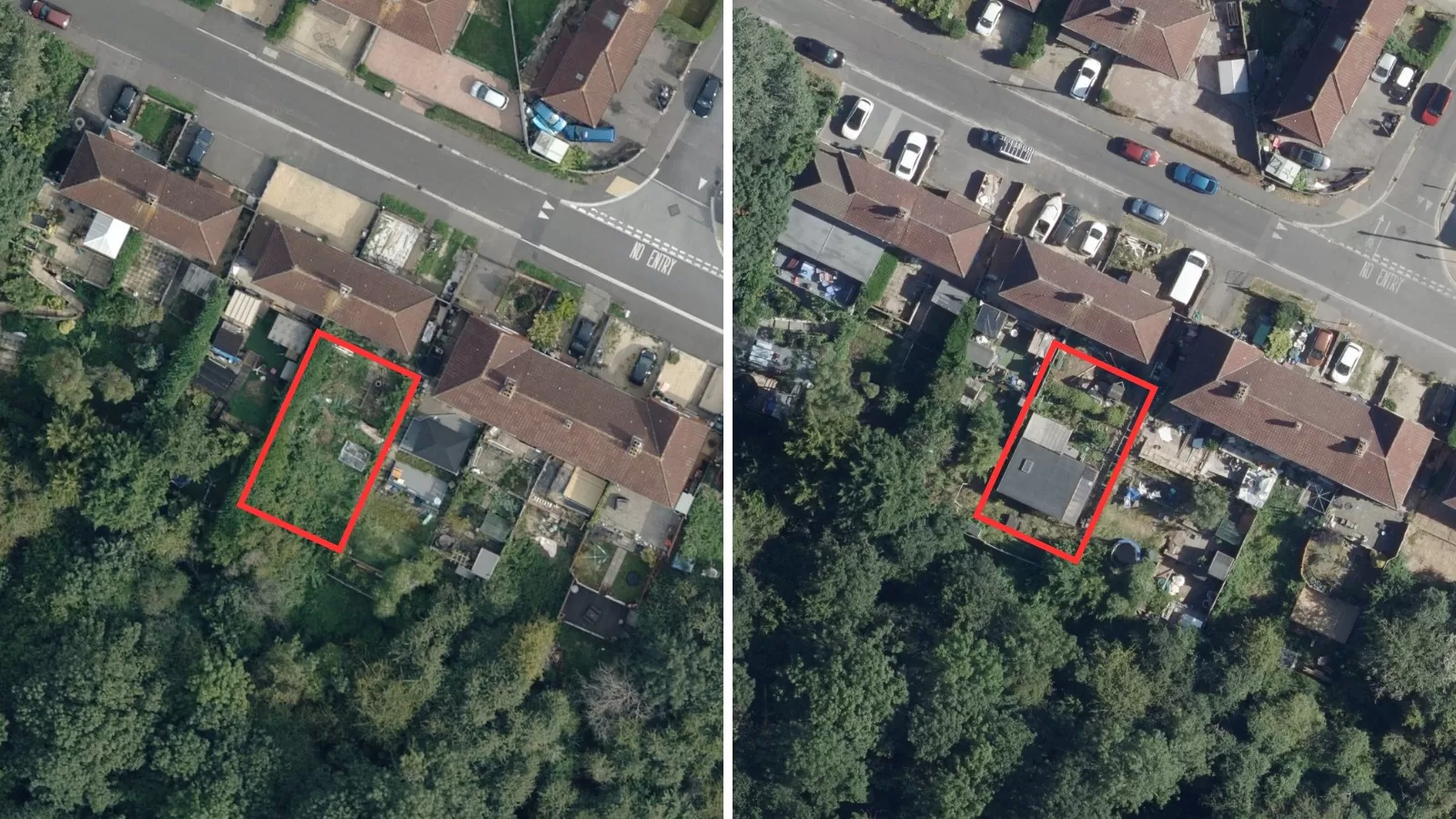
The benefits of using aerial photography in combination with more traditional mapping include currency, detail and ease of use. “Aerial photography is now being more widely-used for applications across our professional and personal spaces making it more familiar and easier to engage with for non-technical staff within the Met, members of the public and other stakeholders”, said Ralph Coleman, Chief Commercial Officer at Bluesky International. “The additional detail is particularly vital when more granular analysis is necessary as within the images you can clearly see important features like road markings, undergrowth information and street furniture, including rubbish bins that would not be present in other types of maps. The age of the imagery is also important; as we commit to a three-year, nationwide update programme, users can be confident they are accessing the most up-to-date resource available.”
The largest police force in the UK, the Metropolitan Police employs more than 34,000 officers together with specialist support staff and more than 2,500 volunteer police officers in the Metropolitan Special Constabulary. As well as policing London’s 620 square miles and 8.9 million population the Met has responsibility for a variety of specialist policing units and hosts the UK’s Counter Terrorism Policing HQ.
The Bluesky data is supplied under the Aerial Photography Great Britain (APGB) contract, which gives local authorities, emergency services, environmental bodies and central government departments, access to, free at point of use, high quality aerial data. Other data available from Bluesky under this contract includes 3D height models and Colour Infrared imagery. Bluesky is the lead consortium partner for the APGB contract.