New geospatial mapping technology is enabling the carbon storage benefit of Great Britain and Ireland's hedgerows to be calculated from the skies.
The nation’s hedgerows have been in the spotlight over recent months, with growing awareness of their vital role in improving biodiversity and increasing carbon sequestration.
As well as providing shelter for wildlife, hedgerows capture carbon and help to reduce flooding.
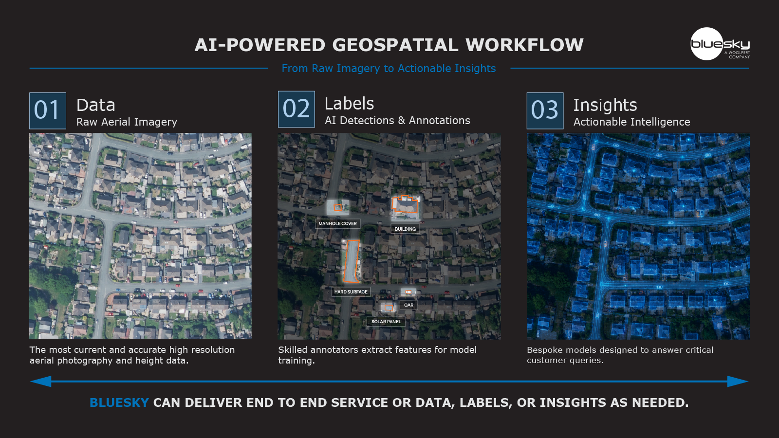
Bluesky International has now developed a further layer of geospatial data which enable users to calculate the carbon storage capacity of hedgerows.
The Leicestershire-based company is the UK's leading aerial survey company and has been mapping Great Britain and Ireland's trees for more than a decade.
Recognising the increasing need for accurate data to support regeneration and hedge planting initiatives, it has extended its tree expertise to the National Hedgerow Map™ (NHM™).
Importantly, the NHM™ has the unique ability to calculate hedgerow carbon storage capacity.
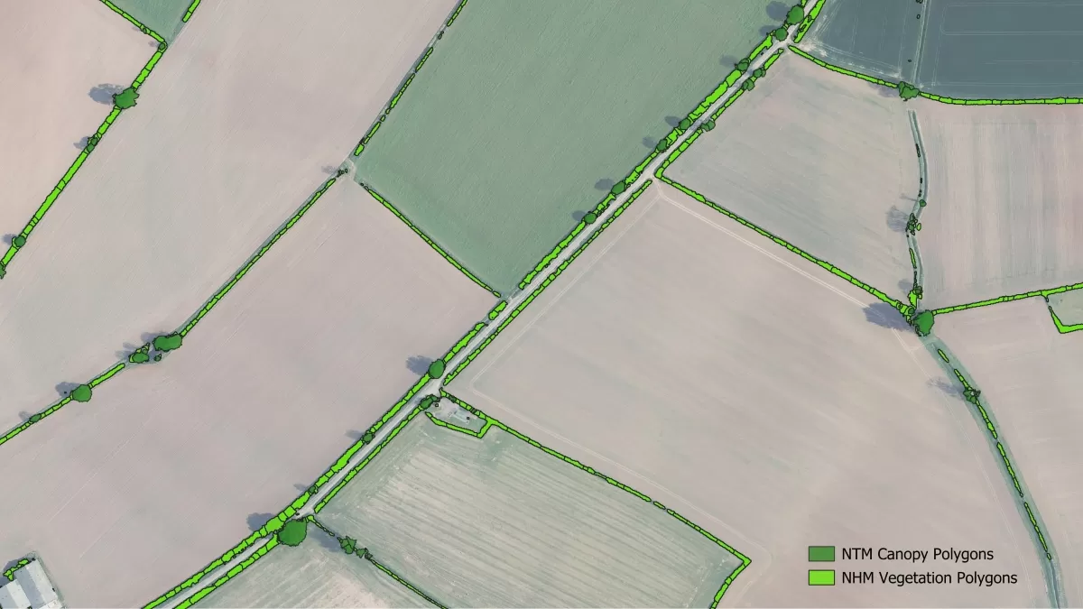
This is made possible by the availability of volumetric data through Bluesky technology. The dataset offers location, height, volume, vegetation extent, and the centreline for all vegetation below three metres.
It means that, when coupled with data from Bluesky’s National Tree Map™, ecologists, conservationists and planners gain a desktop overview of all Great Britain and Ireland’s vegetation.
Ralph Coleman, Chief Commercial Officer at Bluesky, said: “It’s been great to see increased interest in hedgerows, as well as the new products that are coming to the market to conserve and improve them.
“We launched our National Tree Map™ more than 12 years ago, so expanding our scope to include hedgerows was a natural step.
"There has been a considerable decline of hedgerows over the past 80 years and it's vital we reverse this to maintain biodiversity levels.
“The NHM™ facilitates desktop analysis of hedgerows and, when coupled with the NTM™, a fuller vegetation assessment can be undertaken.
“Hedgerow gaps are easy to identify and analysis can be automatically undertaken on any geography reducing the need for costly site visits.”
Potential applications for NHM™ data vary and go beyond hedgerow monitoring and management. Hedgerows are also important for flood risk mitigation, planning of wildlife corridors and habitat monitoring, biodiversity net gain planning for developers, carbon storage and above ground biomass calculations, hedgerow creation and restoration projects, and noise mitigation.
NHM™ has been developed using Bluesky’s high resolution national aerial photography, accurate terrain and surface data, and NDVI vegetation index.