- Revolutionary datasets deliver unprecedented insight into the UK’s trees with monthly updates
Aerial survey specialist Bluesky International, a Woolpert company, has unveiled two groundbreaking datasets that transform how the UK’s trees are mapped, monitored, and managed.
Building on the success of its pioneering National Tree Map™ (NTM™), Bluesky today launches NTM+™ and NTM Risk™, offering users richer, more contextual and current tree intelligence than ever before. With the ability for monthly updates for the + and Risk products, the new datasets are the most up-to-date source of tree attribute information available in the UK.
“For over a decade, the National Tree Map™ has been the go-to resource for organisations seeking reliable tree data,” said Ian Dee, Associate Director – R&D and Innovation at Bluesky. “These new releases take that to the next level, giving our customers deeper insight, faster updates, and data tailored to real-world needs.”
NTM+™ – Contextual Intelligence for Every Tree
NTM+™ reveals not just where each tree is, but what surrounds it. Each mapped tree is now linked to detailed contextual data, including:
- Location: nearest UPRN, postcode, LSOA, district, and county
- Conservation: SSSI, AONB, SAC, National Park, or Greenbelt designations
- Land Use: residential, industrial, agricultural, and more
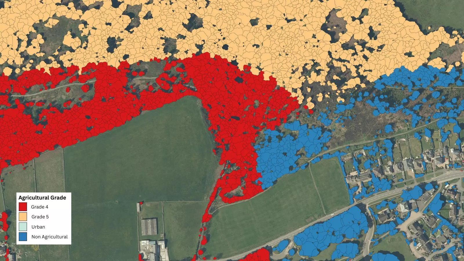
- Soils & Agriculture: soil type, drainage, and ALC grade
This rich context enables users across local government, utilities, insurance, and property sectors to make smarter, faster decisions – all from the desktop.
NTM Risk™ – Quantifying Tree Impact and Hazard
NTM Risk™ provides intelligence on how trees interact with people, property, and infrastructure, offering a clear view of potential hazards and risks:
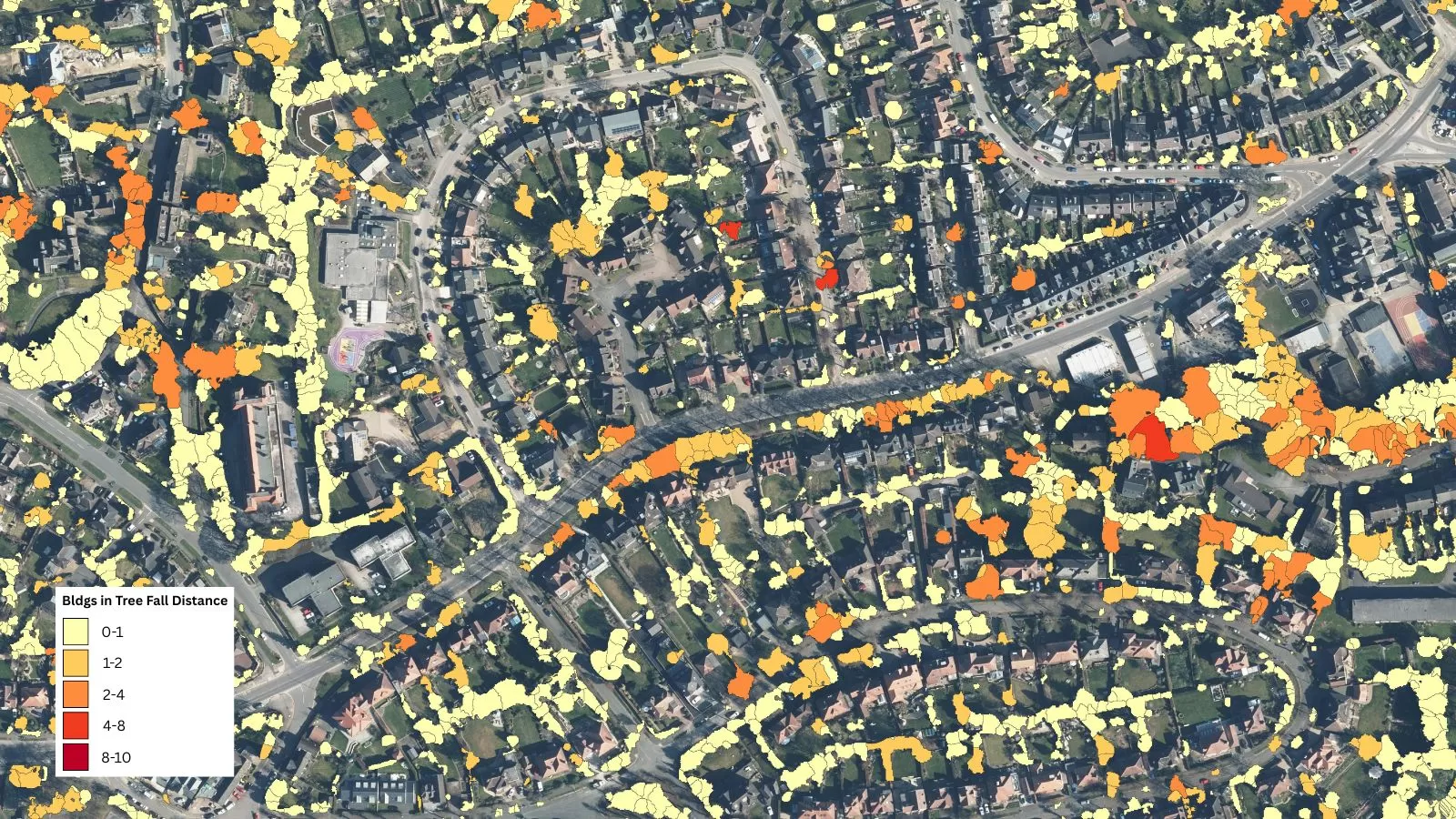
- Buildings: distance, height, fall radius, and number of properties at risk
- Road & Rail: proximity and angle to transport infrastructure
- Rivers: nearest watercourses, proximity and angle
- Wind: seasonal average speeds, predicted future speeds based on climate change levels
- Elevation: ground height above sea level — vital for flood-risk analysis
- Flood Zones: classifications including Zones 2 and 3
Bluesky’s innovation pipeline continues with a Knowledge Transfer Partnership (KTP) with the University of Leicester, a 24-month study aimed at enhancing tree species identification within the NTM™ suite.
“We’ve listened closely to customer feedback to evolve the NTM™ platform,” added Ian Dee. “NTM+™ and NTM Risk™ directly address industry pain points, reducing project time, increasing precision, and delivering immediate, actionable insight.”