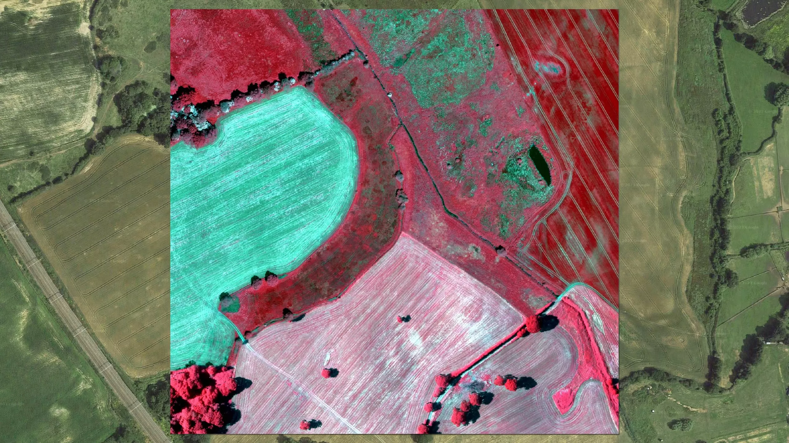
Colour Infrared
As concerns for the environment grow, colour infrared photography (CIR) offers a unique tool to assist with the assessment of the health and state of vegetation. It also helps to identify areas of healthy vegetation from non-vegetated areas. The near infrared data is captured at the same time as the standard colour (RGB) aerial photography.
The combination of the four bands can be used during specialist image processing techniques such as NDVI (Normalised Difference Vegetation Index). Used in conjunction with other geo-spatial data it can assist in the making of informed decisions.
Specification
-
Resolution (GSD) between 10cm and 50cm
-
5cm to 1m accuracy in X&Y
-
Available in uncompressed TIFF format
-
Continually updated
-
NIR, Red and Green bands used
-
Also available as NDVI
Application
-
Crop management
-
Environmental monitoring
-
Coastal management
-
Determine foliage health
-
Identify surface materials
-
Afforestation & deforestation studies
-
Soil sealing
Benefits
-
Off-the-shelf coverage
-
High accuracy
-
Ongoing update programme
-
Available for instant download
-
GIS and CAD Ready
-
Compatible with Ordnance Survey products
-
Corresponds to aerial photography
-
Flexible licensing terms
NDVI
Ongoing expansion of our towns, cities and infrastructure continues to jeopardise the health of our vegetation. Bluesky’s new Normalised Difference Vegetation Index (NDVI) gives you an instant, detailed insight into the health and maturity of the Nations flora.
This Nationwide dataset, created using Colour Infrared (CIR) imagery acquired using state-of-the-art aerial remote sensing techniques, gives users the unique opportunity to quantify the concentration and quality of vegetation anywhere across the country.
NDVI is a simple to interpret graphical dataset, facilitating speedy identification of vegetation maturity, health, and even potential insect attack and drought. Used in combination with Bluesky’s unique National Tree Map™ (NTM™) data, our NDVI is part of a powerful set of analytical tools for assessing and monitoring the world around us.
Specification
-
National coverage
-
Simple to interpret graphical dataset
-
Integrate easily with other geographic product
-
Compatible with Bluesky National Tree Map (NTM)
-
GIS ready, multi-format
Application
-
Forestry Mapping, Management and Monitoring
-
Vegetation Health Analysis
-
Agricultural Monitoring
-
Vegetation/Land Cover Classification
-
Soil Moisture
-
Biomass Production
Benefits
-
National off-the-shelf coverage
-
Ongoing update programme
-
Available for instant download
-
GIS and CAD Ready
-
Compatible with Ordnance Survey products
-
Corresponds to Aerial Photography
-
Flexible licensing terms