[ccfic]
Renewable energy is a crucial pillar in the global battle to mitigate climate change and achieve long term sustainability goals. Unlike fossil fuels, which release significant amounts of greenhouse gases into the atmosphere, renewable energy sources are derived from natural processes including wind, solar, hydroelectric and bioenergy. These are essential for reducing our carbon footprint and transitioning to a sustainable energy system. The shift to renewable energy is important as it not only helps tackle climate change but provides energy security and economic benefits.
Renewable Energy in the UK
In the UK, renewable energy is at the forefront of the Government's strategy to achieve net zero by 2050. This target includes a commitment to transforming the energy sector and reducing greenhouse gas emissions. To accelerate this, electricity providers have been set a target to provide 100% zero-carbon electricity by 2035. Currently, around 70% of renewable energy is used for electricity generation, with 17% used for heat, and 9.9% used for transport (1).
In recent years the UK has made incredible progress in increasing the amount of renewable energy generated. In 1981 renewable energy accounted for just 2% of the country’s electricity generation, increasing to 14.6% in 2013. Since 2020, renewable energy has contributed to over 40% of electricity production.
Wind energy is the largest contributor to electricity production in the UK. Wind farms, both onshore and offshore, harness the power of the wind to generate electricity using turbines. The world's largest offshore wind farm is made up of 165 wind turbines and is sited off the coast of Yorkshire, generating enough electricity to power 1.4 million homes (2). In 2023, wind contributed to 29.4% of electricity production (3), with a government target to increase this to 1/3 by 2030.
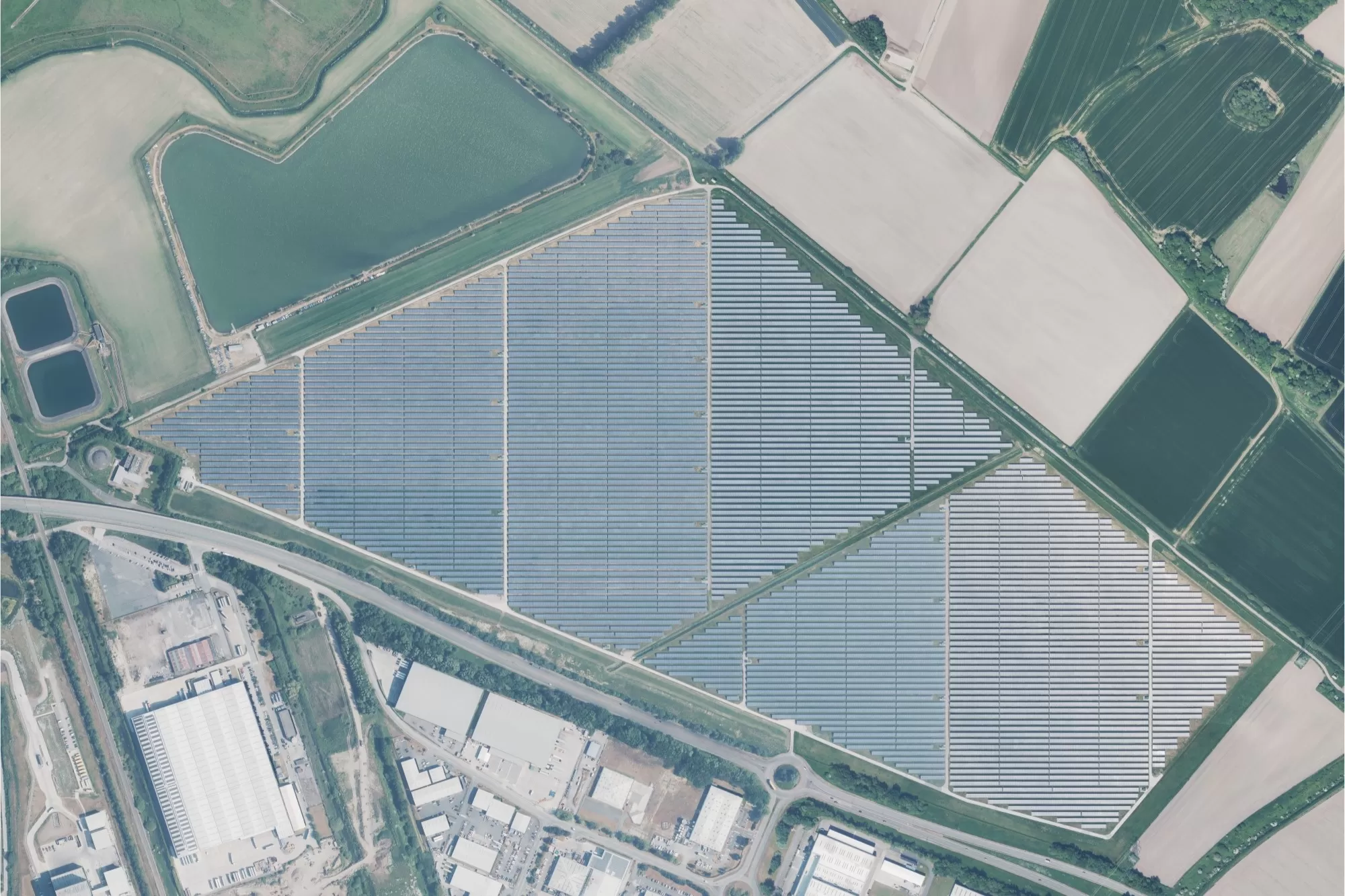
Shotwick Solar Farm
Solar power is collected through photovoltaic (PV) panels installed on rooftops or in solar farms. Solar energy has seen a substantial growth recently with a 5,000% increase in solar panels on homes over the last 15 years. Despite this, only 1.4 million (5.5%) homes in the UK currently have solar panels installed (4). The largest solar farm in the UK, Shotwick, was commissioned in 2016 and generates 68,590 MW/hrs of energy annually. This project has delivered a significant reduction of 15,991 kg of carbon emissions1 (5). In 2023 solar energy contributed 4.9% to the UK's electricity production (3).
Hydroelectric power is generated from the flow of water through hydro stations. Although it represents only a small amount of the UK's electricity generation, 1.8% in 2023 (3), two thirds of hydropower generation occurs in winter, helping meet peak demands. Hydropower has been around since 1878 with many stations built in the 1900s. There are currently 1,657 hydropower stations in the UK, but many are over 100 years old, which demonstrates the energy security that can be provided by renewables (6).
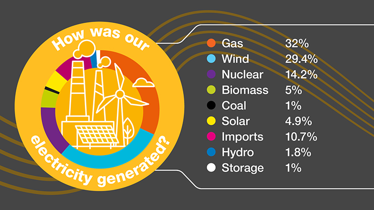
Electricity generated in 2023 (National Grid ESO, 2024)
Geospatial data in the renewable energy sector
Geospatial data is transforming the renewable energy sector by providing critical insights that help guide decisions for planning, development and in the operational phases of implementation. Data such as terrain models, including LiDAR, 3D building models and aerial photography can aid in site selection, infrastructure planning, operational efficiency, and environmental impact assessments.
When identifying sites for projects, factors such as topography, solar irradiance, wind speed and proximity to other features can impact decisions. Using terrain models, surfaces can be mapped to identify areas with the most consistent and strongest wind. Using 3D building models and datasets such as the National Tree Map™ (NTM™), shade analysis can be undertaken to calculate solar irradiance at different times of day or year to maximise solar potential. Similarly, slope and aspect can be calculated for rooftops to identify locations for PV panels.
When planning a new renewable energy project, environmental impact assessments must be undertaken to meet increasingly stringent regulations. Using land classification maps derived from high-resolution aerial photography, sensitive ecosystems can be identified early in the planning process. Using consistent and regularly updated data can help support environmental monitoring to understand changes in land use, vegetation cover and water quality.
Using terrain models derived from photogrammetry or LiDAR can help identify areas prone to hazards. Floods, storms and wildfires can all pose a threat, particularly to solar and wind farms. Using data to identify and map floodplains or assess wildfire risk aids strategic planners in their design projects that minimise exposure to risks.
Geospatial data has become a critical tool for governments and public sector organisations to identify feasible and cost-effective schemes. Governments can use derived information to guide the allocation of subsidies and incentives to encourage development. It can also help with planning renewable energy developments that align with strategies and to meet targets whilst balancing the need for space for agriculture, conservation and urban development.
Case studies
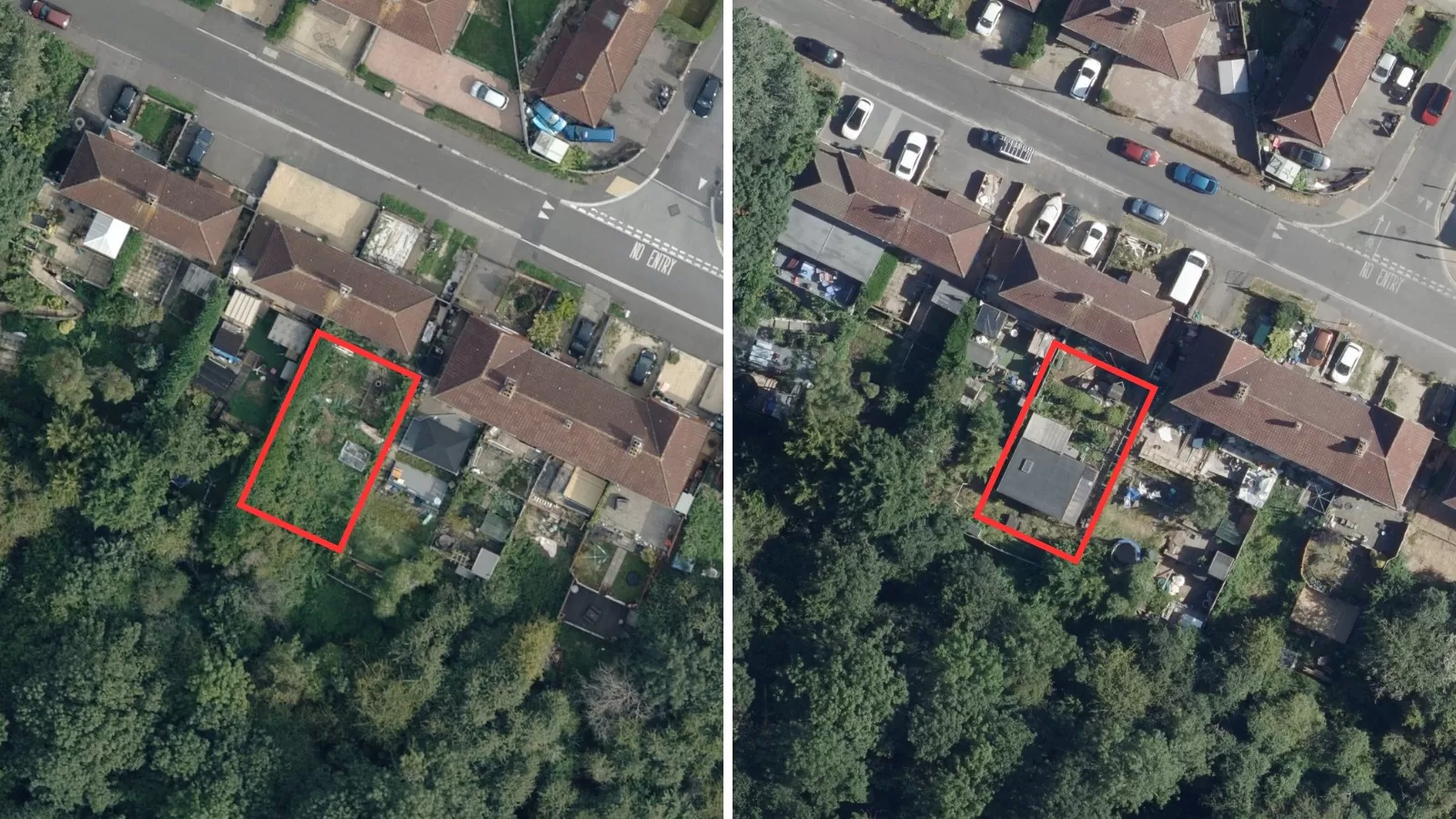
Derby Homes and Bluesky undertook a project to identify suitable rooftops assessing more than 8,000 addresses considering size, pitch, aspect, existing furniture and infringing vegetation (7). Using ultra-high resolution imagery, Bluesky was able to determine the suitability of each property, measure the number of panels the address could accommodate and calculate potential output. In 2022, Derby Homes installed its first integrated solar array on an initial batch of trial properties identified by Bluesky. Using geospatial data and integrating the installation with the renewal of existing roofs is a cost-effective way of providing renewable energy to homes in Derby.
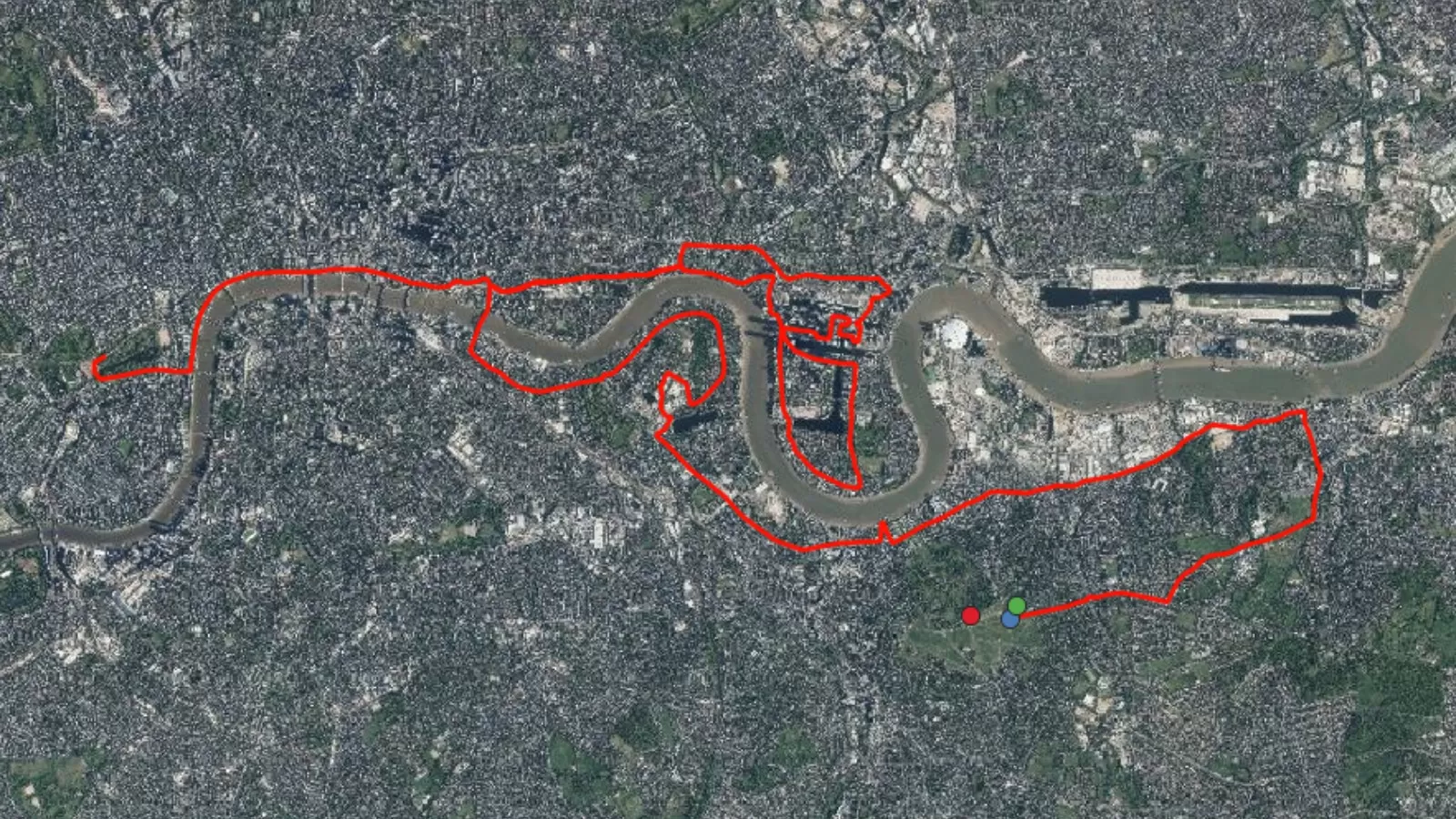
3D mapping and terrain models (DTM and DSM) can be used to secure planning permission for solar farms across the Republic of Ireland. Macro Works have used Bluesky’s data to understand how solar farms could be seen from the surrounding area and the impact reflected light might have on existing properties and infrastructure (8). Using DTM and DSM data, Zone of Theoretical Visibility maps and Glint and Glare assessment reports have been used to secure permission for over 100 solar farms in Ireland. Similar projects have been undertaken by Macro Works for the development of wind farms and other major infrastructure projects.
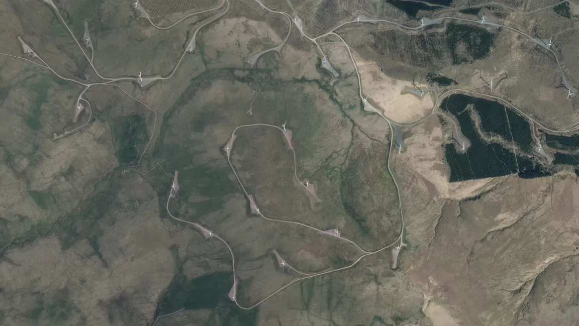
LiDAR data and photogrammetrically derived height models can help companies save time, money and resources when determining suitable locations for renewable energy farms. Hydro Environmental used Bluesky’s LiDAR data to analyse drainage patterns at proposed wind farm sites (9). Using geospatial data, allows sites unsuitable for development to be identified during the early planning stages. Without the data, time consuming and costly site visits would be required to identify these drainage patterns and areas of environmental importance.
To conclude
Geospatial data can help support the renewable energy sector as it grows to support the transition to low carbon energy.
High quality, current geospatial data is transforming the sector by providing essential insights to guide decisions at every stage of a project, aiding in early site selection, project implementation, and environmental monitoring after installation. High-resolution aerial photography and digital terrain models captured and produced by Bluesky is already being widely used in renewable energy projects. Partnerships with other market leading organisations are driving innovation and generating impactful results across the renewable energy sector.
References:
- Gov.uk (2024a) – Digest of UK Energy Statistics (DUKES): renewable sources of energy – GOV.UK (www.gov.uk)
- Orsted (2022) – Hornsea 2, the world's largest windfarm, enters full operation (orsted.com)
- National Grid ESO (2024) – Britain's Electricity Explained: 2023 Review | ESO (nationalgrideso.com)
- Gov.uk (2024b) – Solar photovoltaics deployment – GOV.UK (www.gov.uk)
- BSR (2024) – BSR | Shotwick Solar Park, Flintshire | 72.2 MW | British Solar… (britishrenewables.com)
- BHA (2024) – Hydropower in the UK – British Hydropower Association (british-hydro.org)
- Bluesky (2022a) – Bluesky Aerial Photography Helps Derby Homes Boost Solar Energy Output and Reduce Carbon Emissions – Bluesky (bluesky-world.com)
- Bluesky (2022b) – Bluesky 3D Models Help Macro Works Plan Milestone Solar Farm in Ireland – Bluesky (bluesky-world.com)
- Bluesky (2023b) – Renewable Energy Planning in Ireland – Bluesky International Ltd (bluesky-world.com)