- New offering combines AI and nationally consistent aerial photography and height data to deliver scalable insights for infrastructure, environmental monitoring and risk analysis
- Scalable service supports customers at varying stages of the Geo AI journey
Bluesky International, a Woolpert Company, has announced the launch of a suite of Geo AI services that apply advanced artificial intelligence to its high resolution geospatial data and imagery to deliver actionable intelligence at scale.
Bluesky’s Geo AI services are designed to help customers detect change, extract insight and address real-world challenges more efficiently. The introduction of these services is timely with the rapid evolution of artificial intelligence transforming the geospatial sector, enabling organisations to move beyond static data delivery towards insight led decision making.
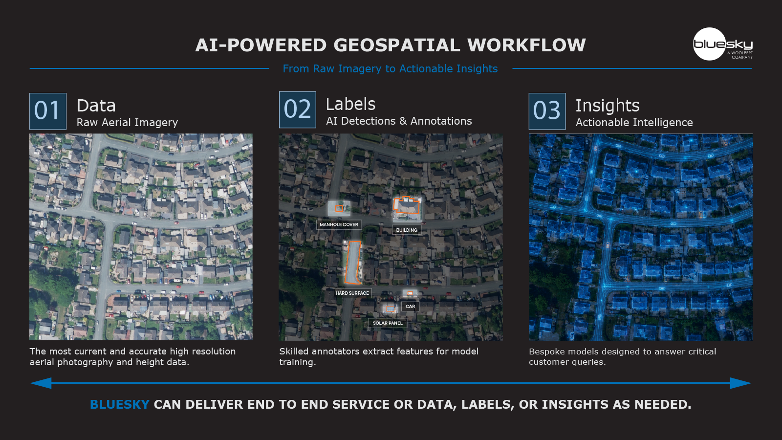
Building on its long-established reputation for high quality aerial photography, height models, and environmental datasets, the new suite of services are flexible and scalable, supporting customers at different stages of Geo AI adoption. Customers can choose from any of the following services:
- Data – Best-in-class national aerial photography and height data
- Labels – AI ready labels and verification from an expert in-house team
- Models – Robust bespoke AI models developed to respond to customer needs
- Full Service – An end-to-end Geo AI solution from data to insight
Bluesky’s Geo AI services combine advanced AI techniques with its nationally consistent, high-resolution datasets to automate analysis and deliver measurable outcomes across a wide range of sectors, including infrastructure, environmental monitoring, asset intelligence, and risk analysis.
Ian Dee, Associate Director – Innovation at Bluesky, said: “Our datasets offer an incredible level of detail, and our customers rely on them to inform critical projects and planning decisions. What AI now enables us to do is deliver those insights directly, at scale. By using our own data, which is unmatched in terms of currency, we can provide a Geo AI service that helps customers work smarter and achieve measurable impact.”
Unlike generic solutions, AI is built on Bluesky’s proprietary datasets, ensuring models are trained and validated with up to date, high-quality imagery and geospatial information. This approach enables more accurate outputs and greater confidence for customers integrating Geo AI into operational workflows.
The launch of Geo AI based services underscores Bluesky’s continued investment in innovation, reinforcing its role as a trusted geospatial partner delivering intelligence, not just data.