MetroVista™ Mesh Models
3D Urban Mesh Models Transforming Urban Management
In a world balancing the pressures of urban expansion with environmental impact, understanding our surroundings has never been more critical. MetroVista™ brings cities to life with highly accurate, geospatially precise 3D mesh models — the foundation for the next generation of Digital Twins.
From policy makers and planners to engineers, surveyors, environmentalists, and insurers, MetroVista™ empowers professionals to visualise, analyse, and interact with digital versions of the real world.
Why MetroVista™?
Our 3D urban mesh models combine vertical and oblique imagery with simultaneously captured LiDAR data, producing a rich, true-to-life digital representation of urban environments.
With MetroVista™ you can:
- Access detailed asset information directly from your desktop
- Make informed decisions backed by real-world accuracy
- Plan infrastructure with confidence
- Optimise resources and manage environmental impact effectively
MetroVista™ cities captured include:
-
Birmingham
-
Bournemouth
-
Brighton
-
Bristol
-
Cambridge
-
Cardiff
-
Derby
-
Doncaster
-
Eastbourne
-
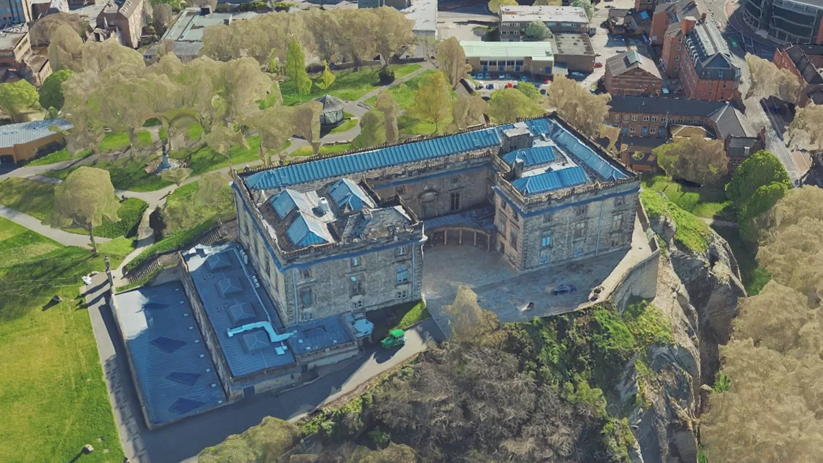
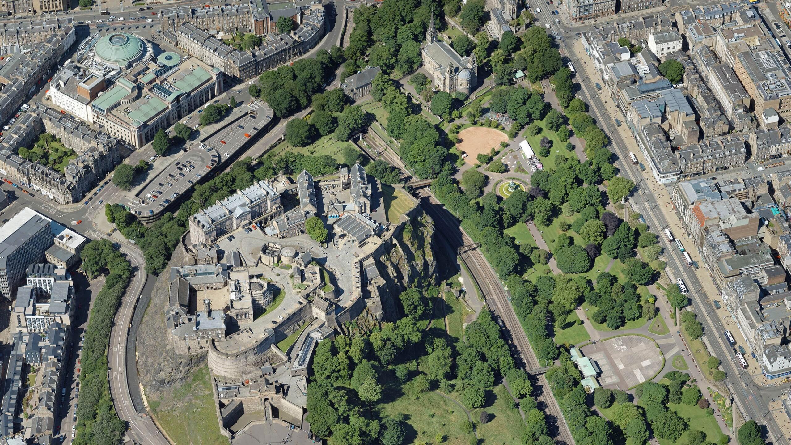
Edinburgh
-
Glasgow
-
Leicester
-
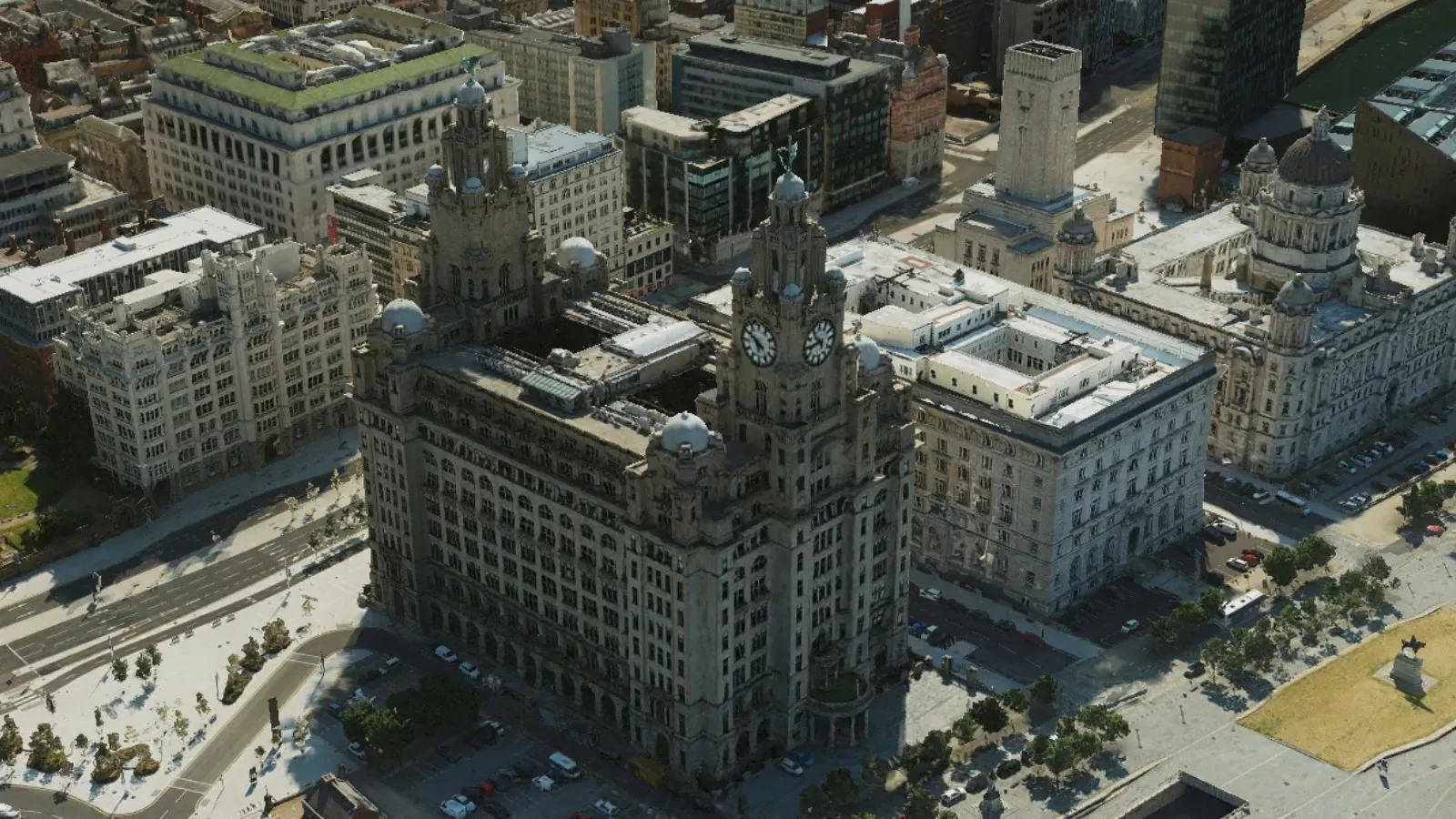
Liverpool
-
London
-
Manchester
-
Newcastle
-
Norwich
-
Nottingham
-
Oxford
-
Southend
-
York
The Foundation of Smart Cities
3D geospatial data is rapidly becoming the backbone of smart cities and advanced urban planning. MetroVista™ delivers unmatched detail and precision, enabling you to explore and analyse the built environment like never before.
Off-the-Shelf Data or Bespoke Capture
We've already captured numerous urban areas across Great Britain, ready to license and use immediately.
Need something specific? Our bespoke data capture service tailors the MetroVista™ approach to your project's location, scope, and requirements.
How We Capture MetroVista™ Data
We use the Leica CityMapper 2, the world’s first hybrid airborne sensor combining:
- Oblique and nadir imaging
- LiDAR system for ultra-dense point clouds and grids
All captured simultaneously to deliver:
- Traditional 2D aerial ortho products
- Highly detailed static oblique imagery
- Dense LiDAR datasets
- Immersive, geospatially accurate 3D city visualisations
This integrated approach ensures every MetroVista™ dataset meets the highest standards of precision and usability.
See your city in a new dimension with MetroVista™. The future of urban management is here.
Specification
- 5cm ultra hi-resolution aerial photography and obliques
- LiDAR coverage from 16-100 points per metre
- 20 cities across Great Britain captured
- Many formats (incl. JPG, TIF, KMZ, ASCII, DXF, OBJ, FBX)
- OSGB1936 projection
- For use with GIS, CAD and web mapping services
Applications
- Smart City and Digital Twin city modelling and analysis
- Visualisation and simulation
- Insurance and risk assessment
- Energy and utilities
- Civil engineering
- Telecoms
- Property and land development
- Urban planning and architects
- Estate agents
- Education
- Environmental impact
Benefits
- An enabler of the Smart City vision
- Bespoke surveys by commission
- Create 3D interactive mesh models
- Datasets available separately or as fully rendered mesh models
MetroVista™ examples
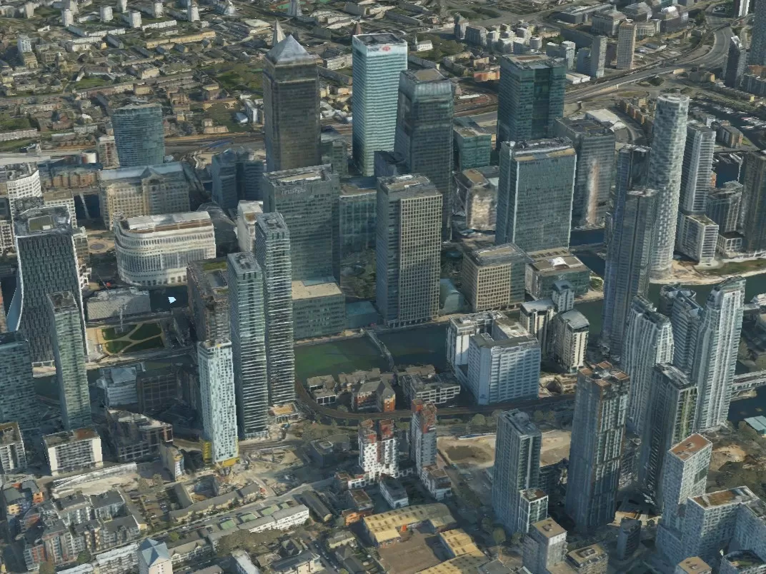
London
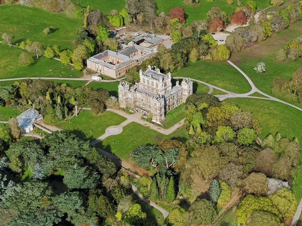
Nottingham
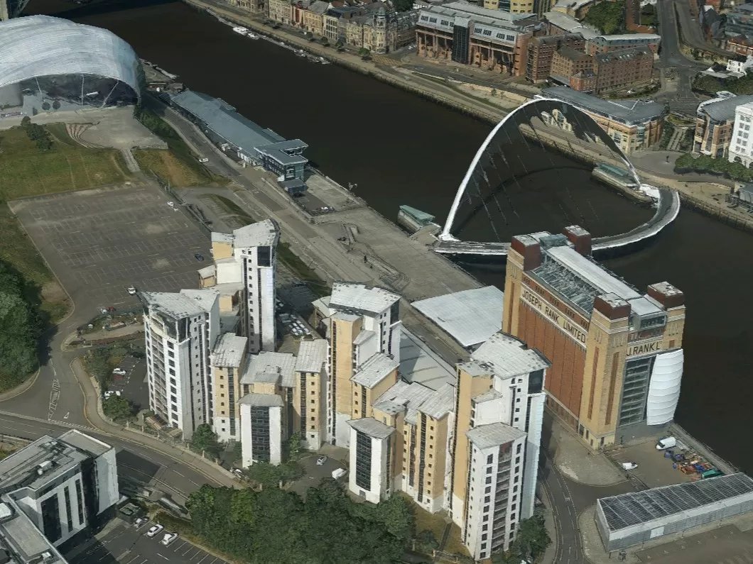
Newcastle
Visit The Mapshop To Access our world of data
Our online Mapshop gives you immediate access to a diverse range of geospatial data ranging from Aerial Photography, LiDAR, Terrain, National Tree Map™, Ordnance Survey, Derived Data.
Quick search: Enter area of interest
(postcode, town/city, coordinates or OS reference)