


Building Footprints
Affordable property intelligence for every addressable building in Great Britain.
Building Footprints is a Great Britain-wide dataset featuring more than 24.5 million individual buildings. Each footprint comes with property, height and energy attributes, giving you a consistent base to link your own records and third-party data to.
A practical alternative for property-based analysis.
Designed as an entry-level commercial alternative to rudimentary open datasets and premium authoritative mapping, our Building Footprints offers organisations a cost-effective way to work with building data at national scale.
The dataset focuses on addressable properties to ensure you’re working with the buildings that matter most for your analysis. Each footprint acts as a property intelligence spine: a fixed reference point you can use to connect your portfolio, asset, claims, or planning records.
Every footprint carries a Bluesky unique reference number and, where available, a Unique Property Reference Number (UPRN), along with a count of the UPRNs linked to it. That makes it easier to analyse blocks of flats and multi-unit commercial buildings, while the Bluesky reference keeps coverage complete where no UPRN exists.
| 24.5M+ | Individual buildings across Great Britain |
| 91% | Building-area coverage when tested against authoritative national building data |
| 85% | Segmentation match when tested against authoritative building data |
| ~50% | Of Great Britain’s residential properties with EPC attributes |
| Annual | Dataset update cycle |
What’s included:
- UPRN and associated UPRN count.
- Bluesky unique reference number.
- Footprint area.
- Ordnance Survey 1 km, 10 km and, 100 km grid references.
- Freehold or leasehold indicator, derived from HM Land Registry data.
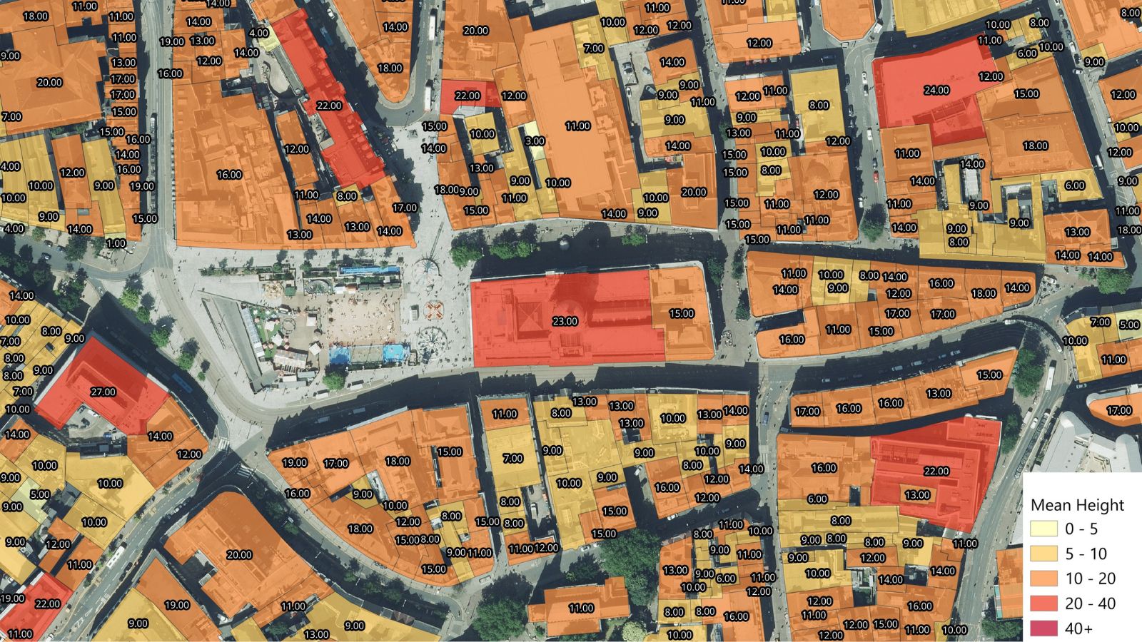
- Mean and maximum building height, derived from Bluesky’s height data.
- Residential Energy Performance Certificate attributes where available: current and potential ratings, energy consumption, building age band, built form and property type.
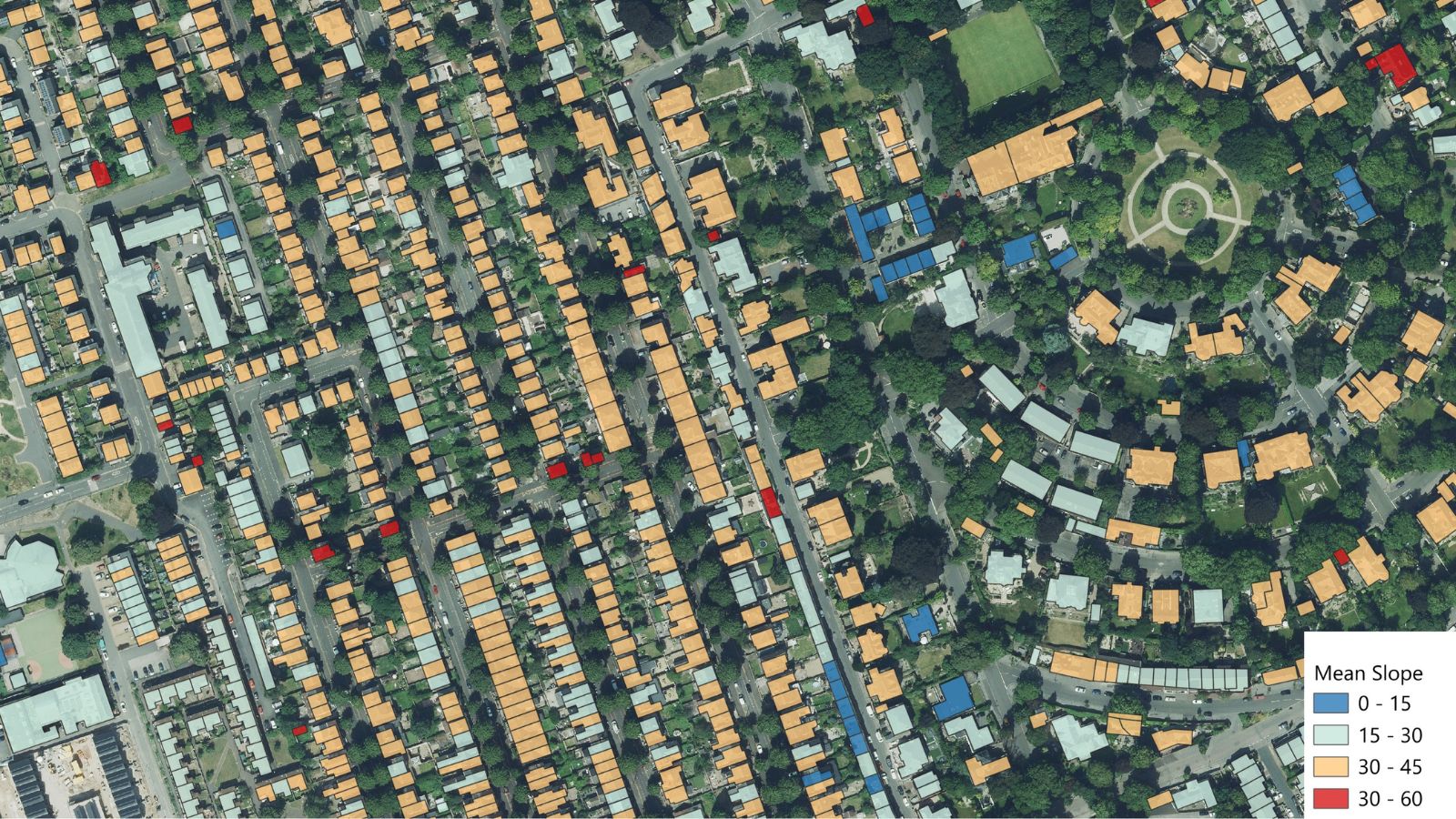
- Average roof slope and aspect derived from proprietary Bluesky data (available as an addition).
Who’s it for:
Insurers, housing associations, real estate and built-environment organisations, local planners, utilities and energy providers, and any organisation that needs a consistent view of buildings across Great Britain.
Applications
- Property portfolio enrichment
- Building and address analytics
- Exposure and risk modelling
- Asset management
- Planning
- Energy analysis
- Data integration
Benefits
- Nationwide coverage at an accessible price point.
- Focused on addressable buildings, not ancillary structures.
- Comprehensive identifiers including UPRN.
- Apply the attributes as supplied or enrich with your own data.
- Managed data integration available (if required).
- Flexible, area-based purchasing via the Mapshop.
Specification
- Coverage across Great Britain
- Bluesky unique reference, UPRN where available and UPRN count
- Annual update frequency
Visit The Mapshop To Access our world of data
Building Footprints is available now through the Bluesky Mapshop. Select your area of interest and buy only the coverage you need. Need help joining it to your own data? Get in touch and our team can manage the integration for you. Our online Mapshop gives you immediate access to a diverse range of geospatial data ranging from Aerial Photography, LiDAR, Terrain, National Tree Map™, Ordnance Survey, Derived Data.
Quick search: Enter area of interest
(postcode, town/city, coordinates or OS reference)

Building Footprint Examples