


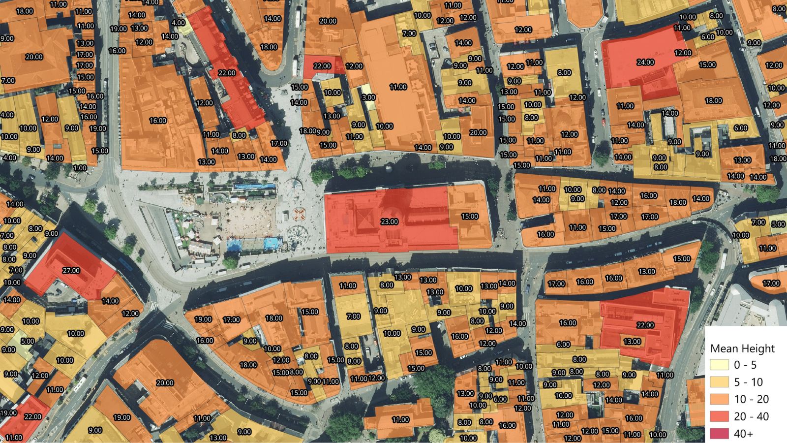
- New dataset combines addressable building geometry with property, energy, and height attributes for portfolio analysis, risk modelling, and planning
- Property information available for nearly 25 million properties
Bluesky International, a Woolpert company, has launched Building Footprints, a new Great Britain-wide dataset that gives organisations an accessible, cost-effective foundation for linking property information to over 24.5 million individual buildings.
Designed as an entry-level commercial alternative to rudimentary open datasets and premium authoritative mapping. Each footprint can act as a property intelligence spine, allowing customers to connect their own records and third-party information to a consistent national dataset.
The product focuses on addressable properties rather than ancillary structures such as sheds and outbuildings, helping customers work with the buildings that matter most to property-based analysis. Testing against authoritative national building data achieved 91% building-area coverage and 85% segmentation, demonstrating strong alignment while retaining the accessibility and affordability of the dataset.
Building Footprints provides a Bluesky unique reference number and, where available, a Unique Property Reference Number (UPRN), together with the number of UPRNs associated with each footprint. This supports analysis of complex properties such as blocks of flats and multi-unit commercial buildings, while Bluesky reference numbers maintain coverage where no UPRN is available.
Building intelligence, ready to use
- UPRN, and associated UPRN count
- Bluesky unique reference number
- Footprint area and Ordnance Survey 1 km, 10 km, and 100 km grid references
- Freehold or leasehold indicator derived from HM Land Registry data
- Mean and maximum building height derived from Bluesky height data
- Residential Energy Performance Certificate attributes where available, including current and potential ratings, energy consumption, building age band, built form, and property type
- Average roof slope and aspect derived from Bluesky’s proprietary height data (available as an addition)
Energy Performance Certificate information is available for approximately 50% of Great Britain’s residential properties. Customers can use the supplied attributes as delivered or enrich the footprints with their own portfolio, asset, claims, planning or operational data. Bluesky can also support data integration for organisations that require a managed service.
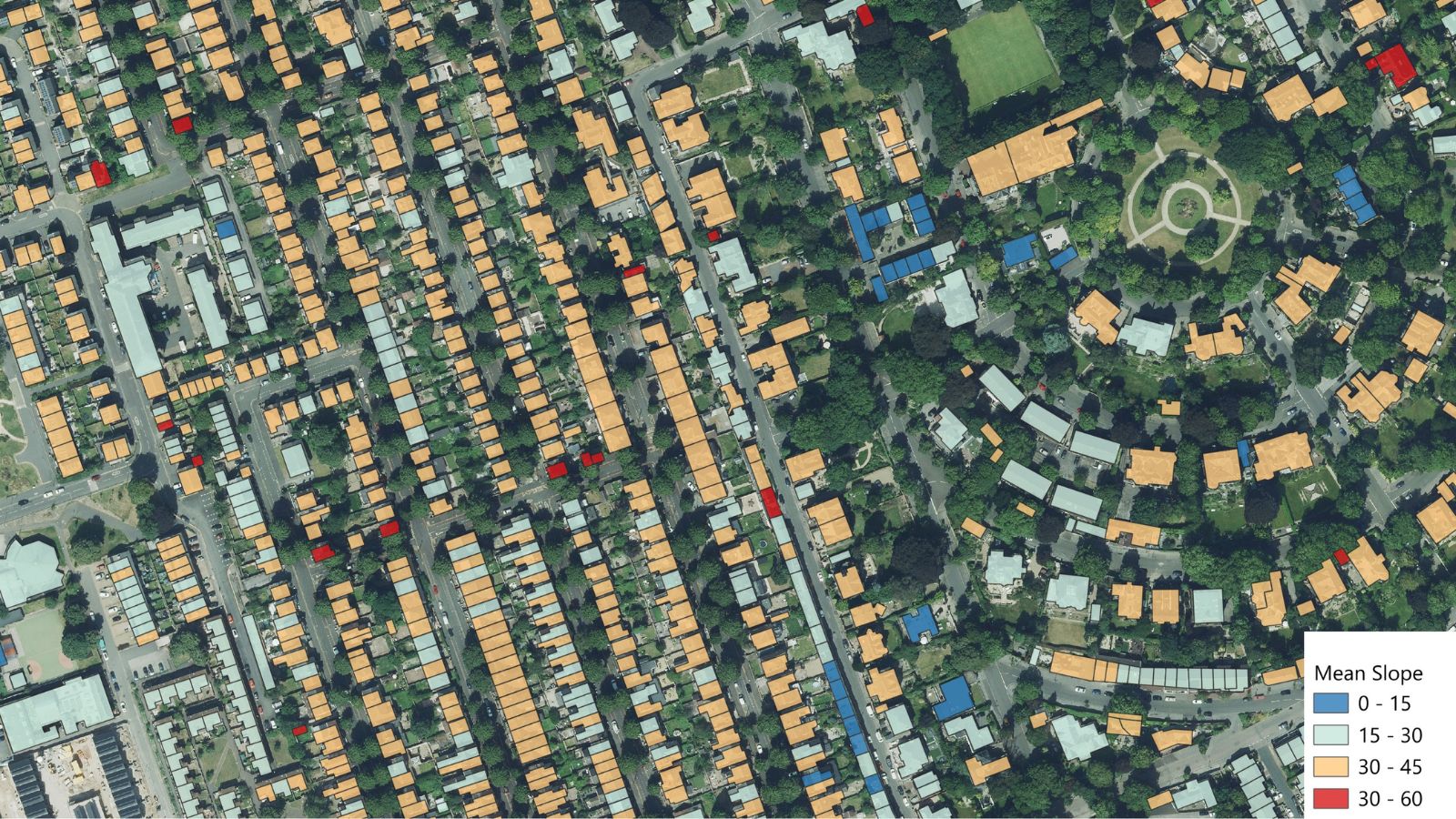
Applications include property portfolio enrichment, building and address analytics, exposure and risk modelling, asset management, planning, energy analysis, and data integration. The dataset is suited to insurers, housing associations, real estate and built-environment organisations, local planners, utilities and energy providers, and any organisation that needs a consistent representation of buildings across Great Britain.
Ian Dee, Associate Director – R&D and Innovation at Bluesky International, explains: “Building Footprints gives customers more than a map of building outlines; it creates a practical building intelligence database that can be linked to the information they already hold. By combining nationwide coverage with useful property and height attributes at a more accessible price point, we are helping organisations move more quickly from location data to informed decisions.”
Building Footprints is available now through the Bluesky Mapshop for flexible, area-based purchasing. The dataset will be updated annually.