

August 2023
-
Bluesky MetroVista 3D City Model Underpins Nottingham’s Digital Twin
Nottingham City Council is a step closer to achieving its vision of creating a digital twin for the city. In what’s believed to be a UK first they are combining…
Read More
September 2022
-
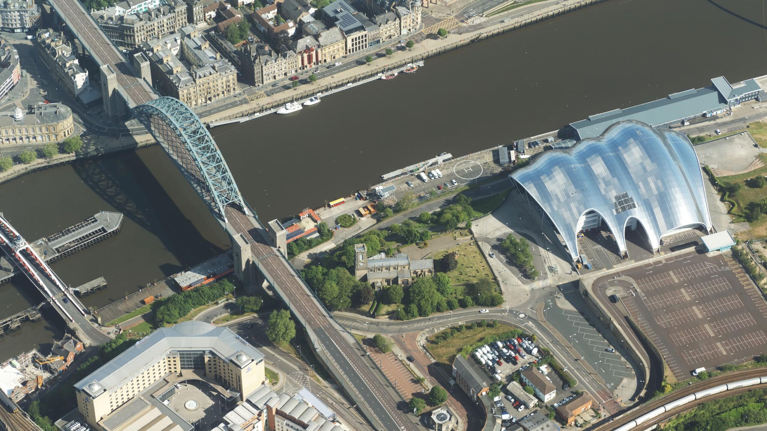
Bluesky Takes to the Skies to Capture More Oblique Views of UK Cities
Aerial mapping company Bluesky International, is using one of the world’s most advanced hybrid sensors to expand its library of high-definition oblique photographs of UK cities to reveal more detail…
Read More
March 2022
-
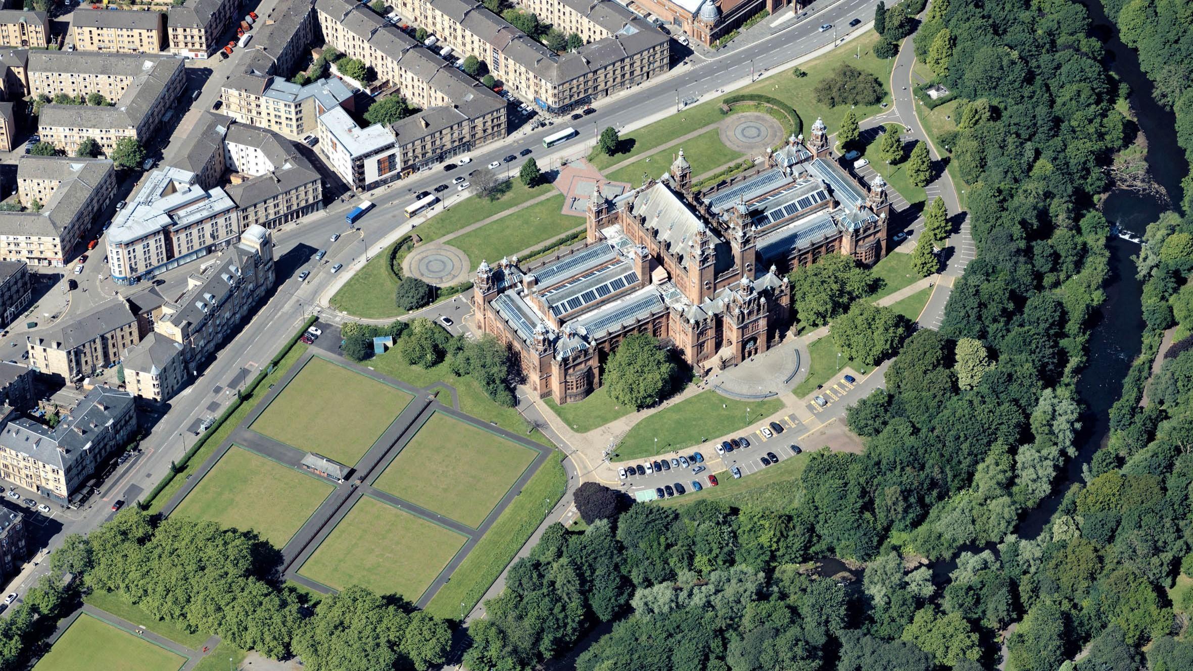
Bluesky Adds Scottish Cities to MetroVista 3D City Line-up
Aerial mapping company Bluesky International has added Edinburgh and Glasgow to its growing coverage of MetroVista 3D city models. Acquired using a state-of-the-art aerial sensor that simultaneously captures vertical and…
Read More
September 2021
-
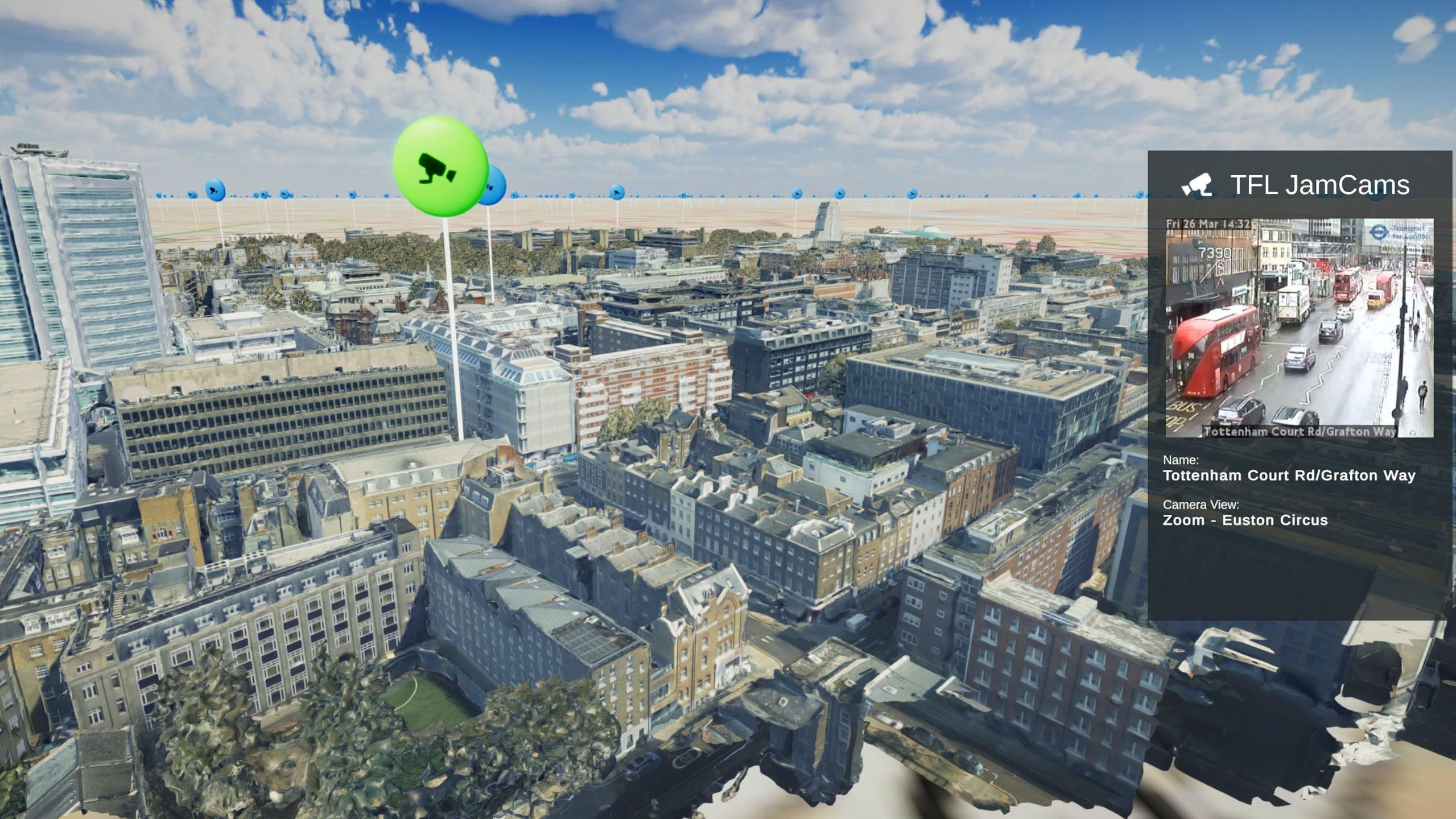
Bluesky and University of Leicester Use AI to Reduce Data Intensity for Smart City Applications
Aerial mapping company Bluesky International and the University of Leicester are using Artificial Intelligence and Machine Learning to make 3D models easier to use in smart city and digital twin…
Read More
June 2021
-
Bluesky MetroVista Models Transform Real Estate Marketing with 3D Visualisations
Photorealistic 3D models from aerial mapping specialist Bluesky are being used to create real-world interactive visualisations to transform how unbuilt commercial and residential property is presented for sale. Created by…
Read More
April 2021
-
Bluesky MetroVista Mesh Models Underpin Dynamic Map of London
Photorealistic 3D models from Bluesky are being used to produce a new interactive map of London. Created by the Centre for Advanced Spatial Analysis (CASA), part of the Bartlett Faculty…
Read More
February 2021
-
Newcastle University Pioneers Hyper-Resolution Flood Risk Modelling using Bluesky MetroVista Data
Newcastle University is developing advanced computer modelling to assess the flood risk of individual properties using LiDAR data and oblique aerial photography from Bluesky. The project will use Artificial Intelligence…
Read More