June 2026
-
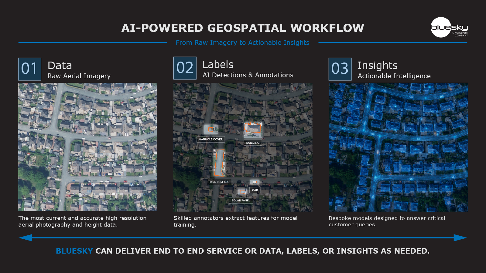
Bluesky Launches suite of Geo AI Services to Transform High Resolution Geospatial Data into Actionable Intelligence
New offering combines AI and nationally consistent aerial photography and height data to deliver scalable insights for infrastructure, environmental monitoring and risk analysis Scalable service supports customers at varying stages…
Read More -
Bluesky Launches National Clutter Map to Boost Telecoms Network Planning
Bluesky International, a Woolpert Company, has launched a new Great Britain-wide 50m Clutter Map, delivering consistent 2.5D surface intelligence designed to support telecommunications network planning, signal modelling, and rollout optimisation.…
Read More
October 2023
-
Geospatial Insight and Bluesky Launch Strategic Partnership to Drive Rooftop Solar Uptake
With solar energy becoming a crucial component in the journey towards achieving net zero, Geospatial Insight and Bluesky International are proud to unveil their strategic partnership aimed at transforming the…
Read More -
Bluesky Aerial Maps Improve Efficiency for Forest Surveys
Forest Surveys is using high-resolution imagery from Bluesky International to improve its understanding of terrain in difficult to access locations. Working with clients across the forestry sector, Forest Surveys is…
Read More -
Richard Evans Appointed to Role of Sales Consultant at Bluesky International
Aerial mapping innovator Bluesky International, has recruited Richard Evans to its expanding commercial team. Taking on the role of Sales Consultant, Evans brings with him more than 12 years’ experience…
Read More
September 2023
-
Midlands Aerial Mapping Company Bluesky Sponsors Tamworth Women’s Football Team
Midlands-based aerial mapping company Bluesky International has announced it is 2023/24 kit sponsor for Tamworth Football Club Women’s team. The deal sees Bluesky’s logo appear on the first team women’s…
Read More -
MWH Treatment uses 3D Building Models from Bluesky to Drive Innovation in Water Sector
MWH Treatment is using highly detailed, geographically accurate 3D models to create visualisations, animations and interactive applications that are improving standards for safe and sustainable solutions within the water sector.…
Read More -
Bluesky 3D Imagery Brings Global Warming Sea Level Rises to Life
Immersive story telling company Sairo has used high resolution aerial photography and 3D mapping from UK aerial survey and mapping company Bluesky International to illustrate the impact of global warming…
Read More
August 2023
-
Bluesky Aerial Data Helps CGL Pinpoint Natural Hazards at Development Sites
A geotechnical and consultancy agency is using geospatial data to work smarter, saving significant time and money, both for themselves and their clients. Card Geotechnics Ltd (CGL) is applying aerial…
Read More -
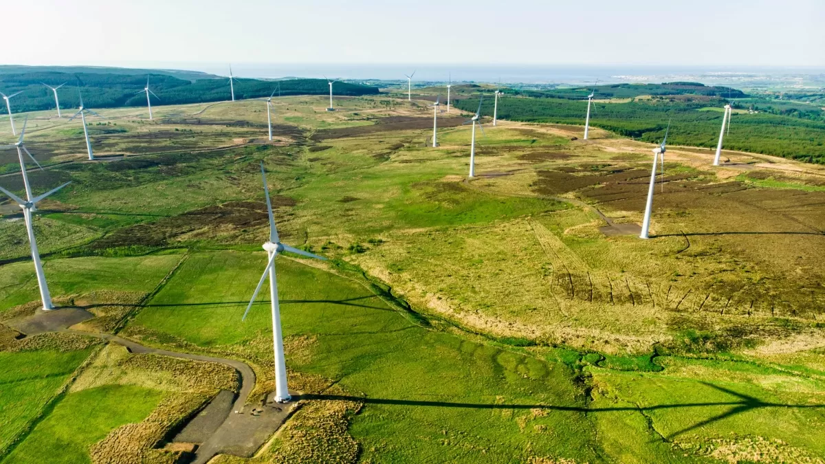
Renewable Energy Planning in Ireland
With ambitious plans to tackle climate change, Ireland has already seen a dramatic increase in energy generated from renewable resources yet there is still a growing demand that is not…
Read More -
Bluesky MetroVista 3D City Model Underpins Nottingham’s Digital Twin
Nottingham City Council is a step closer to achieving its vision of creating a digital twin for the city. In what’s believed to be a UK first they are combining…
Read More
July 2023
-
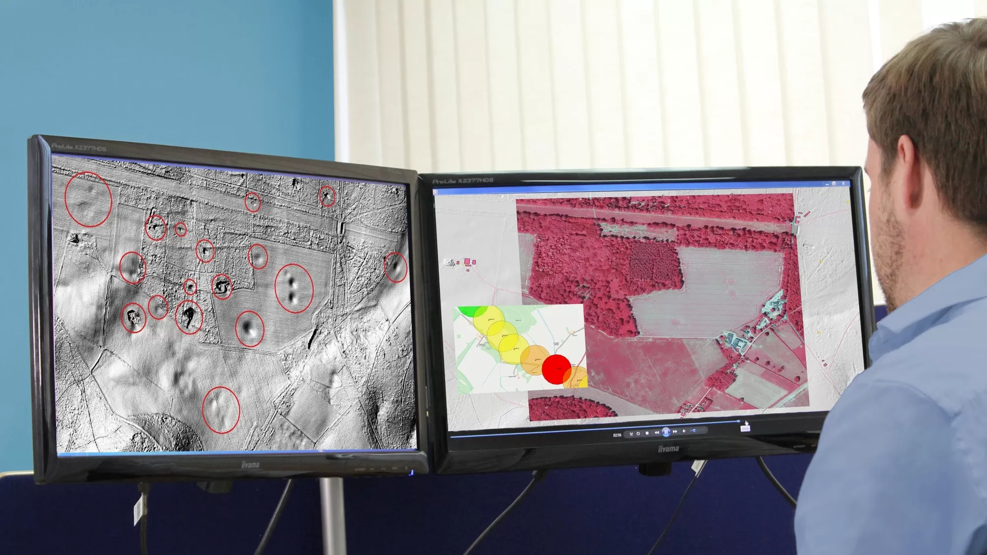
Bluesky’s Airborne Sensors Help Developers Protect Wildlife Habitats
Multi-spectral imagery from Bluesky International is helping developers contribute to government targets to protect and conserve wildlife habitats in the UK. Using the latest Artificial Intelligence (AI) technology, in combination…
Read More -
Bluesky Building Models Aid Planning for World’s Largest Cultural Hub
3D building models from aerial mapping company Bluesky International, are at the heart of plans for a landmark development in the centre of Coventry, informing Virtual Reality (VR) presentations and…
Read More
June 2023
-
Bluesky Makes a Record Breaking Start to the 2023 Mapping Flying Season
Aerial mapping company Bluesky International has made a record-breaking start to its 2023 flying season having captured more than 96 per cent of its UK flying target in the first…
Read More -
LexisNexis Improves Insurer Risk Assessment Portfolio with National Tree Map
A new suite of geospatial products has been launched by LexisNexis Risk Solutions in a bid to address weather-related challenges faced by the UK and Ireland insurance market. Bluesky International…
Read More -
Bluesky Expands Commercial Team with Appointment of Bassett and Hoskins
Aerial survey and geographic data company Bluesky International has expanded its commercial team with the appointment of Kate Bassett and Andy Hoskins. Taking on the role of Head of 3D…
Read More -
Birmingham Council Creates Interactive Mapping Portal using Bluesky Tree Data
Birmingham City Council has launched a first of its kind mapping portal to address the issue of tree equity across the city. With National Tree Map data, created by aerial…
Read More
April 2023
-
Bluesky and Ecopia Partner to Create First 3D Map of Ireland
Bluesky International and Ecopia AI (Ecopia) have announced a partnership to develop the first ever 3D land cover map of Ireland. Generated using Bluesky’s 12.5 and 25 cm resolution aerial…
Read More -
Bluesky Launches New Data-as-a-Service Offering
A new geospatial data subscription service has been launched by aerial survey and mapping company Bluesky designed to ensure customers can access data they need, when they need it, without…
Read More -
Bluesky Partners with Berlin-based UP42 to Supply Aerial Imagery and Geospatial Data
Bluesky International announces a new partnership with Berlin-based UP42, a leading geospatial developer platform and marketplace. The recently signed agreement will see Bluesky supply its accurate, high resolution aerial imagery…
Read More
March 2023
-
Bluesky Partners with SkyFi to Widen Access to its Aerial Imagery Catalogue
Bluesky International announces a new partnership with SkyFi, an American company, based in Texas, that aims to democratise access to earth observation assets by providing access of multi-perspective imagery to…
Read More -
Cardiff Council Addresses Flood Risk Using Bluesky National Tree Map
Cardiff Council is using an aerial map of trees to help it prioritise essential works in order to reduce the risk of surface water flooding. Created by Bluesky International, the…
Read More -
How Green is the London Marathon? Aerial Mapping Company Bluesky Reveals All
Aerial mapping company Bluesky International has completed a study into tree canopy cover at differing points along the route of the upcoming London Marathon. Using its unique database of more…
Read More
February 2023
-
Bluesky Tree Map Enhances Online Urban Forest Mapping Platform
Greentalk, a London based ecotech start-up, is offering a map of trees from Bluesky International within its online urban forest engagement platform. Incorporating Bluesky’s National Tree Map data, Greentalk will…
Read More
January 2023
-
Bluesky National Tree Map Helps Dudley Council Keep Black Country Green
A unique map database from Bluesky International is helping Dudley Metropolitan Borough Council inform research and development projects, engage with stakeholders and ensure the historic capital of the Black Country…
Read More
December 2022
-
Bluesky National Tree Map Helps Bradford District Council Manage Tree Disease
A local authority has turned to data from aerial survey and mapping company, Bluesky International, to manage tree health and felling across a 98-hectare estate and areas of an adjoining…
Read More -
Tree Map Data Key Tool To Protect Highways From Falling Trees
A unique tree mapping tool is being used by Leicestershire County Council as part of its programme to help keep its highways safe throughout the county. The local authority is…
Read More
November 2022
-
Research by Bluesky International Reveals Link Between Trees and Happiness
Research by aerial mapping company Bluesky International has shown a direct correlation between happiness and the ‘greenest’ London Boroughs. By comparing its unique database of more than 3 million trees…
Read More -
Night Surveys Show Heat-Loss from Homes to Help Councils Allocate Energy-Saving Funds
Aerial surveying company Bluesky is planning night-time flights over UK cities this winter with the latest high-tech thermal imaging camera to measure heat loss from roofs. UK local authorities are…
Read More
October 2022
-
Bluesky International announced as supplier for new Ordnance Survey framework
Bluesky International, a leading UK aerial survey and mapping company, has fought off stiff competition to be named as one the selected organisations to sit on a new framework created…
Read More
September 2022
-
Bluesky Takes to the Skies to Capture More Oblique Views of UK Cities
Aerial mapping company Bluesky International, is using one of the world’s most advanced hybrid sensors to expand its library of high-definition oblique photographs of UK cities to reveal more detail…
Read More
August 2022
-
Bluesky Celebrates Extension to Multi Million Pound Government Mapping Contracts
Aerial mapping company and consortium lead Bluesky International, in partnership with Getmapping plc, has been granted a contract extension from the Geospatial Commission to continue to supply aerial photography, 3D…
Read More -
Bluesky Reveals Growing Appetite for Same Day Delivery Geospatial Data
Aerial mapping company Bluesky International, has revealed a huge upsurge in the demand for same day delivery geospatial data. Since launching its online Mapshop, companies from industries such as architecture,…
Read More
July 2022
-
Bluesky’s Tree Map Helps Green Infrastructure Planning for Swansea Housing
Bluesky International’s geospatial data is providing environmental insights and informing future green space plans in a bid to enhance resident well-being, improve air quality, maximise biodiversity and improve surface water…
Read More
June 2022
-
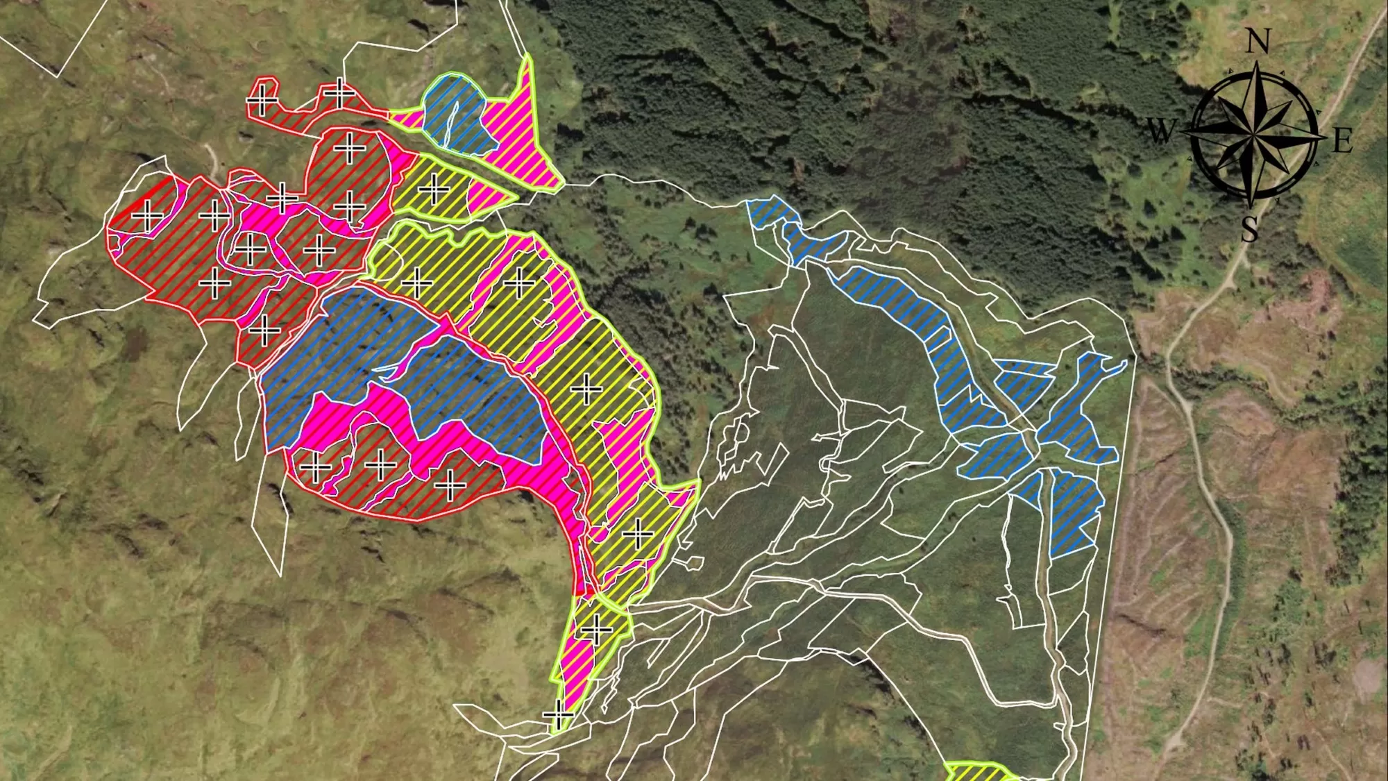
Bluesky Aerial LiDAR Survey Data Helps Farmers Apply for Carbon Credits
A new government funded project is using LiDAR data captured by aerial survey and mapping company, Bluesky International to identify areas of hedgerow and subsequently the amount of carbon captured…
Read More -
Bluesky LiDAR and Aerial Photography Bring Builds to Life for Dublin Design Studio
A Dublin based architectural consultancy is using data from aerial survey and mapping company Bluesky International to ensure the planning process is conducted as efficiently and smoothly as possible for…
Read More
May 2022
-
Bluesky’s National Tree Map Helps Improve Biodiversity in London
A project targeting biodiversity gain and climate change resilience in Bloomsbury, London is turning to data from Bluesky International’s National Tree Map (NTM) to ensure proposals are built on evidence-based…
Read More
February 2022
-
Waterford City and County Council Use Bluesky National Tree Map Data to Support Carbon Neutral Plans
Data from Bluesky International’s National Tree Map is being used by Waterford City and County Council to help benchmark current tree cover across the city and to look at suitable…
Read More -
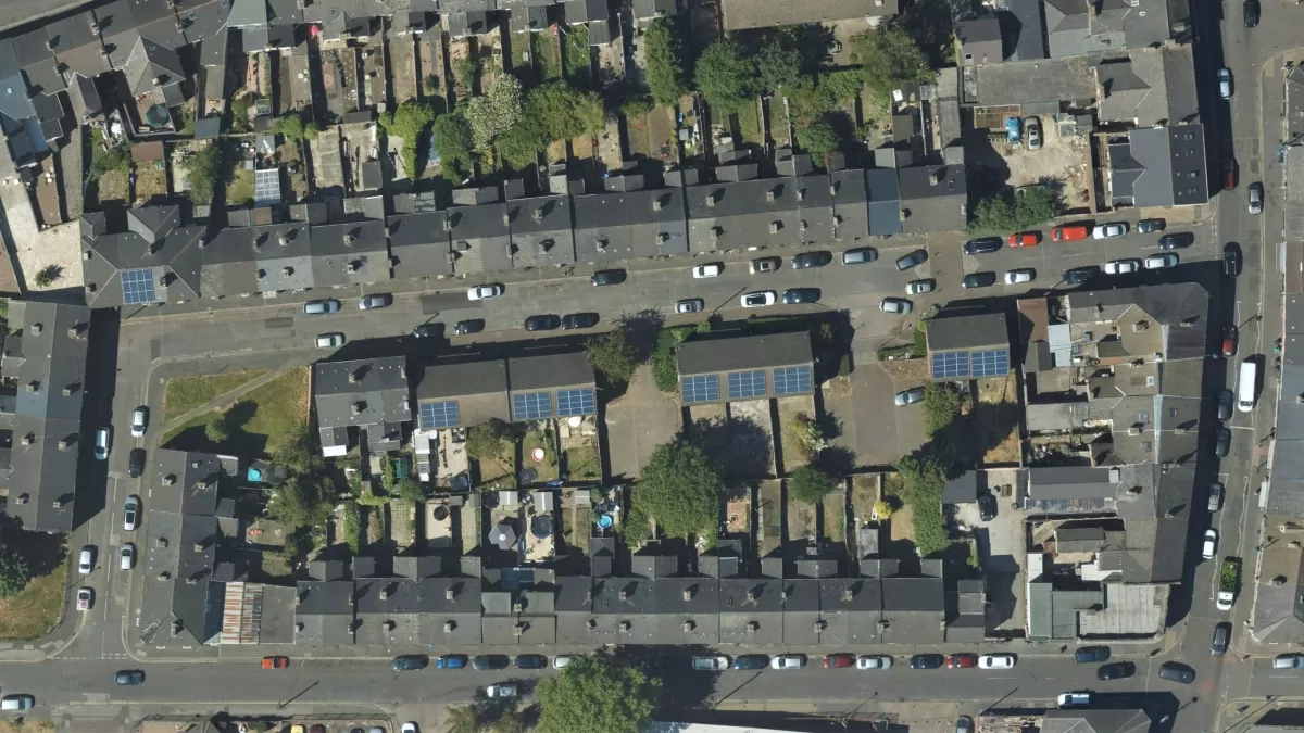
Bluesky Aerial Photography Helps Derby Homes Boost Solar Energy Output and Reduce Carbon Emissions
Aerial mapping company Bluesky is helping Derby Homes roll out integrated solar photovoltaic (PV) systems across its housing stock. A project to identify suitable roof coverings assessed more than 8,000…
Read More
July 2021
-
Bluesky and BlackSky Join Forces to Bring Satellite Imagery to the UK
Bluesky International (Bluesky), the leading aerial survey company in the U.K. and Republic of Ireland, announced it has joined BlackSky’s Global Reseller Program. BlackSky is a leading technology platform providing…
Read More
April 2021
-
Architect Brings Design to Life with Virtual Reality Using 3D Building Models
Architects Kirkland Fraser Moor (KFM) are pioneering the use of Virtual Reality (VR) to bring to life design processes and stakeholder consultations. Using VR based on a 3D building model…
Read More -
Wiltshire Council uses Bluesky National Tree Map to Manage Public Tree Stock
Wiltshire Council is using data from a map which details the location and attributes of more than 300 million trees to improve the management of its trees in parks and…
Read More